Sestrières Wood and Torrent du Vallon, starting from Montgenèvre

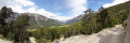
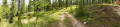
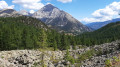
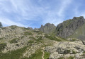
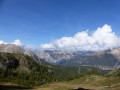
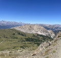
A walk through a beautiful, open forest canopy dominated by larch trees, which grow alongside a few deciduous trees such as oaks, alders and birches. Higher up, the forest features other conifers, including various species of pine and fir, where the bird cherry grows. The path is lined with beautiful flowering willowherbs and coltsfoot. From the Bois des Bans, there is a stunning view over the Clarée valley. This walk is classified as difficult as there are a few sections with steep, challenging gradients.

Details

24929226
Creation:
Last update:
Last review:
  • Walking
    Activity: Walking
  • ↔
    Distance: 9.04 mi
  • ◔
    Average duration: 6h 25 
  • ▲
    Difficulty: Difficult

  • ⚐
    Back to start: Yes
  • ↗
    Ascent: + 2,585 ft
  • ↘
    Descent: - 2,589 ft

  • ▲
    Highest point: 6,089 ft
  • ▼
    Lowest point: 4,649 ft

Photos

Description of the walk

Park in the car park by the covered trench opposite the ski runs, near Saint Maurice Church on Rue de l’Église.

(S/E) Turn right onto Rue de l’Église, continue to Rue des Sablon, turn left to cross the underpass, and continue until you reach the Durancia building.

(1) Turn right onto the wide forest track, which leads downhill, and keep to the right at the next junction. You’ll reach a designated rest area.

(2) Carry on to quickly reach the sharedGR® 5 and 653D.

(3) Take this path to the left, continuing downhill, and follow the red and white markings until you reach the junction with the Chemin du Vallon.

(4) Carry on straight ahead along theGR® to reach the bottom of the descent at the Ravin du Vallon junction.

(5) Leave theGR® here and start a steep climb along the path on the left. After several hairpin bends, you’ll reach a forest track.

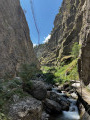
(6) Follow this track to reach the Torrent du Vallon.

(7) Begin another descent, passing through the Chalets du Vallon. Stay on this track and, after a few hairpin bends, you’ll reach a junction with the Chemin du Vallon path.

(8) Keep left on the track to reach the junction with the Chemin du Vallon that you passed earlier.

(4) Follow the route you took on the way out in the opposite direction to return to the Durancia junction.

(1) Turn right onto Rue du Bois de Setrière and continue to the roundabout at the entrance to the underpass. Keep to the right, then cross the road and return via Route d’Italie to the car park at Saint-Maurice Church (S/E).


Waypoints

  1. S/E : mi 0 - alt. 6,086 ft - Car park near Saint-Maurice Church
  2. 1 : mi 0.5 - alt. 6,004 ft - Durancia - La Durance
  3. 2 : mi 0.96 - alt. 5,942 ft - Designated rest area
  4. 3 : mi 1.39 - alt. 5,594 ft - GR junction
  5. 4 : mi 2.54 - alt. 4,882 ft - Chemin du Vallon
  6. 5 : mi 2.93 - alt. 4,649 ft - Ravin du Vallon crossroads
  7. 6 : mi 3.83 - alt. 5,699 ft - Forest track
  8. 7 : mi 4.75 - alt. 5,938 ft - Torrent du Vallon
  9. 8 : mi 5.39 - alt. 5,594 ft - Chemin du Vallon
  10. S/E : mi 9.04 - alt. 6,083 ft - Car park near Saint-Maurice Church

Notes

There are no water sources along this route.
Shelter is available in the blockhouses and pillboxes.
Between (7) and (8), the Vallon chalets are occupied.
This hike requires a good level of fitness as there are some challenging sections. There is a steep uphill section between (5) and (6).
Standard hiking kit is required, and as this route is not very busy, please inform a friend or family member of your route if you are setting off alone.

Worth a visit

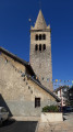
(S/E) Saint-Maurice Church: this religious monument dates fromthe 18th century. The lantern, fitted with an oil lamp and hung on the south-southeast wall of the bell tower, was used to guide travellers when visibility was poor.
(8) Viewpoint over the Clarée Valley.
During this walk, where you might not come across a single soul for an hour or more, do take the time to visit the blockhouse, the pillbox and the shelter where the French soldiers were stationed; they defended this strategic pass at the start of the Second World War and repelled all Italian attempts to breach it in 1940.
The whole region is dotted with defences that formed part of the Maginot Line – known as the Alpine Line – in the south-east of France. There is an excellent half-day tour led by a local historian who skilfully brings this period to life; the tour concludes at a dam capable of halting any invasion in six seconds.
To benefit from this historian’s extensive knowledge, visit the Montgenèvre Tourist Office – booking is essential.
Enjoy the stunning view over the Clarée Valley. It is worth noting that the Clarée should have been one of the tributaries of the Rhône rather than the Durance, which has a much lower flow rate, but the Roman occupation decided otherwise.

Always be cautious and plan ahead when you're outdoors. Visorando and the author of this route cannot be held responsible for any accidents occurring on this route.

The GR® and PR® markings are the intellectual property of the Fédération Française de Randonnée Pédestre.

Reviews and comments

4.8 / 5
Based on 2 reviews

Reliability of the description
5 / 5
Ease of following the route
5 / 5
Route interest
4.5 / 5
User 26336084

Overall rating : 5 / 5

Date of your route : Jun 29, 2025
Reliability of the description : ★★★★★ Very good
Ease of following the route : ★★★★★ Very good
Route interest : ★★★★★ Very good
Very busy route : Yes

Very well sheltered
A beautiful forest

Machine-translated

capcine1526
capcine1526

Overall rating : 4.7 / 5

Date of your route : Jul 29, 2025
Reliability of the description : ★★★★★ Very good
Ease of following the route : ★★★★★ Very good
Route interest : ★★★★☆ Good
Very busy route : Yes

A lovely, easy walk with beautiful larch trees, flowers and stunning panoramic views; clear and well-explained information

Machine-translated

Other walks in the area

For more walks, use our search engine .

The GPS track and description are the property of this route's author. Please do not copy them without permission.