Refine your search for walks in Pradiers
Pradiers walks


 Circular route through the Pradiers mountain pastures
 Visorando Member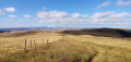
 9.58 mi
 +1,020 ft
 -1,027 ft
 5h 20
5h 20
 Moderate
 Departure from Pradiers (Cantal)
A walk through beautiful pastoral scenery and in relative seclusion, punctuated by numerous stepping stones that allow you to cross the fences. For most of the route, you can enjoy a superb panoramic view of the Monts du Cantal. Please read the warning in the practical information carefully before setting out on this walk.
This walk combines two routes designed and recommended by Chamina.
Courbières Mountain and Pradiers from Rascoupet
 11.97 mi
+1,250 ft
-1,237 ft
6h 35
11.97 mi
+1,250 ft
-1,237 ft
6h 35
 Difficult
Departure from Landeyrat (Cantal)
Difficult
Departure from Landeyrat (Cantal)
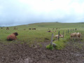
A long and magnificent hike in the little Mongolia of Cézallier. Pastures as far as the eye can see, herds of Aubrac and Salers cows, burons (stone huts)... and the Monts du Cantal on the horizon. No technical difficulty, good trails or wide paths that are always well marked, with numerous ladders to cross barriers. The route is circular except for the section between Rascoupet and before Courbières, which is a round trip.
Chaos de Landeyrat and the Knoll of Roucoulès circuit
 6.94 mi
+558 ft
-538 ft
3h 40
Moderate
Departure from Landeyrat (Cantal)
6.94 mi
+558 ft
-538 ft
3h 40
Moderate
Departure from Landeyrat (Cantal)
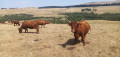
A varied walk offering superb views of the Cézallier, the Monts du Cantal and the Puy de Sancy massif. The route passes at the foot of a basaltic rock field and an ancient burial mound. For a while, it follows a disused railway line, now used for rail biking.
The Paths of Science: at the heart of the INRAE pastures in Marcenat
 Local authority
 2.94 mi
+390 ft
-377 ft
1h 40
2.94 mi
+390 ft
-377 ft
1h 40
 Easy
Departure from Marcenat (Cantal) (Cantal)
Easy
Departure from Marcenat (Cantal) (Cantal)
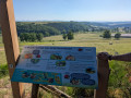
This 5 km family walk takes you on a journey into the heart of the Cézallier, through meadows, woodland edges and wetlands. Keep your eyes peeled – these unspoilt landscapes are a haven for biodiversity, where you can observe and record butterflies.Allow around 1½ hours to explore these wild areas and enjoy nature, with 8 themed information boards and an orientation table to guide your discovery. There are plenty of activities on offer.
The Orthodox Monastery of La Traverse
 6.79 mi
+892 ft
-922 ft
3h 55
Moderate
Departure from Montgreleix (Cantal)
6.79 mi
+892 ft
-922 ft
3h 55
Moderate
Departure from Montgreleix (Cantal)
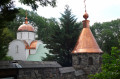
A pleasant loop around the pretty village of Montgreleix, ending at the Orthodox Monastery of the Mother of God Znaménié (open to visitors at certain times) at La Traverse. No technical difficulties and a wide variety of landscapes (pastures typical of the Cézallier region and burons, valleys and small woods, streams and waterfalls, etc.). You may even return with a Saint-Nectaire cheese in your bag...
The Loup trail starting from Fortuniès
 9.12 mi
+751 ft
-748 ft
4h 50
Moderate
Departure from Dienne (Cantal)
9.12 mi
+751 ft
-748 ft
4h 50
Moderate
Departure from Dienne (Cantal)
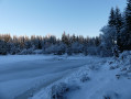
This route takes you to Lac du Pêcher, La Roche du Pic, the Frau de Collanges peat bog and Lac de Sauvages. I encountered a wolf in this area in the winter of 2017. Then I forgot about it until early 2025. It then reappeared, attacking livestock multiple times between winter and summer. I tracked it down and know its favourite spots. This does not guarantee that you will see it, but it may increase your chances of an encounter.
Circuit of the Signal du Luguet
 8.43 mi
+1,512 ft
-1,512 ft
5h 10
Moderate
Departure from Anzat-le-Luguet (Puy-de-Dôme)
8.43 mi
+1,512 ft
-1,512 ft
5h 10
Moderate
Departure from Anzat-le-Luguet (Puy-de-Dôme)
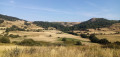
Circular route on the summit of the Cézallier, amidst the summer pastures, with numerous stepping stones to cross the fences. The route offers sweeping panoramic views of the Monts du Cantal and the Monts Dore, including the Puy de Sancy. The route passes at the foot of the Cézallier’s two highest peaks but does not climb them, as they are surrounded by woodland and offer no views.
Route designed and organised by Chamina.
The Tour de Besse and the old Bave sawmill
 5.67 mi
+886 ft
-906 ft
3h 25
Moderate
Departure from Anzat-le-Luguet (Puy-de-Dôme)
5.67 mi
+886 ft
-906 ft
3h 25
Moderate
Departure from Anzat-le-Luguet (Puy-de-Dôme)
A circular walk that ascends and descends along both banks of the Bave stream. The route passes by the foot of a 15th-century tower and offers views of the remains of an old sawmill. Beautiful panoramic views of the Cézallier await.
Route designed and suggested by Chamina.
Luguet signpost
 11.32 mi
+1,549 ft
-1,542 ft
6h 35
Moderate
Departure from Anzat-le-Luguet (Puy-de-Dôme)
11.32 mi
+1,549 ft
-1,542 ft
6h 35
Moderate
Departure from Anzat-le-Luguet (Puy-de-Dôme)
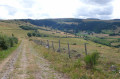
The Signal du Luguet is the highest point of the Cézallier. This hike along wide tracks, the only difficulty being the distance, takes you around the peak and up to the summit. But as for the view from the top, forget it, as it’s covered in trees! You can nevertheless enjoy the scenery by skirting the summit and taking in a 360° panorama, from the Puy de Dôme to the Monts du Cantal.
Lac de Sauvages
3.47 mi
+308 ft
-312 ft
1h 50
Easy
Departure from Dienne (Cantal)
A family walk offering beautiful views of the Limon Plateau on the other side of the Santoire Valley.
Mont Chamaroux
 6.99 mi
+1,348 ft
-1,335 ft
4h 25
Moderate
Departure from La Godivelle (Puy-de-Dôme)
6.99 mi
+1,348 ft
-1,335 ft
4h 25
Moderate
Departure from La Godivelle (Puy-de-Dôme)
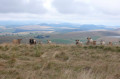
With its distinctive silhouette, Mont Chamaroux offers a magnificent viewpoint in the heart of the Cézallier; the route suggested here is a return walk through little-used pastures, where you’ll need to navigate the fences and know how to deal with the herds... No technical difficulties apart from the slightly steep final climb, and flexibility and agility are required to get over the fences.
Moderator’s note added on 19/08/2021. See the comments at the bottom of this page regarding passages through summer pastures when herds are present
The Jassy Waterfalls
 0.63 mi
+95 ft
-95 ft
0h 20
Easy
Departure from Saint-Alyre-ès-Montagne (Puy-de-Dôme)
0.63 mi
+95 ft
-95 ft
0h 20
Easy
Departure from Saint-Alyre-ès-Montagne (Puy-de-Dôme)
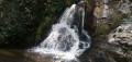
A short walk, suitable for young children, to discover two beautiful waterfalls in refreshing surroundings. You’ll also enjoy a lovely view of the summer pastures and the surrounding peaks.
The historical heritage of Neussargues en Pinatelle
9.06 mi
+1,056 ft
-1,033 ft
5h 05
Moderate
Departure from Chalinargues (Cantal)
Discover the history of this part of the Cézalier through the archaeological and historical remains that dot this route. Prehistoric rock shelters, tumuli, Merovingian sarcophagi, medieval forest trails, 12th-century churches, a monumental 15th-century cross, a communal oven, a wash house and beautiful old houses.
Grand tour of La Godivelle
 9.22 mi
+1,086 ft
-1,089 ft
5h 10
Moderate
Departure from La Godivelle (Puy-de-Dôme)
9.22 mi
+1,086 ft
-1,089 ft
5h 10
Moderate
Departure from La Godivelle (Puy-de-Dôme)
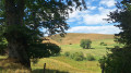
Mainly along paths and tracks, this walk around the pretty hamlet of La Godivelle takes in the characteristic landscapes of the Cézallier: pastures stretching as far as the eye can see, the gentle contours of the ‘mountains’, peat bogs, lakes and a few woods. On the way back, the route passes by Lake Saint-Alyre and the Sagnes de la Godivelle peatland reserve.
Chanterelle
3.66 mi
+446 ft
-443 ft
2h 05
Easy
Departure from Chanterelle (Cantal)
Chanterelle circular route, passing through the hamlet of Le Bac between Puy du Sancy and the Monts du Cantal. Set amidst the peaceful pastures of Chanterelle, this delightful escape invites you to enjoy a rural interlude through the rolling landscapes of the Cantal. From the village, the path descends gently through the meadows, winding its way towards Espramau and then on to the picturesque hamlet of Le Bac, where you skirt the grassy hilltops in soft light. The route then climbs gently northwards, offering soothing views of the sleepy rooftops of Lavergne and the surrounding hills. Upon reaching the highest point of the route, the horizon opens up to reveal unspoilt, tranquil countryside. The return journey begins gently through Les Travers, skirting the green, pastoral slopes. In a final breath of fresh air, the path serenely leads the walker back to Chanterelle. A true ode to a leisurely stroll, where time stands still between earth and sky.
The Rock of Laqueuille
5.24 mi
+876 ft
-889 ft
3h 10
Easy
Departure from Dienne (Cantal)
The summit of Rocher de Laqueuille is covered with magnificent moorland, ideal for a picnic. To get there, you will pass close to the pretty Château de la Cheyrelle. On your return, don't miss a visit to the beautiful village of Dienne, which has a remarkable 12th-century church with a bell tower and some very beautiful old houses.
From Dienne to Le Claus via the Chemin des Quiroux
 8.09 mi
+1,857 ft
-1,736 ft
5h 20
Difficult
Departure from Dienne (Cantal)
8.09 mi
+1,857 ft
-1,736 ft
5h 20
Difficult
Departure from Dienne (Cantal)
A superb crossing of the Limon plateau along a beautifully marked path, the Sentier des Quirous.
The Limon Plateau
10.85 mi
+2,041 ft
-2,037 ft
6h 45
Difficult
Departure from Dienne (Cantal)
Hike on the mountain pastures of the Limon Plateau, where beautiful Salers cows graze from May to October. From these heights, you will enjoy beautiful unobstructed views of the surrounding valleys and mountains, in particular the Puy Mary. This circuit follows part of the Sentier des Quirous, remarkable for its ancient stone signposts.Visorando app essential
The peat bogs of Chastel-sur-Murat
 5.04 mi
+600 ft
-587 ft
2h 50
Easy
Departure from Chastel-sur-Murat (Cantal)
5.04 mi
+600 ft
-587 ft
2h 50
Easy
Departure from Chastel-sur-Murat (Cantal)
Although it takes a while to get there, this walk takes you along a wild trail through pastureland, where you can see several peat bogs at different stages of development and enjoy magnificent views of the Cantal mountains and the Planèze plateau on the Saint-Flour side.
Circular Lac Chauvet starting from Égliseneuve-d’Entraigues
 10.52 mi
+978 ft
-978 ft
5h 40
Moderate
Departure from Égliseneuve-d'Entraigues (Puy-de-Dôme)
10.52 mi
+978 ft
-978 ft
5h 40
Moderate
Departure from Égliseneuve-d'Entraigues (Puy-de-Dôme)
A walk whose destination is the very beautiful Lac Chauvet, which unfortunately cannot be walked around (private property). The route alternates between fenced-off meadows, woodland and summer pastures. This walk can be done as a circular route, as suggested, or as a return trip.
The Drils Mill
0.76 mi
+226 ft
-226 ft
0h 35
Easy
Departure from Dienne (Cantal)
A very short walk, with water as its theme, to discover a magical place.
 Tourism professional