Country:

 City:
City:


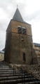
Start from the Place de l’Église (car park) in Anzat. In the village, head downhill towards the cemetery, walk past the church and turn immediately right.
Markings: Yellow + Red and White + Red cow’s head on a white background
(S/E) At the west end of the church (hiking sign), first turn left then right and walk gently downhill along a small road. Pass the cemetery (another possible parking spot).
(1) When the road bends to the right, leave it and turn left onto a stony path that leads downhill. Further on, cross a stream and head back up the other side.
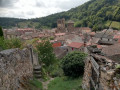
(2) You’ll come out onto a small road; follow it to the right. Climb gently, then head back down. Enter Besse and pass by the foot of its tower. Shortly afterwards, you’ll reach a crossroads.
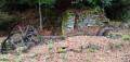
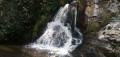
(3) Turn right here and head downhill. Just before the end of the road, turn right onto a path and descend quite steeply. After a few bends, cross the first stream by wading across or using a footbridge. Then cross the Bave stream via a small stone bridge (opposite, the remains of an old sawmill).
(4) Turn left and head uphill through the woodland, with the stream below on your left. The path soon veers away from the stream and becomes very stony, whilst the gradient steepens. Stay within the woodland.
(5) Cross a road and take a path diagonally to the right which runs parallel to it.
Yellow markings
(6) You’ll come out onto a gravel track; follow it to the right along the flat. Ignore a turn-off on the left and carry on straight ahead until the next junction.
(7) Cross a small road and carry on straight ahead onto another small road. Ignore the turn-off to the left for the hamlet of Sagne and continue to a three-way junction.
(8) Turn right towards Lastauve and head downhill. Go round the hamlet on the left.
(9) As you come out of the right-hand bend, turn left onto a stony track. Descend quite steeply. At the bottom, cross a stream, turn right and head back uphill.
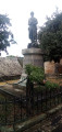
(10) Cross the D721 and continue straight ahead along a short tarmac section followed by a grassy track. Walk uphill, keeping the bell tower of Anzat church clearly in view. Return to the tarmac; ignore a narrow lane on the left and then a dead end on the right. When you reach the foot of the war memorial, turn right and then immediately left to return to the Place de l’Église (S/E).
 Visorando Member

 Easy
Easy 
 Tourism professional