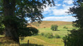
The Paths of Science: at the heart of the INRAE pastures in Marcenat

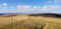
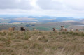
This 5 km family walk takes you on a journey into the heart of the Cézallier, through meadows, woodland edges and wetlands. Keep your eyes peeled – these unspoilt landscapes are a haven for biodiversity, where you can observe and record butterflies.
Allow around 1½ hours to explore these wild areas and enjoy nature, with 8 themed information boards and an orientation table to guide your discovery. There are plenty of activities on offer.

Details

102141698
Creation:
Last update:
Last review:
  • Walking
    Activity: Walking
  • ↔
    Distance: 2.94 mi
  • ◔
    Average duration: 1h 40 
  • ▲
    Difficulty: Easy

  • ⚐
    Back to start: Yes
  • ↗
    Ascent: + 390 ft
  • ↘
    Descent: - 377 ft

  • ▲
    Highest point: 3,829 ft
  • ▼
    Lowest point: 3,494 ft

Photos

Description of the walk

Park in the village centre (Place de la Castellane, 15190 Marcenat).

The walk starts from Place de la Castellane. Look out for sign 1: ‘Once upon a time in Marcenat’.

(S/E) With your back to the car park, head right onto the D679 for a few metres, then turn left onto the road towards the cemetery. Turn right onto thesecond path on the right, the Chemin du Chazame, towards INRAE Herbipôle. Just before the Herbipôle buildings, take the path on your left to go round the back.

(1) Pass through the two cattle grids to reach signpost 2 (General guidelines for walkers) on your right. Go through the gate and walk along the meadow until you reach signpost 3 (Discovering Herbipôle).

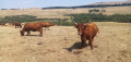
(2) At the end of the path, go through the gate, then take the track on your right to signpost 4 (The diversity of cattle breeds).

(3) Go through the gate. Walk alongside the wetland and the hedge until you reach signpost 5 (Dive into the heart of the wetland). This is also your chance to contribute to science by counting the butterflies along this wetland – simply scan the QR code.

(4) Continue your walk to the next clearing, where you’ll find sign 6 (‘What does a cow eat in a mountain area?’).

(5) Follow the tree-lined path to the left up the hill until you reach the next gate leading onto a track. Take this track by turning left. A few metres further on, on your left, you’ll find panel 7. This is yoursecond opportunity to contribute to science by observing the butterflies along the track.

(6) Take the path on your right, heading towards the woods. Walk up the hill to signpost 8 (Livestock farming and landscape management).

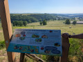
(7) Continue along the path through the woods to the next gate. Go through it and turn left onto the track, heading towards the orientation table, which is located before the water tower.

(8) Continue down the path until you cross the path you took on the way there again.

(1) Finish the walk by taking the Chemin du Chazame (S/E) opposite.

Waypoints

  1. S/E : mi 0 - alt. 3,497 ft - Sign 1: Once upon a time in Marcenat
  2. 1 : mi 0.63 - alt. 3,632 ft - Sign 2: General guidelines for walkers
  3. 2 : mi 0.69 - alt. 3,629 ft - Sign 3: Discovering Herbipôle
  4. 3 : mi 0.93 - alt. 3,645 ft - Panel 4: the diversity of cattle breeds
  5. 4 : mi 1.06 - alt. 3,638 ft - Sign 5: Immerse yourself in the heart of the wetland
  6. 5 : mi 1.26 - alt. 3,632 ft - Panel 6: What does a cow eat in the mountains?
  7. 6 : mi 1.38 - alt. 3,681 ft - Sign 7: Second butterfly sighting
  8. 7 : mi 1.67 - alt. 3,809 ft - Sign 8: Livestock farming and landscape management
  9. 8 : mi 2.16 - alt. 3,727 ft - Sign 9: orientation map
  10. S/E : mi 2.94 - alt. 3,494 ft - Sign 1: Once upon a time in Marcenat

Notes

A few guidelines:

  • Dogs are not permitted, even on a lead;
  • make sure you walk round herds rather than through them, and do not stroke the animals;
  • Close gates and fences behind you;
  • be careful, as some fences may be electrified;
  • make sure you’re properly kitted out with clothing suitable for the conditions and walking shoes;
  • Remember to bring water.

Worth a visit

- Several information boards on site.

Other walks in the area

For more walks, use our search engine .

The GPS track and description are the property of this route's author. Please do not copy them without permission.