The Rentières Valley

Starting from Rentières, you’ll head down into the valley of the same name. You’ll enjoy the scenery, the peace and quiet, the river, the flora and, if needed, the shade of the woodland.

Details

3041899
Creation:
Last update:
Last review:
  • Walking
    Activity: Walking
  • ↔
    Distance: 2.13 mi
  • ◔
    Average duration: 1h 20 
  • ▲
    Difficulty: Easy

  • ⚐
    Back to start: Yes
  • ↗
    Ascent: + 407 ft
  • ↘
    Descent: - 420 ft

  • ▲
    Highest point: 2,457 ft
  • ▼
    Lowest point: 2,041 ft

Photos

Description of the walk

Park at the far end of the village, in the car park near the fortified house.

(S/E) Set off westwards along the path that runs behind this pretty house to reach a lovely viewpoint, taking a small path on the left.

(1) Carry on along the path until you reach the Ardes/Saint-Alyre road.

(2) Keep left (towards Ardes) then turn right to cross an old bridge

(3) Take the path on the left after the ‘private property’ sign. Walk alongside the Couze d’Ardes, keeping to the left at all times. When you reach the road, turn left and take the path on the right which leads back up to the village of Rentières.

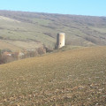
(4) Keep left to walk past the small chapel, then continue straight on to the viewpoint. Lovely views of Rentières, Ardes, Le Fromental and the valley… Then return to the road and follow it to the left as far as Notre-Dame Church.

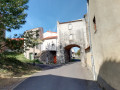
(5) It is situated at the back of the old, deconsecrated cemetery. Take Impasse Notre-Dame to return to the car park. You can stop off at L’Accueillette des Pensées for a herbal tea, a cup of tea or a coffee (S/E).


Waypoints

  1. S/E : mi 0 - alt. 2,451 ft - Fortified house, known as the château
  2. 1 : mi 0.11 - alt. 2,441 ft - Viewpoint
  3. 2 : mi 0.51 - alt. 2,139 ft - Route
  4. 3 : mi 0.74 - alt. 2,123 ft - Old bridge/‘Private property’ sign
  5. 4 : mi 1.8 - alt. 2,379 ft - Rentières
  6. 5 : mi 1.99 - alt. 2,402 ft - Rentières Church
  7. S/E : mi 2.13 - alt. 2,448 ft - Fortified house, known as the château

Notes

Dress for the weather; bring a hat for the walk down to the Couze, sturdy shoes and perhaps a walking stick – there are quite a few stones on the path down to the Couze

Worth a visit

L’Accueillette des Pensées for a drink and/or a self-guided tour of the garden. Cécile will be delighted to welcome you (provided she hasn’t gone out to gather wild plants).

Reviews and comments

4.4 / 5
Based on 3 reviews

Reliability of the description
5 / 5
Ease of following the route
4.3 / 5
Route interest
4 / 5
User 25314257

Overall rating : 5 / 5

Date of your route : Sep 17, 2026
Reliability of the description : ★★★★★ Very good
Ease of following the route : ★★★★★ Very good
Route interest : ★★★★★ Very good
Very busy route : No

A lovely walk – well worth doing and exploring.
Relatively easy.

Machine-translated

User 26767172

Overall rating : 4.7 / 5

Date of your route : Aug 25, 2025
Reliability of the description : ★★★★★ Very good
Ease of following the route : ★★★★★ Very good
Route interest : ★★★★☆ Good
Very busy route : No

The route ends at a pretty hamlet worth exploring

Machine-translated

BAJ_BE
BAJ_BE

Overall rating : 3.7 / 5

Date of your route : Apr 28, 2025
Reliability of the description : ★★★★★ Very good
Ease of following the route : ★★★☆☆ Average
Route interest : ★★★☆☆ Average
Very busy route : No

Apart from the panoramic view accessible from the village at the end of the route, the scenic appeal of this walk is rather limited.
The section along the Couze was difficult, as it was littered with branches and tree trunks. Presumably due to the winter floods. I don’t know if a ‘spring clean’ is planned for this part of the route.

Machine-translated

Other walks in the area

For more walks, use our search engine .

The GPS track and description are the property of this route's author. Please do not copy them without permission.