Country:

 City:
City:



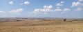
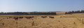
Starts from the Chaos de Landeyrat car park (information sign), situated to the left of the access road from the D679, between the cemetery and the village entrance.
Yellow markings (rare)
Signposts are provided at major junctions.
(S/E) Facing the information sign, turn left towards the Chaos de Landeyrat. Just before the cemetery, take a stony path on the right, still heading towards the Chaos. Climb gently and continue along a grassy path (after a left-hand bend, you’ll see the Chaos on your right). Take the first stepway and descend opposite to a second stepway.
(1) Take this and cross a stream. Cut diagonally across a meadow to the right, towards a clearly visible signpost higher up (no marked path). Take another step-stone and continue along a shaded path. Descend slightly and reach the foot of the basalt rock formation (information boards).
(2) Continue along the shaded path, descending slightly before climbing quite a bit. At the top, you’ll come out onto the D679; cross it carefully and follow it to the right for about fifty metres.
(3) Then turn left towards La Roussille. Walk uphill until you reach a junction with paths on a flat stretch where the small road is blocked by a wire fence (as at August 2026).
Signposting: red cow’s head on a white background (sparse)
(4) Turn left onto a grassy track. Climb gently, then descend just as gently.
(5) At a junction, follow the road to the right. Climb gently and pass La Sens farm on your left.
No signposting
(6) When you reach a second farm, turn right towards Rascoupet. At the corner of a large shed on the right-hand side, turn right and pass some other large sheds on the left. Follow the small road to Rascoupet Bas (water fountain on the left).
Signposting: Red cow’s head on a white background (sparse)
(7) Continue straight on along a track. Further on, ignore a turn-off to the left and turn right onto the best-marked track (view of the Monts du Cantal straight ahead). Enter a meadow where the track disappears and follow a tree-lined hedge on your left. Reach a grassy path and follow it as it continues. Wind your way along this path between the hedge and a fence, then between two fences.
Yellow signposting (rare)
Directional signs are provided at major junctions.
(8) At the end, turn left then immediately right towards Les Prades and the old Landeyrat station. Head downhill and go round the old Les Prades farm (a fine complex of buildings) on the right, keeping a fence on your right. At the end of the path, head down the access road to the right and you’ll immediately rejoin the D679.
(9) Follow the road to the left towards the old Landeyrat railway station (busy road, take great care).
(10) Just after a cattle pen on the left-hand side, turn right and cross the road carefully. On the other side, head towards the old station, pass through an electric fence (close it behind you if it was already closed) and enter a vast meadow. Go straight on, keeping as close as possible to the fence on the right-hand side (there is no path).
(11) At the far end of the meadow, go through the fence again (there is no opening; the easiest way is to crawl along the ground). On the other side, turn left and head down towards a clearly visible gap in another fence. Go through this gap and cross a stream. Next, you need to reach a stile on the other side of the mound in front of you (an ancient burial mound), either by climbing up and down it (purple line on the IGN map), or by going round it to the left, following a rather faint track (as shown on the map).
(12) Take the footbridge, turn left and cross a stream via a footbridge. Continue straight on between two fences.
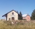
(13) You’ll come out onto a railway line; follow it to the right as far as the old Landeyrat-Marcenat station. The railway line is now used for rail cycling: watch out for vehicles approaching from the front or behind.
(14) Just before the old station, first turn right then left and cross a car park. At the Stop sign, follow a small road to the right towards Landeyrat and head uphill. Note an old buron on the right-hand side.
(15) Shortly after a solitary chestnut tree on the right-hand side of the road and just past the entrance to a meadow on the left, take an inconspicuous path on the left, still heading towards Landeyrat (view of the rock formations on the right). At the end of the path, go through a fence (there is no stile here). Then turn left and head uphill. At a three-way junction in the path, turn left again and continue uphill. Walk between fenced-off meadows (beautiful views of the Monts du Cantal on the left and the Puy de Sancy massif on the right).
(16) You’ll come out onto a gravel track; follow it to the right towards Landeyrat. Shortly afterwards, continue along a small tarmac road and head downhill.
(17) At the first houses, turn sharply left towards the Chaos de Landeyrat and head downhill. At a T-junction, turn right. At the next junction, turn left. At the Stop sign, cross the road and you’ll immediately reach the car park where you started (S/E).
 Visorando Member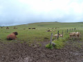
 Difficult
 Local authority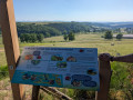
 Easy
Easy