Country:

 City:
City:


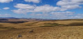
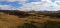
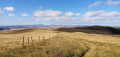
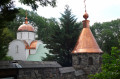
Start from Pradiers church. Park in the car park located at the west end of the church, along the D39 (Route du Cézallier).
Green signposting (on one side only, in the direction of this description).
Follow the PR® signposts for “La Montagne de Courbières”. Directional signs are provided at key points.
(S/E) Head north, leaving the town hall on your left, and follow the Route du Cézallier. At the Fork in the road shortly afterwards, turn left onto Rue des Estives. Immediately ignore Rue des Fontaines on your left and head slightly downhill. Cross a stream and continue along a gravel track. Climb gently until you reach a three-way junction.
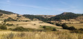
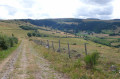
(1) Keep to the right and head uphill. Follow the track for a long stretch, heading north then north-east (on the left, a view of the Monts du Cantal). Cross a stream and you’ll soon reach a livestock enclosure.
(2) Look for a stile on the right-hand side of the enclosure and use it to cross a fence. On the other side, turn left, then immediately right at the corner of the fence. Follow a faintly marked path northwards and head between two hillocks (elevations 1365 and 1358). Cross a damp stretch where the path disappears: head slightly to the left towards a small rock, behind which you’ll find a clearly visible signpost.
(3) At the marker post, turn left and climb straight up the slope, keeping the fence on your right. Cut left with the path and continue on roughly level ground, still following the fence. Go over a stile and continue straight on to the next stile.
(4) Take this to cross the fence and turn immediately left (note: the sign appears to suggest going straight on, northwards, but you must in fact turn left, heading due west). Follow the fence on your left and, after about 200 m, turn right and head straight up the slope. Then turn left and climb more gently, keeping the fence on your left. Gradually head north until you reach the next sheepfold (a ruined buron on the right).
(5) Turn left to take this sheep track and head onto a wide path between two fences. Descend gently, heading south-west, with the Monts du Cantal in the distance ahead. Ignore the first sheep track, which is no longer in use, and you’ll soon reach the next one.
(6) Take this one and continue straight on, along a poorly marked path, keeping to the right of a fence. Further on, pass another footbridge, continue straight on and keep to the right of a fence that is in poor condition at the start. Further on, cross a perpendicular fence, either via a stile on the left or by simply stepping over it as it has collapsed (as of August 2026). Immediately take a new stile situated to the left of a containment pen.
(7) Then turn left (south) and follow a path between two fences, which descends and then becomes roughly level. Note the Bel-Air buron below on the left.
(8) Take a footbridge on the left and follow a fence on your left, with a steep slope to your left. Take another footbridge and descend slightly, still keeping the fence on your left. Shortly afterwards, take yet another footbridge and continue along the fence on your left, first on level ground and then downhill.
(9) Take a footbridge and turn immediately right, following a fence on your right-hand side. Head due south, initially on roughly level ground above a small copse, then downhill. You’ll reach a fence running at right angles.
(10) Then turn left (no footbridge here...) and follow the fence on your right. Cross a stream, either by wading or using a footbridge and (yet another) footbridge. Head slightly uphill on the opposite side.
(11) You’ll come out onto a gravel track; follow it to the right. Pass the metal barrier that appears shortly afterwards by using the step on the right. Climb slightly, then descend; the track then gives way to tarmac. You’ll reach a fork in the road.
Blue signposting (on one side only, in the direction of this description).
Follow the PR® signposting for “Les Rochettes”. Directional signs are in place at key points.
(12) Then turn sharply left onto a gravel track. Cross a stream and you’ll immediately reach a junction.
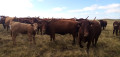
(13) Turn right, pass an electric fence and take a path between two fences. Head uphill, take a sharp left-hand bend with the path and walk alongside a coniferous copse on your right. At the end of the copse, take a footbridge and go straight on through the middle of the mountain pasture. Pass a cattle pen on your left and take the final footbridge.
(14) On the other side, head straight on along a track, passing a small metal cross on the right. Descend gently. Further on, ignore a turn-off to the right and turn left to quickly reach a junction you passed at the start of the walk.
(1) Turn right towards Pradiers. Following the outbound route in the opposite direction, head for the car park at Pradiers church (S/E).
 Visorando Member
 Difficult
 Local authority
 Easy
Easy