Country:

 City:
City:


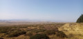
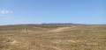
Start from the hamlet of Parrot (cross-country skiing centre). Park in the large car park along the D721, on the left at the entrance to the hamlet when approaching from the Col de Vestizoux.
Markings: Green + Red and White + Red cow’s head on a white background
(S/E) Just as you enter the hamlet, turn left onto the Chemin du Buffier. At the Fork in the road that appears immediately, keep right and stay on the small tarmac road. Walk gently downhill.
(1) At a hairpin bend to the right, leave the road and take a stony track to the left. At the Fork in the road shortly afterwards, keep left and stay on the main track, which climbs steadily. Pass a shed and you’ll soon reach a junction.
(2) Turn right onto the signposted path and pass between fenced-off meadows. Descend gently, then more steeply, with a few bends in the shade. At the bottom, turn left onto the path and cross a stream.
(3) At a three-way junction, turn left. Cross two streams in succession. Then climb steadily between fenced meadows. At a T-junction, turn right and you’ll immediately come out onto the D721.
Green signposting
(4) Cross it carefully and head straight ahead onto the small road that runs diagonally to the right (Rue du Château, dead end; let the GR® head off slightly further to the left along Rue du Signal). At the end, go round a house on the right via a footpath. Go round another house on the right and rejoin a gravel track. Ignore a small road on the right and carry on straight ahead until you reach a clearly marked junction.
Green and yellow markings
(5) Then turn right onto a wide path that climbs gently and steadily.
(6) At a three-way junction, turn right. Then walk alongside a woodland on your left. Shortly after a sharp left-hand bend, look out for a stile on the right.
(7) Use the ladder to climb over a meadow fence. Follow a path westwards between the blueberry bushes and the heather (this path is not shown on the 1:25,000 map but can be seen if you zoom in). Climb steadily, keeping as close as possible to a fence on your right (below and to the right lies the Artout Glacial Cirque).
(8) At a junction, carry on straight ahead, keeping the fence on your right.
Green markings
(9) When you reach a gate in the fence, take a stile on the left. On the other side, turn left (ignore the yellow markings and continue straight ahead). Follow a path that climbs steadily, keeping to the left of a fence this time.
(10) Cross a fence at right angles to the one you are following. If there is no step-over, there are three options: crawl under, pass between two widely spaced wires (provided they are not electrified), or use a small rock on the right to climb over (option not tested). Continue the ascent westwards along a path and alongside a fence on the left.
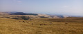
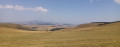
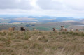
(11) Take a ladder again to cross a perpendicular fence. Follow a path opposite and walk along the right-hand side of the woodland, within which lies the summit of the Signal du Luguet – not included in this route as it offers no views. However, note the beautiful panorama of the Cantal mountains on the left.
(12) At a junction, turn left, heading due west. Walk alongside a fence on your left. Take another footbridge and emerge onto a gravel track.
Markings: Green + Red cow’s head on a white background
(13) Follow the track to the right (north-east) and pass between the two local peaks, which are not very prominent: the Bois du Cézallier on the left and the Signal du Luguet on the right. Note the Monts Dore and the Puy de Sancy in the distance to the left. The track then turns north and descends quite steeply. At a livestock enclosure (marked ‘parking’ on the IGN map), turn left and follow a small tarmac road for about a hundred metres.
(14) Take a stile on the right and follow a path running alongside a fence on your left. At the end, take one final stile and you will immediately find the Parrot car park on your left (S/E).
 Visorando Member

 Easy
Easy 
 Tourism professional