Country:

 City:
City:


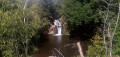
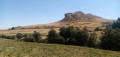
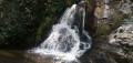
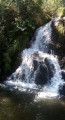
The walk starts from the hamlet of Jassy, on the D721, on the north side of the bridge over the Couze d’Ardes. You can park on either side of the bridge, in a car park (on the south side of the bridge) or at the side of the road.
Signposted ‘Waterfalls 1 & 2’
(S/E) Take Rue du Four and head gently downhill. You’ll come out onto Rue des Cascades (not signposted here) and follow it to the right at a sharp angle.
(1) When the street bends sharply to the left, carry on straight ahead, passing a house on your left decorated with a ceramic tile depicting a butterfly. Follow a path that winds its way down and you’ll soon reach the entrance to the first waterfall.
(2) Head down to the right and you’ll reach the first waterfall straight away. Retrace your steps.
Signposted ‘Waterfall 2’
(2) Continue to the right along the path, which soon runs alongside the stream through a shaded area. Climb over a fence using a small stepladder and carry on straight ahead along the edge of the meadow to quickly reach the entrance to the second waterfall.
(3) Head down a steep slope to the right and you’ll soon reach a sort of small lake with the waterfall on your right. Climb back up the steep slope.
(3) Turn right along the edge of the meadow (a lovely view opposite of the two peaks of Loubinat). Turn right again towards some small rocks, from where you’ll have a lovely view of the second waterfall.
(4) Follow the route in the opposite direction to return to the hamlet of Jassy (S/E).

 Visorando Member
 Moderate


 Tourism professional