


Refine your search for walks in Plumelec
Plumelec walks


 The La Grée to Plumelec route
 Visorando Member
 7.36 mi
 +699 ft
 -719 ft
 4h 00
 Moderate
 Departure from Plumelec (Morbihan)
Dotted with sunken lanes, this route will take you on a journey through history: the early days of the liberation of France in 1944, marked by this monument to Corporal Bouétard; then back in time to the Revolution, commemorating General Cadoudal; before returning to the present day as you catch sight of the famous Plumélec climb, so dreaded by cyclists; and finally, through the lush Claye valley.
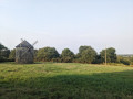
Short circuit around the Sédon
 3.61 mi
+348 ft
-528 ft
1h 45
Moderate
Departure from Guéhenno (Morbihan)
Starting from Guéhenno, famous for its monumental calvary, the route passes through several hamlets around the River Sédon, as well as through woods and along field edges. Most of the route is on paths and, occasionally, on a few quiet roads.
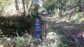
Hedgerows between Monterblanc and Saint-Nolff
 3.94 mi
+341 ft
-341 ft
2h 05
 Easy
Departure from Monterblanc (Morbihan)
A short, very well-marked walk in the Vannes countryside. Highlights include: hedgerow landscapes, sunken paths, woodland, a bread oven, the little Saint-Amand Chapel, the hamlets of Grand Gillard and Scourboc, and the village of Monterblanc.
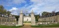
Route from Kerguehennec to Bignan
 8.18 mi
+318 ft
-315 ft
4h 00
Moderate
Departure from Bignan (Morbihan)
Circular route starting from Bignan, including the Domaine de Kerguéhennec and, in particular, the Chapelle de la Trinité. This route is marked in yellow.
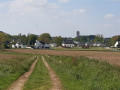
Route of the Landes de Lanvaux in Bignan
 7.83 mi
+719 ft
-745 ft
4h 15
Moderate
Departure from Bignan (Morbihan)
A circular route starting from Bignan, crossing a rural landscape and moorland around the two large wind turbines in Bignan, then passing by the Sainte-Nolwenn fountain. This route is marked in yellow under the name "Circuit des Landes de Lanvaux".
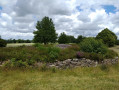
Colpo - The Larcuste burial mounds
 5.20 mi
+200 ft
-207 ft
2h 35
Easy
Departure from Colpo (Morbihan)
A short walk south of Colpo with varied scenery.
Route from Saint-Gobrien to Guillac
8.85 mi
+279 ft
-289 ft
4h 20
Moderate
Departure from Guillac (Morbihan) (Morbihan)
A route offering beautiful green landscapes, partly near the Nantes–Brest Canal, which you follow along the GR® 37. Old chapels, churches and crosses also dot this route, which will undoubtedly give you a real change of scenery.
The moors of Pinieux
6.70 mi
+308 ft
-305 ft
3h 20
Moderate
Departure from Sérent (Morbihan)
The moors of Pinieux offered the resistance fighters of the Maquis de la Nouette a fragile shelter during dark times. This wooded area occupies a hilltop between the Claie and Oust valleys and offers some views of eastern Morbihan. And a gem nestles in the hollow of one of the valleys: the Kerfontaine bog.
Please note: crossing the bog requires off-track walking.
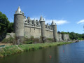
The canal bank and Sainte-Croix Church in Josselin
 2.03 mi
+49 ft
-49 ft
1h 00
Easy
Departure from Josselin (Morbihan)
A walk along the banks of the canalised River Oust to explore Beaufort Island and its mill, as well as the austere ramparts of the Château des Rohan. After crossing the canal, a short climb leads to the Church of Sainte-Croix, the last remaining part of a priory founded in the 1050s–1060s by Josselin de Porhoët, founder of the castle and the town.
Along the Oust, from the Château de Josselin to the Chapelle Saint-Gobrien
 5.47 mi
+16 ft
-16 ft
2h 30
Easy
Departure from Josselin (Morbihan)
Dominated by the tall silhouette of the Château de Josselin, the River Oust is one of the sections of the Nantes-Brest Canal. This walk follows the shaded course of the river and leads to the charming Chapelle Saint-Gobrien.
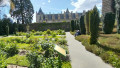
Short heritage trail in Josselin
 Association / Club / Walk leader
 1.97 mi
+148 ft
-135 ft
1h 00
Easy
Departure from Josselin (Morbihan)
Take a stroll to discover what makes Josselin such a historic place. As you wander through the town's narrow cobbled streets, you can admire the many half-timbered houses, the oldest dating back to 1538, the churches and the castle (entrance fee). A very pleasant walk.
From Mangolérian to Camp de Meucon to bypass Vannes Airport
8.53 mi
+236 ft
-253 ft
4h 10
Moderate
Departure from Monterblanc (Morbihan)
This route, which involves little change in elevation, will take you around Vannes-Golfe du Morbihan Airport. It skirts the westernmost part of the Meucon camp, where all the buildings are located; this area is safe provided you stay on the described route. It returns via the south of the airport, passing not far from the César camp (viewpoint).
From Saint-Nolff to the Chapel of Saint-Colombier
 5.92 mi
+315 ft
-299 ft
3h 00
Easy
Departure from Saint-Nolff (Morbihan)
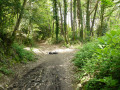
A refreshing circular walk, featuring two unmarked forest sections; best undertaken in light winds due to the risk of falling trees. Plan your route to ensure an enjoyable experience: the path, which is sometimes narrow, may meet wider tracks and pass through undergrowth; note the waypoints, the route’s proximity to the road network (D135, C1, C4) and its junctions with it. The route markings on the ground are generally clear as it is used by joggers. This guide is intended for visual navigation, which requires careful attention. For a first-time walk, the use of a smartphone is recommended.
The route, established in 2015, was revised in March 2023 following a storm. In July 2026, the small bridge leading to the courtyard of the Gourvineg mill, which had been damaged by flooding in 2024, was restored.
Route des Croix in Guillac
7.67 mi
+272 ft
-289 ft
3h 45
Moderate
Departure from Guillac (Morbihan) (Morbihan)
A route that takes you past several crosses located within the town. It also takes you close to the Nantes–Brest Canal, which is always a pleasant walk in fine weather.
Route de la Colonne des Trente
5.28 mi
+230 ft
-249 ft
2h 40
Easy
Departure from Guillac (Morbihan) (Morbihan)
Set in the heart of the countryside, this route takes you along a number of easily accessible dirt tracks, small roads and a few grassy paths and sunken lanes on either side of the RN24.
From Les Moulins to Camp de César in Saint-Avé
 12.13 mi
+633 ft
-650 ft
6h 10
Moderate
Departure from Saint-Avé (Morbihan)
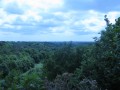
This hike near the town of Saint-Avé allows you to discover a landscape of moors and forests in the first part. In the second part, we follow rivers to discover the old mills. It is very varied, with lots of ups and downs.