Country:

 City:


The Kiceo bus route no. 9 runs to Saint-Nolff from Vannes.
Meet at the car park opposite Saint-Nolff Town Hall, Place Saint-Mayeul, on the side facing the church, near the covered wash house on the Condat and the sign marking the start of the PR® “Vallée du Condat” route, a route marked with yellow signposts. This walk crosses it several times and follows several sections of it, indicated below by black subheadings beginning with: “Yellow markings”. The QR code on the sign marking the start of the Condat walk links to its description, allowing you to follow it if you wish. This guide shows you the shortest route to join it, indicating the points where the two routes intersect.
Yellow markings on the Condat PR® route for reference
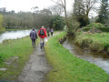
(S/E) Place Saint-Mayeul, sign for “Route du Condat”. Start the walk towards the pedestrian crossing that crosses the D135/Rue des Lavandières; the route follows the Ruisseau du Condat (also known as the Ruisseau du Liziec) downstream; at the start, the stream is on the right and the town hall is visible on the left. Follow the yellow markings. The path passes in turn by a leisure area, a playground and a football pitch. Then walk to the right of the Étang de Gourvineg; at its far end, cross onto the D135 via a small bridge andcross ittowards the mill.
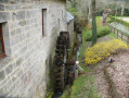
(1) At the Gourvineg Mill, there is an information sign. Head down, following the direction indicated by the ‘Sentier du Condat’ sign, towards the mill courtyard below. Note the layout of the grounds and the dovecotes. It is also possible to walk round the mill to see its restored waterwheel.
Cross the courtyard to reach the small wooden bridge, restored in 2026. At this point, on the left, note the facilities for a wildlife area. Once you have crossed the bridge, turn right; follow the Condat; the first wooden bridge you come to takes you to the right bank. The next one takes you back to the left bank; once you’ve crossed it, continue along the signposted path beside the Condat, without taking the tarmac C4 road, which runs alongside the railway line.
After passing two pondson the left (used for water treatment) and a large pylon (an SNCF network mast), the path crosses a threshold in a small embankment, at the edge of a copse which you’ll need to cross. At the exit, after a low fence, turn right onto the C4. Follow this tarmac road on the right-hand side as far as the Foulon level crossing (level crossing no. 426).
(2) Crossthe railway line and follow the road uphill to the right (C1). On the embankment to the right, 110 metres further on, before the blue sign for “La Saret”, you can see two small granite crosses, approximately 30 cm high.
Continue to the signposted ‘Chemin du Val’, which climbs to the left towards a lodge. Leave this on your right and carry on along a grassy path marked on a wooden sign as ‘Chemin du Val’. The path then enters the forest 200 metres further on.
Yellow and red markings for the GRP® Vannes-Lanvaux towards C1
(3) At the Foulon level crossing, on the downstream side, at the junction of two fairly wide paths, leave the Vallée du Condat route (yellow markings), which is ascending at this point, and take the descending sunken path (GRP®) on the right, marked in yellow and red. This leads onto the C1. Note that the sunken track is flanked by a parallel path which has formed a few metres to its left, no doubt due to the fairly long periods during which it remains blocked by fallen trees.
Once you reach the C1, walk about ten metres to the left and rejoin the marked path at the first entrance to the woodland; the path begins by climbing for 20 metres towards a service track accessible to tractors from a field further up; stay on the path marked in yellow and red by turning right onto the track; it runs a short distance from the C1, which you should use as a reference point. After you see the yellow sign on the right-hand side of the C1 pointing towards the hamlet of Lascouit, cross over to the road and pass through a light barrier, followed, 5 metres further on, by a ‘private forest’ sign. The GRP® markings have been interrupted for several months due to local circumstances (the traditional ‘wrong way’ X sign has been affixed to the trees, leaving no alternative route other than the road). Continue along the path running alongside the C1. Carry on until you come to a wide path on the left.
There are no trail markings towards the Bel Orient sports ground
The path you come to, heading at 225°, leads onto the C1 after a light barrier, where you can check your position.
(4) A low barrier, a landmark for leaving the C1. Before heading back up into the forest on the path at 225°, descend to the right until you reach this low barrier designed to restrict access to a single pedestrian; a useful check: near this barrier you should see the road junction towards Lascouit, mentioned earlier. Once you have confirmed your position, head back up the path at 225° for 60 metres. You will then reach an ascending path veering to the left, at approximately 110°.
This spot features a few protected shrub plantations; you will also often find a neatly stacked pile of logs here.
Take the ascending path, heading 110°, which has no specific markings. The path passes through a low wall via an opening wide enough for one person. This passage is distinctive. Follow the path straight on until you reach its former route, now blocked by successive layers of branches. Then take the path on the left, which climbs gently up the hillside. It runs alongside a long low wall covered in moss. Whilst the path is at 140° and the altitude remains constant, look up and you will see a small group of trees with a sign reading ‘private forest’.
From there, take the first path to the left, heading at 90°, and walk for about a hundred metres. Cross straight across the wide right-of-way, which has already been signposted but is rarely used, and continue for 40 metres. You’ll come out onto the sunken path taken by the PR® du Condat, at a fairly high stone wall with a yellow waymark.
Before continuing straight on along the path, on the other side of the sunken track, take a short detour down 30 metres along the PR®.
(5) Note the wooden sign reading ‘Kervel’ in front of the ruins of a small stone building. Another sign, nearby, attached to a tree, reads ‘Association sylvicole nolféenne’. Then head back up the PR® to the high stone wall mentioned earlier.
Continue your walk by taking the small path to the left of the sunken track, opposite the path you have already followed, towards the Bel Orient sports ground. The path runs alongside a low, continuous fence for the entire 380 metres; keep this on your right. The fence then makes its first right-angled bend. Follow it and, after another bend, continue alongside it until you reach the stadium. Once the stadium comes into view, head towards the residential area without crossing the sports grounds. When you reach a building with metal walls, turn right towards the road entrance to the stadium, having passed the boules courts on your left and the main residential building on your right.
(6) At the ‘local information’ sign, on leaving the stadium, turn right onto the main road (D135), pass the bus stop, walk alongside the high fences of the grounds and continue to the speed bump with a pedestrian crossing leading to the road towards Chapelle Saint-Colomban. Take this road. After houses number 17 (on the left) and 24 (on the right), look out for a road coming in from the right.
Yellow signposts for the PR® Condat Valley trail, towards the Chapel of Saint-Colombier
(7) This junction marks the point where the Condat Valley route joins the road. Continue along the road to Saint-Colombier. Walk round the chapel, noting its calvary and altar with a banner cross; note the presence of a lech.
Leave the chapel grounds and resume the walk along the tarmac road. Pass a path on your right with a wooden sign reading ‘Chemin de Saint-Colombier’. After house no. 29, look out for the wooden sign ‘Chemin des 6 heures’. Follow the PR® markings along a wide, pleasant path. Pass two signposted junctions.
There are no markings on the paths upstream of the D135
(8) At the third junction (a Y-shaped junction of paths), leave the Condat Valley route by turning left onto a path which leads, 150 m further on, to a cultivated field. Turn right and continue along the grassy track running alongside it. Join the tarmac road running alongside the ADM site (the main entrance gate is 40 m away on the right).
Once on the tarmac road, turn left, following the double perimeter fence of the ADM site, one of which is a long, high protective fence under CCTV surveillance. Follow the road up to the ‘Stop’ sign at the junction with the D135, at Bois du Val.
(9) At the ‘Stop’ sign on the D135, turn right, and 50 metres further on, after the access road to the ADM site, take the path that starts right next to the house by the roadside, at the speed bump sign. The path begins by running alongside a tall, long green fence on its right-hand side.
Stay on this forest path, which runs above the D135. The path crosses a clearing for 20 metres that looks like an old quarry. As the path begins to move away from the road and widens, take the first path you come to on the left.
This path is characterised by the fact that it descends, offers a direct view – at least in part – of the road, and is the closest path to it.
Note that if you miss this small descending path by going too far along the wide approach path – despite several branches placed across it to deter you – you will see buildings behind a wire-mesh fence. Turn back to find the descending path, which remains no more than 50 metres from the road, where there is a fair amount of traffic.
(10) The path, which ends 15 metres from a continuous, ascending low wall (marking the boundary between plots), meets a path leading from the D135, 30 metres away. Turn onto this path towards the road, but before reaching it, turn right onto the path that runs alongside it, staying within the woodland. Pass two access points to the road: the first, which is blocked off and was probably intended for carts; the second, which is very wide, is for modern forestry machinery.
(11) After 200 m, take the path on the right which climbs up from the road towards the forest. It runs alongside an old boundary wall for 250 m. The path continues its ascent until it reaches an area where the gradient becomes steep; the path turns left and follows a fairly straight, flat route until a point where a path, climbing steadily, appears on the right. Take this path; you will reach a high point on the route (altitude 126 m). At this level, looking down the slope, the gradient is quite steep; to the right, you will notice a dip separating the path from the ridge. A large radio mast is situated there but remains hidden by the vegetation. The path descends and joins the track that extends from the tarmac road to Bodeno.
(12) Junction with the footpath coming from the access road to the old Bodeno farm. Walk past this old farm, now taken over by the company ‘Armor Bois Construction’. Continue along the hillside footpath until you reach a low wall. Turn left onto a sloping section leading to a straight, level sunken track.
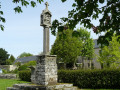
(13) Junction with a straight, level sunken lane. Turn right and head towards the built-up area, along the road which runs between a block of flats on the left and the École Saint-Joseph on the right. Turn left onto Rue du Vieux Couvent; note a large wayside cross, go down to the road, cross the railway line and reach the town hall car park (S/E).
 Visorando Member

 Moderate