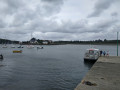
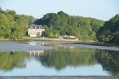
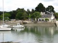
A short circular loop starting from Plescop

This walk can easily be combined with others in Plescop.

Details

n°67920947
Creation:
Last update:
Last review:
  • Walking
    Activity: Walking
  • ↔
    Distance: 3.80 mi
  • ◔
    Average duration: 1h 50 
  • ▲
    Difficulty: Easy

  • ⚐
    Back to start: Yes
  • ↗
    Ascent: + 69 ft
  • ↘
    Descent: - 66 ft

  • ▲
    Highest point: 200 ft
  • ▼
    Lowest point: 79 ft

Description of the walk

Park in the Centre des Trois Soleils car park.

(S/E) Start with your back to the centre, heading towards the roundabout, and walk along Avenue de la Paix.

(1) Take the footpath on the left and follow it straight on until you go round the sewage treatment works. After this, follow Rue René Ampère through the industrial estate to the D779 roundabout.

(2) Cross the avenue and continue straight ahead for about a hundred metres. Cross at the pedestrian crossing to rejoin a footpath and follow it to the first old mill on the Meucon.

(3) Cross the Meucon and continue along the footpath to the hamlet of Bernard.

(4) At the crossroads, turn left onto the cul-de-sac, then take the path that starts on the left at the bend, runs alongside the Meucon and leads onto a forest track.

(5) Turn left, cross the Meucon again, then follow the footpath on the right. Join the road leading to the Moulin de Bot-Lann.

(6) Turn left and carry on straight on to Plescop, crossing over the D779.

(7) Once you’ve entered Plescop, turn left onto the footpath and head towards Avenue du Général de Gaulle.

(8) Cross the avenue, then turn left and follow it to the Kermaria roundabout. Turn right, cross at the pedestrian crossing to return to the car park and the bakery (S/E).

Waypoints

  1. S/E : mi 0 - alt. 138 ft - Les Trois Soleils, car park
  2. 1 : mi 0.12 - alt. 128 ft - Pedestrian path
  3. 2 : mi 0.82 - alt. 144 ft - Roundabout
  4. 3 : mi 1.32 - alt. 79 ft - Old mill - Meucon (cours d'eau) - Affluent de la Marle
  5. 4 : mi 1.48 - alt. 121 ft - Bernard junction
  6. 5 : mi 1.92 - alt. 112 ft - Forest track
  7. 6 : mi 2.48 - alt. 135 ft - Road junction
  8. 7 : mi 3.2 - alt. 194 ft - Pedestrian path
  9. 8 : mi 3.35 - alt. 184 ft - Avenue du Général de Gaulle
  10. S/E : mi 3.8 - alt. 138 ft - Les Trois Soleils, car park

Reviews and comments

3.8 / 5
Based on 2 reviews

Reliability of the description
4 / 5
Ease of following the route
4 / 5
Route interest
3.5 / 5
User 18215772

Overall rating : 3 / 5

Date of your route : Apr 13, 2026
Reliability of the description : ★★★☆☆ Average
Ease of following the route : ★★★☆☆ Average
Route interest : ★★★☆☆ Average
Very busy route : Yes

Several impassable sections, forcing us to take several detours.
An easy walk, but too often through outlying neighbourhoods.

Machine-translated

User 2451375

Overall rating : 4.7 / 5

Date of your route : Dec 01, 2025
Reliability of the description : ★★★★★ Very good
Ease of following the route : ★★★★★ Very good
Route interest : ★★★★☆ Good
Very busy route : No

Very good presentation

Machine-translated

Other walks in the area

For more walks, use our search engine .

The GPS track and description are the property of this route's author. Please do not copy them without permission.