


Refine your search for walks in Monforte del Cid
Monforte del Cid walks


 Sierra de Las Águilas in Orito
 Visorando Member

 6.09 mi
 +1,640 ft
 -1,614 ft
 4h 15
 Moderate
 Departure from Monforte del Cid (Alacant / Alicante)
This walk takes you through the Sierra de San Pascual, whose peak of the same name rises to 550 m, as well as the Sierra de las Águilas, which forms part of the Sierra de la Venta, whose highest point is 515 m.
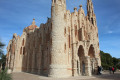
Along the River Vinalopó in Novelda
 4.89 mi
+312 ft
-312 ft
2h 30
 Easy
Departure from Novelda (Alacant / Alicante)
A very pleasant walk along the River Vinalopó in Novelda, offering a cultural experience with a visit to the extraordinary sanctuary of Santa María Magdalena, an ancient castle and a fountain.The view of the sanctuary alone is worth the trip.
El Cau, the Elche dam and Castellar
 4.84 mi
+873 ft
-846 ft
3h 00
Moderate
Departure from Elx / Elche (Alacant / Alicante)
Discover an open-air museum of stone sculptures (El Cau), a beautiful reservoir with lush vegetation, a stunning waterfall and ancient ruins at the summit of El Castellar – that’s what this walk has to offer.
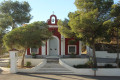
The Coca Trail at Aspe in the province of Alicante
 5.51 mi
+512 ft
-512 ft
3h 00
Easy
Departure from Aspe (Alacant / Alicante)
Proposed by Aspe town council and approved by the FEMECV (Valencian Federation of Mountain and Climbing Sports), this is an easy route, ideal for getting to know part of the Algezares municipal nature reserve.
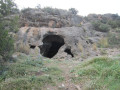
The Del Humo Cave in the Sierra de Fontcalent
 2.54 mi
+400 ft
-377 ft
1h 30
Easy
Departure from Alacant / Alicante
In the Sierra de Fontcalent, the mountain range closest to Alicante, there are numerous caves, but some are difficult to access. This walk takes you to explore a cave that is easily accessible. It is a short walk with little elevation gain that can be enjoyed by the whole family.
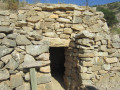
The shelters of the stone-breakers at the Novelda quarries
 2.70 mi
+469 ft
-466 ft
1h 40
Easy
Departure from Novelda (Alacant / Alicante)
This is a themed route, linked to the numerous quarries in the region. More specifically, it involves visiting some of the stonemasons’ huts by making a return trip to these huts whilst following the circular route of this walk.
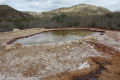
The source of the Rio Salinetes and the Clot de la Sal near Novelda
 7.14 mi
+525 ft
-535 ft
3h 45
Moderate
Departure from Novelda (Alacant / Alicante)
This is a beautiful hike starting from the stunning Santuario de Santa Maria Magdanela (a must-see). You then set off in search of the source of a small river and finish with a dip in the thermal baths.
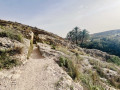
The Elche Reservoir
 7.60 mi
+236 ft
-233 ft
3h 40
Easy
Departure from Elx / Elche (Alacant / Alicante)
A very pleasant, easy walk suitable for the whole family along the River Vinalopo towards the Elche dam, or even beyond, offering views of an impressive waterfall some twenty metres high. The walk described here goes well beyond the dam, right up to a point where the owner of the farmland prohibits access, but this allows you to walk round the lake a little. As this is a round-trip walk, you can stop whenever you like.
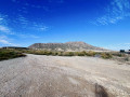
Circular around Fontcalent
 7.63 mi
+522 ft
-522 ft
4h 00
Moderate
Departure from Alacant / Alicante
This hike takes you around the Serra de Fontcalent, allowing you to see it from all angles, but from below! It's an easy alternative to climbing to the summit, which is 700 metres high. Ideal for hikers who don't want to or can't climb. Admittedly, the view will not be the same. But this circular still offers some beautiful views: between the industrial and agricultural areas, you will see the major roads and railways. In short, life around Fontcalent.
Summit of Fontcalent starting from Alicante
 4.56 mi
+1,329 ft
-1,332 ft
3h 15
 Difficult
Departure from Alacant / Alicante
Hike to one of the closest peaks to Alicante, crossing desert areas and ultimately rewarded with a 360° view of Alicante and all the peaks surrounding the city.
Elche Palm Grove Trail
 5.90 mi
+66 ft
-69 ft
2h 45
Easy
Departure from Elx / Elche (Alacant / Alicante)
A walk accessible to all, between the city and the palm grove. Ideal for discovering Elche and its horticultural heritage (listed by UNESCO). This route follows the PR®-CV 439, the official path of the Valencian Community, but with a different starting point for accessibility and easier parking.
Pla del Totxar
 7.84 mi
+774 ft
-771 ft
4h 15
Moderate
Departure from Sant Vicent del Raspeig / San Vicente del Raspeig (Alacant / Alicante)
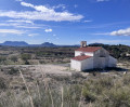
A circular loop that branches off onto the last (and most beautiful) section of the PR®-CV 282, a marked trail that follows the route of the old "Cañada Real", a network of transhumance routes dating back to the time of King Alfonso X el Sabio. You will set off from the Ermita de Nuestra Señora del Carmen to cross small inhabited areas with modest country houses before starting a circular route through the mountains where you can enjoy beautiful views of the coast. Half of the walk is on small, quiet asphalt roads and the other half on a very accessible path with gentle slopes. You won't even notice the 275 m elevation gain. It is also possible to bypass two crossing points, which shortens the walk to 10 km.
Around Maigmó from El Aljibe near Agost
 7.11 mi
+2,904 ft
-2,730 ft
5h 50
Moderate
Departure from Tibi (Alacant / Alicante)
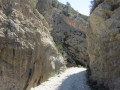
The Maigmó, at an altitude of 1,295 metres, is one of the region’s best-known peaks. However, this walk does not take you to the summit itself, but instead offers an extraordinary circuit around it. After a steep climb to the Balcon d’Alicante, where the view is fantastic, the walk takes you via the famous Col de la Xau, offering magnificent views of the peaks. You follow a barranco (a stream bed), passing through the superb spot known as ‘El Estret’. In short, everything is beautiful and practically in perfect solitude.
Ermita de las Cañadas in Elda
 5.17 mi
+367 ft
-374 ft
2h 40
Easy
Departure from Elda (Alacant / Alicante)
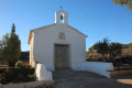
The Ermita de Nuestra Señora de Los Dolores is situated in an area near Elda, at the crossroads between Monovar and Elda, in an area known as Partida de las Cañadas. Consequently, the Ermita is commonly referred to as the Ermita de las Cañadas. It is located in a former agricultural area, irrigated by rainwater.
Even today, it remains an almost desert-like area, and the path leading there, which is not particularly difficult, passes through desert-like terrain, offering a complete change of scenery.
Tibi Dam from Sabinar
 9.04 mi
+1,788 ft
-1,781 ft
5h 45
Moderate
Departure from Sant Vicent del Raspeig / San Vicente del Raspeig (Alacant / Alicante)
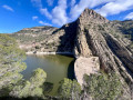
This is a hilly hike that takes you to the Tibi Dam, one of the oldest dams in Europe (1580) still in operation, via a circular route through the surrounding hills. The route offers beautiful views of the coast at the start and finish, but overall, it is more typical of the "Sierra Alicantina" landscape. The route goes up and down quite a bit, but the slopes are not very steep or very long. It is therefore a relatively accessible hike for people with a minimum level of fitness.
The summit of Escobella near Agost
 6.78 mi
+1,371 ft
-1,352 ft
4h 20
Moderate
Departure from Tibi (Alacant / Alicante)
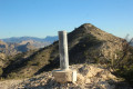
A hike in an almost desert environment to climb two peaks: La Mosca and L'Escobella. Don't forget to bring plenty of water, as the entire route is on paths exposed to the sun.
Llobera, Torreta and Pantano in Elda
 4.63 mi
+522 ft
-525 ft
2h 35
Easy
Departure from Elda (Alacant / Alicante)
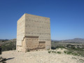
A walk around Elda to see some of its most characteristic spots. Firstly, the walk takes you up to a few peaks overlooking the town and past the remains of a15th-century defence tower at an altitude of 550 metres. You’ll then stroll along the River Vinalopó via a lovely, secluded path and discover the17th-century dam built across the river, enjoying the experience of walking across it.
The caves of Agua, Olm and the summit of El Xocolate in Petrer
 5.24 mi
+1,663 ft
-1,657 ft
3h 50
Difficult
Departure from Petrer (Alacant / Alicante)
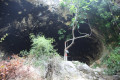
This hike takes you up to one of the peaks in the province of Alicante, which is over 1,000 metres high. While the climb to the summit is not particularly difficult, the start of the hike involves exploring some well-hidden caves. This means passing through areas where there is virtually no path and having a good sense of direction. This hike is therefore not suitable for everyone.
The Mill Trail in Tibi
 3.29 mi
+607 ft
-449 ft
2h 05
Easy
Departure from Tibi (Alacant / Alicante)
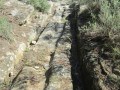
Here, we suggest exploring the old mills of Tibi, which once produced flour or paper. There were once as many as 11 mills in the area. You can see the main gate of the Groc mill at the crossroads at the entrance to Tibi. For your information, the rating established by the French Hiking Federation (FFR) gives an IBP of 22, which classifies this walk as ‘easy’.
It is an easy walk that generally follows the river known as the ‘Riu de Montnègre’ or ‘Rio Verde’.
The Mos del Bou and Moleta peaks near Tibi
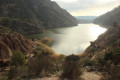 4.16 mi
+1,181 ft
-1,175 ft
2h 55
Difficult
Departure from Tibi (Alacant / Alicante)
A superb hike with exceptional views of Lake Tibi and impressive peaks to climb. However, it is a difficult hike with some very steep climbs and a path that is quite difficult to follow.
A GPS track is essential to avoid getting lost.
The summit of Del Frare via the ridges of Les Moreres to Crevillent
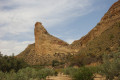 5.66 mi
+1,375 ft
-1,365 ft
3h 50
Difficult
Departure from Crevillent (Alacant / Alicante)
This is a two-part hike. First, you’ll walk along the spectacular ridges of Les Moreres. Then, you’ll climb to the summit of El Frare, a superb rocky peak overlooking the valley. This hike is best done in fine weather, as you’ll often be on rocky terrain and must take care not to slip.
The Penya Negra archaeological site
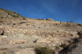 3.34 mi
+666 ft
-643 ft
2h 05
Easy
Departure from Crevillent (Alacant / Alicante)
A lovely walk around Crevillent, with the added bonus of a visit to an open-air archaeological site dating from the 9th century BC.
The Cabeço Redondo and Cabec Redo peaks as seen from Tibi
 4.57 mi
+2,415 ft
-2,425 ft
4h 10
Moderate
Departure from Tibi (Alacant / Alicante)
This walk takes you to two peaks over 1,000 metres in altitude amidst fantastic scenery near Penya Mitjorn. It is a fairly short walk but has an elevation gain of almost 600 metres, which means the climb is quite steep right from the start and continues steadily.