The Penya Negra archaeological site

A lovely walk around Crevillent, with the added bonus of a visit to an open-air archaeological site dating from the 9th century BC.

Details

n°42923622
Creation:
Last update:
Last review:
  • Walking
    Activity: Walking
  • ↔
    Distance: 3.34 mi
  • ◔
    Average duration: 2h 05 
  • ▲
    Difficulty: Easy

  • ⚐
    Back to start: Yes
  • ↗
    Ascent: + 666 ft
  • ↘
    Descent: - 643 ft

  • ▲
    Highest point: 1,280 ft
  • ▼
    Lowest point: 682 ft

Photos

Description of the walk

The starting point for this walk is at the spot known as Els Pontets (a sort of aqueduct) near Crevillent.
To get to this starting point by car, see the ‘Practical Information’ section below.

(S/E) From the car park, continue straight ahead along the road (so do not go under the aqueduct).

(1) Follow the path on the left. A short while later, at the signpost, follow the direction for “Pouet de la Mel”, i.e. straight ahead on the wide path (so do not follow the other direction, “Yacimiento Penya Negra”, which is a shortcut to get there). You are now following thePR®CV108.

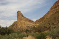
(2) Take the path on the right. You’ll now leave thePR®CV108to join thePR®CV109. It feels like you’re in the setting of a real Western film: all that’s missing are the horses. You’re about to enter the vast protected area of the archaeological site. There’s a chain blocking the road to prevent vehicles from entering, but of course not walkers. A little further on, follow the signs for Barranc del Corcons – in other words, carry on straight ahead. This is also where the shortcut mentioned earlier joins the route.

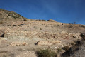
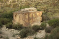
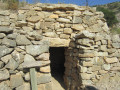
(3) Arrive at the site itself. Take the time to explore it and read the various information boards.
Resume the walk by following the signs for Barranc del Corcons – that is, turning left rather than going straight on, although this path does not appear on maps.

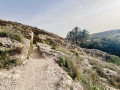
(4) At the signpost, carry on straight ahead. You’re now on a narrow mountain track surrounded by lovely scenery.

(5) You’ll emerge at a place called Costera de la Bigotilla onto a very wide dirt track, wide enough for cars to pass. Turn right as you head downhill. This wide track will become a tarmac road.

(6) Follow the tarmac road, turning right.

(7) Continue along the tarmac road, heading to the right. This will take you gently to Els Pontets and thus to the car park (S/E).

Waypoints

  1. S/E : mi 0 - alt. 686 ft - Els Pontets
  2. 1 : mi 0.23 - alt. 778 ft - Junction
  3. 2 : mi 0.72 - alt. 951 ft - Junction
  4. 3 : mi 1.39 - alt. 1,125 ft - Website
  5. 4 : mi 1.58 - alt. 1,158 ft - Signpost
  6. 5 : mi 1.87 - alt. 1,276 ft - Crossroads
  7. 6 : mi 2.16 - alt. 1,060 ft - Tarmac road
  8. 7 : mi 3 - alt. 741 ft - Junction
  9. S/E : mi 3.34 - alt. 682 ft - Car park

Notes

To drive to the starting point of the walk:
from Alicante city centre, take the A31 motorway (from Calle Mexico) towards Madrid and, shortly afterwards, take exit 235B towards the A70 / airport / Elx / Elche / Murcia.
Continue on the A70 towards Elche.
Take exit 523 for the N340 / Elx / Elche / Crevillent, then turn right onto the N-340 / Crevillent.

At the roundabout, take the 3rd exit towards the N-340 / Crevillent.
At the next roundabout, take the 2nd exit towards the N-340 / Crevillent.
You will enter Crevillent.
On the N-340, you’ll see a sign next to a traffic light for Tarrotorio / Policia Local / Iglesia S. Cayetano; carry on straight ahead.
Pass two sets of traffic lights and, at the third set, turn right. At the traffic lights, turn left onto Avenue de Madrid.
At the roundabout, turn right towards the obelisk and carry on straight ahead.
You’ll then come to a stone bridge, which you pass under.
At the roundabout after this stone bridge, turn left and, at the top of the street, turn left again.
You will then reach Carrer Molins, veering slightly to the left.
At the junction, turn left to stay on Carrer Molins and carry on.
You’ll then arrive at a place called Els Pontets (a sort of aqueduct), where you can park.

In Crevillent, you can also drive through the town centre (which the suggested route avoids) or enter “Carrer Molins” into your sat-nav in Crevillent.

For your information, by car from Alicante, the journey is approximately 35 km and takes about 35 minutes.

Worth a visit

The archaeological site of La Penya Negra was inhabited from the 9th to the 8th century BC until the 5th century BC. Covering an area of over 40 ha, this is the ancient city of Herna, which had close ties with the Phoenicians of the River Segura. This influence transformed the way of thinking and living of the population, who gradually adopted an urban way of life.
Excavations were carried out between the 1970s and 1980s, and resumed in 2014.

To find out more, here is a link to studies carried out by the University of Alicante (in Spanish):
https://dprha.ua.es/es/herna/

Always be cautious and plan ahead when you're outdoors. Visorando and the author of this route cannot be held responsible for any accidents occurring on this route.

The GR® and PR® markings are the intellectual property of the Fédération Française de Randonnée Pédestre.

Reviews and comments

5 / 5
Based on 1 review

Reliability of the description
5 / 5
Ease of following the route
5 / 5
Route interest
5 / 5
CJCB
CJCB

Overall rating : 5 / 5

Date of your route : Mar 04, 2025
Reliability of the description : ★★★★★ Very good
Ease of following the route : ★★★★★ Very good
Route interest : ★★★★★ Very good
Very busy route : No

A great route for an afternoon. Thanks to the organiser

Machine-translated

Other walks in the area

For more walks, use our search engine .

The GPS track and description are the property of this route's author. Please do not copy them without permission.