Country:
 City:
City:


The starting point for the walk is the Mariano Ros car park. See the ‘Practical Information’ section for details on how to get there by car.
(S/E) From the car park, cross the road (note the stone marked ‘El Cau’) and take the path opposite, following it straight ahead.
(1) Look out for a stone on the ground marked ‘El Cau’, indicating the direction to follow. Leave the main path and head right to explore the entire exhibition. See further details below in the ‘During the hike’ section. Then retrace your steps slightly but head down into the mountains to reach the final artwork, which stands apart from the others in the heart of the countryside.
(2) Location of the final artwork in the heart of the countryside: Puente Arquet, which is where you need to go.
(3) You’ll then reach a very wide dirt track; follow it downwards. This leads onto a tarmac road, which you’ll follow for a while.
(4) Leave the road and take the dirt track on the right.
(5) This is where the circular section of the walk begins. Pass under the arches of the aqueduct that was used to carry water and continue straight on. You’ll then find yourself in a small quarry. Follow the well-marked path and walk along the banks of the lake formed by the dam’s reservoir. You’ll also notice the various structures used for water transport and the irrigation system with its canals. Just before reaching the dam, cross a footbridge to find yourself in the middle of the water. You’ll then reach the dam and descend a little further to see the entire dam and the waterfall. See explanations below in the ‘During the walk’ section. If you wish, you can descend much further to reach the foot of the dam, but you’ll of course have to climb all the way back up.
(6) Then climb back up to the building and go round to the left of this house, taking the stone steps. The rest of the climb (which is quite steep) involves following the large boulders, and you’ll need to use your hands at times.
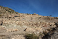
(7) Summit of Castellar and a look at the archaeological remains. See explanations further down in the ‘During the walk’ section. Then look out for the start of the gravelly descent path. It’s quite difficult to spot, although it’s marked by a very small cairn. The descent is steep and very steep-sloped: you must therefore proceed with great caution. You’ll then reach the starting point of the circular route.
(5) Retrace your steps in the opposite direction until you reach a junction you have already passed on the way out.
(3) Turn right and head back to the original fork.
(1) Continue straight ahead, following the path in the opposite direction to the outward journey, to return to the car park (S/E).

 Visorando Member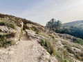
 Easy
Easy 


 Difficult