Country:
 City:


The starting point for this walk is at the car park for the Cueva de San Pascual, near the village of Orito in the province of Alicante. To get to this starting point by car, see the ‘Practical Information’ section below.
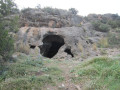
(S/E) Continue up the tarmac road to reach the Cueva de San Pascual.
(1) Look out for a signpost to the left of the building and the path at its base, which starts off to the right. Take this path, ignoring a track on the right further up, until you reach a four-way junction with a signpost.
(2) Continue to the right towards Cumbre de San Pascual (San Pascual summit), following the white and yellow crossed markings. Follow this path, known as “Subida a cima San Pascual” (ascent to the summit of San Pascual). Pass a small summit with a cairn and continue along the path to the summit of San Pascual (555 m)
(3) Continue along the path for about a hundred metres, until you reach a cairn, then turn right to take the path which is not visible from where you are, as it lies on the other side of the mountain and leads downhill. You will reach a junction with another path, called Camino de la Sena.
(4) Turn right and head downhill (taking care due to the condition of the path) towards the large reservoir known as the Embalse de Espejeras. Walk alongside it and then, after a steep climb, continue along the path to the right.
(5) Take the path on the right – note a fork to the left – and head for the highest peak in this part of the Sierra de las Águilas.
(6) This peak is marked by a cairn, rises to an altitude of 504 m and is simply called Sierra de las Águilas. Retrace your steps and turn right onto the path you noticed on the way up, then reach a fork in the path.
(7) Take the path on the left to reach the final peak.
(8) Further on, at a large electricity pylon, head up to the left to the highest peak at an altitude of 515 m. This peak is also marked by a cairn.
(9) Head back down the same path, using the large electricity pylon as a landmark.
(8) Continue by taking the path to the left which follows the line of tall electricity pylons; this leads onto a wide track, which you follow to the right to rejoin the route you have already taken.
(7) Turn left and ignore the path leading back from the summit of the Sierra de las Águilas.
(5) Carry on straight ahead to follow, in the opposite direction, the path leading to the large reservoir and, finally, head back up to the junction.
(4) Leave the route you have already taken and continue straight on.
(10) When you reach a building (the only one in the area), take the wide path on the left which ends at a platform. Then head uphill, keeping slightly to the right, cross several levels of old terraced fields and you’ll come to a lovely path.
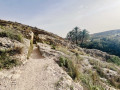
(11) Follow this path to the right; it is clearly marked as it is bordered by stones, with white and yellow markings, and dotted with wooden steps, some of which are quite high.
(12) At the signpost, turn left towards the Cueva de San Pascual and return to the four-way junction you passed on the way there.
(2) Turn right towards “Orito”, following the path downhill.
(13) At the signpost, turn left towards “Cueva de San Pascual”, which you’ll reach after a steep climb.
(1) Walk back down the short stretch of road to return to the car park where you started (S/E).

 Visorando Member

 Easy

 Difficult