Refine your search for walks in Lauchenkopf
Lauchenkopf walks


 The Lauchenkopf
 Visorando Member
 10.85 mi
 +1,631 ft
 -1,614 ft
 6h 25
6h 25
 Moderate
 Departure from Sondernach (Haut-Rhin)
A moderately difficult hike of about 6 hours through stubble fields, forests, passes and peaks.
The difficulties are mainly at the beginning, after which it's smooth sailing.
Platzerwasel, Lauchenkopf, Oberlauchen Pass, return via the Uff Rain Inn
 4.30 mi
+663 ft
-669 ft
2h 35
4.30 mi
+663 ft
-669 ft
2h 35
 Easy
Departure from Sondernach (Haut-Rhin)
Easy
Departure from Sondernach (Haut-Rhin)
Mostly shaded walk. Beautiful views along the way of the Markstein, Sondernach and the Oberlauchen Pass.
Chaumes and forests of Lauchen
 10.29 mi
+1,995 ft
-1,985 ft
6h 30
Moderate
Departure from Linthal (Haut-Rhin)
10.29 mi
+1,995 ft
-1,985 ft
6h 30
Moderate
Departure from Linthal (Haut-Rhin)
Near the source of the Lauch, on the secondary ridge between Breitfirst and Petit Ballon, Lauchen is an area of stubble fields with remarkable views and forests, including the most beautiful and highest altitude beech forests in the Vosges mountains. It is also a peaceful area, within the Guebwiller integral biological reserves, dominated by the Klintzkopf, home to the emblematic animal of the Vosges, the capercaillie or wood grouse.
Exploring the Bois de Munster
 5.27 mi
+876 ft
-883 ft
3h 10
Moderate
Departure from Metzeral (Haut-Rhin)
5.27 mi
+876 ft
-883 ft
3h 10
Moderate
Departure from Metzeral (Haut-Rhin)
A route with little elevation gain but offering magnificent panoramic views of the peaks of the Hautes-Vosges on several occasions. Passing by two farmhouse inns, it offers the chance to sample regional specialities.
Schnepfenriedkopf, Nonselkopf and Lauchenkopf
 Tourism professional
 7.38 mi
+1,280 ft
-1,276 ft
4h 30
Moderate
Departure from Sondernach (Haut-Rhin)
7.38 mi
+1,280 ft
-1,276 ft
4h 30
Moderate
Departure from Sondernach (Haut-Rhin)
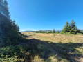
A hike starting from the hamlet of Schnepfenried, towards the Schnepfenriedkopf (1,258 m), then the Nonselkopf (1,257 m) and the Lauchenkopf (1,314 m). Along the path that runs along the ridge, through stubble fields and forests. Return via wide paths, passing the Salzbach and Uff Rain farm inns. Start and finish near the Schnepfenried Farm Inn.
From the Col du Platzerwaesel to the Klintzkopf
6.70 mi
+1,194 ft
-1,152 ft
4h 05
Moderate
Departure from Sondernach (Haut-Rhin)
Please note that the circular route starting from (5) is closed to traffic from 1 December to 30 June, to ensure the animals’ peace and quiet. It is essential to comply with this ban.
A pleasant walk which, in addition to the scenery of the Hautes Vosges, allows you to discover the fifth highest peak in the Vosges. The route passes through magnificent beech forests in places, and the stop at two farmhouse inns is a definite highlight.
Walks near Lauchenkopf
Hahnenbrunnen – Willer-sur-Thur
 13.02 mi
+886 ft
-3,524 ft
6h 45
Moderate
Departure from Metzeral (Haut-Rhin)
13.02 mi
+886 ft
-3,524 ft
6h 45
Moderate
Departure from Metzeral (Haut-Rhin)
The final stage passes via the Markstein and beneath the Grand Ballon, with more downhill sections and shade provided by the trees, ending in the Thur Valley where you can catch a train to Mulhouse.
Markstein – Petit Ballon – Linthal
 Tourist office12.88 mi
+1,407 ft
-3,619 ft
7h 10
Tourist office12.88 mi
+1,407 ft
-3,619 ft
7h 10
 Difficult
Departure from Oderen (Haut-Rhin)
Difficult
Departure from Oderen (Haut-Rhin)
Take the time to admire the landscapes and views that make this second day’s walk so special. The route follows the ridges for the most part, leading to the Petit Ballon via the Klintzkopf. Once again, you’ll be able to fully enjoy the panoramic views over the plains and valleys on either side of the mountain. This route, which passes through forests and stubble fields, will allow you to discover the richness of the local flora.
Hahnenbrunnen Pass and Uff Rain from Langenwasen
 9.32 mi
+2,182 ft
-2,146 ft
6h 10
Difficult
Departure from Metzeral (Haut-Rhin)
9.32 mi
+2,182 ft
-2,146 ft
6h 10
Difficult
Departure from Metzeral (Haut-Rhin)
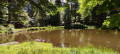
A lovely climb towards the Vosges ridge along the River Pfahlrunz, with a stop at a charming little lake (unnamed). Lots of remarkable trees. Then an easy walk along theGR®5along the ridge before heading towards the farm inns at Salzbach and Uff Rain, with panoramic views of the Vosges peaks.
Le Markstein – Thann
 17.72 mi
+2,359 ft
-5,187 ft
10h 10
17.72 mi
+2,359 ft
-5,187 ft
10h 10
 Very difficult
Departure from Oderen (Haut-Rhin)
Very difficult
Departure from Oderen (Haut-Rhin)
From the Markstein, the sixteenth stage of the journey across the Vosges proposed by Passion Vosges magazine continues along the Great Vosges Ridge towards the massif’s highest point, the Grand Ballon. After a visit to the Hartmannswillerkopf battlefield (1914–1918) and a climb to the summit of the Molkenrain, a long descent through the forest begins, heading towards Thann and its famous Gothic collegiate church. Franck Buchy’s account of this sixteenth stage can be found in *Passion Vosges*.
From the ridges towards the Petit Ballon
8.32 mi
+866 ft
-784 ft
4h 35
Moderate
Departure from Ranspach (Haut-Rhin)
The Munster Valley, Hohrodberg, Haut-Koenigsbourg Castle – just how far will the Col d’Oberlauchen take your view?
Setting off from Markstein, before crossing the resort’s ski slopes, you can stop off to visit the Notre-Dame-des-Neiges Chapel for a brief cultural break. Heading towards the Petit Ballon, this route crosses numerous passes and peaks, such as the Klintzkopf and the Hilsenfirst, not to mention the Col d’Oberlauchen, from which you’ll be able to spot many of the area’s distinctive features… Keep your eyes peeled!
Ascent to the Grand Ballon from Sengern (Guebwiller) via the lake
 5.78 mi
+2,910 ft
-39 ft
5h 10
Difficult
Departure from Lautenbachzell (Haut-Rhin)
5.78 mi
+2,910 ft
-39 ft
5h 10
Difficult
Departure from Lautenbachzell (Haut-Rhin)
A challenging climb to the Grand Ballon from Sengern (past Guebwiller). The route passes by the beautiful Lac du Ballon and the Gustiberg farmhouse inn, both of which offer very pleasant places to stop for a break.
Linthal – Grand Ballon – Markstein
12.20 mi
+3,553 ft
-1,319 ft
8h 40
Difficult
Departure from Linthal (Haut-Rhin)
A very physically demanding first day with a wide variety of landscapes.
Starting from Linthal, the most mountainous village in the Guebwiller region, the first day of this multi-day hike will take you to the Auberge du Steinlebach, via the Grand Ballon – the highest peak in the Vosges mountains, rising to an altitude of 1,424 metres – and the Markstein resort. The ascent is quite challenging and requires a good level of fitness. Along the way, you’ll pass the Gustiberg farmhouse inn, Lake Ballon and the Haag farmhouse inn…
Descent into the Noble Valley
11.33 mi
+705 ft
-3,825 ft
5h 50
Moderate
Departure from Sondernach (Haut-Rhin)
Begin your descent through varied landscapes towards the first villages of the Alsace plain, situated on the Wine Route.
After enjoying the 360° view from the Petit Ballon over the valleys of Guebwiller and Munster and the Hohneck and Grand Ballon mountain ranges, it is as you begin the descent at the end of the ridge that you will catch sight of the Petit Ballon glacial cirque. Beautiful little paths, winding through woods and meadows, vineyards and mountains, will take you to the village of Soultzmatt, via Wintzfelden and Osenbach, not forgetting a short stop at the remarkable site of the ruins of Schwartzenthann Convent.