From the ridges towards the Petit Ballon

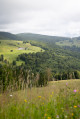
The Munster Valley, Hohrodberg, Haut-Koenigsbourg Castle – just how far will the Col d’Oberlauchen take your view?
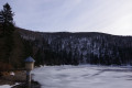
Setting off from Markstein, before crossing the resort’s ski slopes, you can stop off to visit the Notre-Dame-des-Neiges Chapel for a brief cultural break. Heading towards the Petit Ballon, this route crosses numerous passes and peaks, such as the Klintzkopf and the Hilsenfirst, not to mention the Col d’Oberlauchen, from which you’ll be able to spot many of the area’s distinctive features… Keep your eyes peeled!

This walk is part of a multi-day hike: The Grand Ballon circuit in 5 days

Details

n°46128553
Creation:
Last update:
Last review:
–
  • Walking
    Activity: Walking
  • ↔
    Distance: 8.32 mi
  • ◔
    Average duration: 4h 35 
  • ▲
    Difficulty: Moderate

  • ⚐
    Back to start: No
  • ↗
    Ascent: + 866 ft
  • ↘
    Descent: - 784 ft

  • ▲
    Highest point: 4,160 ft
  • ▼
    Lowest point: 3,688 ft

Description of the walk

(S) Cross the road and follow it towards Col de la Schlucht – Munster – La Bresse to reach the resort’s main buildings. After passing the Maison d’Accueil du Markstein on your right (opposite the restaurant Chez Speck), leave the main road and take a small, slightly downhill tarmac road leading to the Notre-Dame-des-Neiges Chapel. When you reach it, take the small path branching off to the right. This passes in front of the chapel entrance and joins a forest track. After a few metres downhill, this track joins a path running at right angles to it, marked with a Red Triangle.

(1) Follow it to the left, towards Steinlebach – Oberlauchen. Walk past the beautiful Chalet Nansen, owned by the Mulhouse Ski Club Vosgien, cross the Fédérale ski runs, and finally arrive at the Auberge du Steinlebach (catering available).

(2) Walk past the inn and head towards Oberlauchen along a straight, gently ascending path, still marked with a Red Triangle. Initially in open country, it enters the forest. After crossing a stream, at a hairpin bend to the right, the path splits.

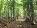
(3) Leave the Red Triangle markings and follow the left-hand path, which climbs gently (marked for cross-country skiing and mountain biking). This almost level track, running along the mountainside through a magnificent beech forest, leads to the Col d’Oberlauchen (altitude 1,211 m).

(4) Crossing the

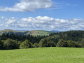
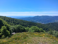
(5) “Beautiful views over the Munster Valley, the villages of Sondernach and Metzeral, the Hohrodberg and the Gazon du Faing cirque. In the distance, the Taennchel plateau and Haut-Kœnigsbourg. On the other side of the pass, splendid views of the Markstein ridge, the Storckenkopf and the Grand Ballon.”
From this pass, follow the Yellow Rectangle markings (GR®532) coming from Lac de la Lauch on the right. Stay on this route until you reach Rothenbrunnen. Continue straight on until you reach the Col de Lauchen.

(6) Head straight on to the Col du Hilsenfirst, skirting the Langenfeldkopf Nature Reserve. Superb views over the Florival valley.

(7) Keep going in the same direction. At the next junction, turn left onto the path which crosses the first scree slopes of the Steinmauer and switches to the other side of the mountain (stunning views of the villages of Sondernach and Metzeral). Carry straight on along the track, passing the Vosges Trotters mountain hut from Strasbourg. Keep to the right to reach the Amis de la Nature mountain hut in Rothenbrunnen at the foot of the Petit Ballon (E).

Waypoints

  1. S : mi 0 - alt. 3,855 ft - Markstein (le)
  2. 1 : mi 0.39 - alt. 3,822 ft - Perpendicular path
  3. 2 : mi 1.5 - alt. 3,730 ft - Ferme auberge du Steinlebach
  4. 3 : mi 2.04 - alt. 3,763 ft - The path forks
  5. 4 : mi 2.69 - alt. 3,865 ft - La Lauch
  6. 5 : mi 3.16 - alt. 3,957 ft - Col d'Oberlauchen
  7. 6 : mi 4.38 - alt. 3,921 ft - Col de Lauchen
  8. 7 : mi 6.84 - alt. 3,688 ft - Col du Hilsenfirst
  9. E : mi 8.32 - alt. 3,947 ft - Petit Ballon

Notes

Please note: Traffic restrictions are in place between the Col d’Oberlauchen and the Col du Lauchen due to a biotope protection order. The trail crossing via the summit of the Klintzkopf (altitude 1,330 m), with its superb panoramic views, is only permitted between1July and1December. For the rest of the year, follow the track. Both routes are signposted with Yellow Rectangles.

Where to stay and eat at the Petit Ballon?

- Rothenbrunnen Nature Friends’ Mountain Hut: book on 03 89 48 00 36 before 8.30 pm.
Overnight stay in a dormitory: €11. Fully equipped kitchen available.
The refuge is run by volunteers. Open from 4.00 pm on Saturday to 4.00 pm on Sunday. Irregular opening hours during school holidays: please enquire via the booking number 03 89 48 00 36

- Ferme Auberge du Rothenbrunnen: 03 89 77 33 08
Half-board rate (dinner, overnight stay and breakfast) between €34 and €41 (booking recommended)
Picnic: Sandwich + fruit for €4 (Closed on Mondays and throughout January)

- Kahlenwasen Farm Inn: 03 89 77 32 49
Half-board rate (dinner, overnight stay and breakfast) €40 (booking recommended)
Picnic with home-made produce: €6.50 (Open from Easter to November)

- Ferme Auberge du Strohberg: 03 89 77 56 00
Marcaire set menu: €19 and à la carte dishes between €12 and €16
Open every day from 1 May to 1 November except Tuesdays (booking recommended)

- Dynamo Youth Hostel:
Reopening spring 2024 – Tel. 07 49 48 51 00 / assodynamo@free.fr

Worth a visit

- Petit Ballon (E).
- Panoramas.

Always be cautious and plan ahead when you're outdoors. Visorando and the author of this route cannot be held responsible for any accidents occurring on this route.

The GR® and PR® markings are the intellectual property of the Fédération Française de Randonnée Pédestre.

Other walks in the area

For more walks, use our search engine .

The GPS track and description are the property of this route's author. Please do not copy them without permission.