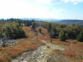
Hahnenbrunnen – Willer-sur-Thur

The final stage passes via the Markstein and beneath the Grand Ballon, with more downhill sections and shade provided by the trees, ending in the Thur Valley where you can catch a train to Mulhouse.

This walk is part of a multi-day hike: Traversée des Vosges du Sud de Kintzheim à Willer-sur-Thur

Details

n°103365635
Creation:
Last update:
Last review:
–
  • Walking
    Activity: Walking
  • ↔
    Distance: 13.02 mi
  • ◔
    Average duration: 6h 45 
  • ▲
    Difficulty: Moderate

  • ⚐
    Back to start: No
  • ↗
    Ascent: + 886 ft
  • ↘
    Descent: - 3,524 ft

  • ▲
    Highest point: 4,147 ft
  • ▼
    Lowest point: 1,217 ft
  • ⚐ Country: France
  • ⚐
  • ⚐ City: Metzeral (68380)
  • ⚑
    Start: N 47.952425° / E 7.018831°
  • ⚑
    End: N 47.843451° / E 7.0708°
  • ❏
    IGN map(s): Ref. 3619OT, 3619OTR, 3620ET, 3719OT, 3719OTR
  • Hour-by-hour weather

Photos

Description of the walk

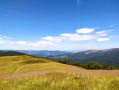
(S) Take the GR®5, signposted with a solid Red Rectangle pointing due south. Follow the Route des Crêtes and, via a virtually flat path, reach the Markstein ski resort.

(1) Continue on the GR®5, running parallel to the Route des Crêtes; after the Hundskopf summit, you’ll reach a crossroads of paths at the edge of the forest.

(2) Turn right, still on the GR®, and head away from the Route des Crêtes. Continue on an almost flat path to reach the Col du Haag.

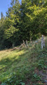
(3) Turn right onto the path marked with a Yellow Cross. Now begin the long final descent, enter the woods and you’ll soon come to the Oberer Sattel shelter.

(4) Continue along this path until you reach the village of Altenbach.

(5) Cross the village, stay on the Yellow Cross markings, join the D13b9 and follow it to the left up to the 721-metre mark at a left-hand bend.

(6) Turn right, following the Yellow Cross markings, and descend to the ponds and the picnic area.

(7) Cross the road to rejoin the same path on the other side of the stream. You’ll soon reach this road again. Shortly afterwards, the path crosses the D13B6.

(8) Cross it again, enter the village of Willer-sur-Thur, and continue on to reach the station (E), the end point of this 5-day walk.

Waypoints

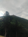
  1. S : mi 0 - alt. 3,881 ft - Refuge du Hannenbrunnen
  2. 1 : mi 2.75 - alt. 3,858 ft - Markstein (le)
  3. 2 : mi 4.79 - alt. 3,917 ft - Route des Crêtes junction - Hundskopf
  4. 3 : mi 6.89 - alt. 4,032 ft - Ferme auberge du Haag
  5. 4 : mi 7.59 - alt. 3,766 ft - Abris Oberr-Sattel
  6. 5 : mi 9.73 - alt. 2,510 ft - Altenbach
  7. 6 : mi 10.28 - alt. 2,362 ft - D13b9
  8. 7 : mi 11.64 - alt. 1,394 ft - Ponds
  9. 8 : mi 12.15 - alt. 1,312 ft - D13B6
  10. E : mi 13.02 - alt. 1,217 ft - Gare de WILLER/THUR (MAIRIE)

Notes

(S) Breakfast is available at the Hahnenbrunnen farm, provided you have booked the day before, or alternatively at the Markstein (1).
(3) A warm welcome at the Haag farm. A popular stop for many cyclists and on the route of the 2026 Tour de France. Do try the fromage blanc with raspberries.
(5) Altenbach: water available.
Note: the path downhill is in good condition as far as Goldbach, but becomes rough beyond that point.

Worth a visit


(3) Option to climb the Grand Ballon; beautiful panoramic views from the summit of this highest peak in the Vosges.
After (3): the path skirts the Storkenkopf, the second-highest peak in the Vosges.

Always be cautious and plan ahead when you're outdoors. Visorando and the author of this route cannot be held responsible for any accidents occurring on this route.

The GR® and PR® markings are the intellectual property of the Fédération Française de Randonnée Pédestre.

Other walks in the area

For more walks, use our search engine .

The GPS track and description are the property of this route's author. Please do not copy them without permission.