Country:

 City:
City:


(S) Starting from Rue du Markstein in Linthal, take the small bridge on the left after the large half-timbered house on the left as you head up the valley. After the bridge, turn right towards Sengern. Walk past the church on the left and, at the junction, turn right onto Rue du Felsenbach twice. Follow this typical mountain village street (very steep at the start) all the way to the end. You’ll arrive at the Felsenbach stables.
(1) Take the path marked with a Red Rectangle crossed by a White Rectangle, which branches off to the right at the edge of the meadow towards Gustiberg (holiday camp and farm inn). At Chemin du Schutzle, turn right and then, after the bend, veer left uphill. The path then crosses it a second time and reaches a junction.
(2) Turn left and follow the Blue Triangle markings, still heading towards Gustiberg. The path passes a few metres from the former holiday camp; leave its access path behind before crossing a very steep meadow, heading towards the Gustiberg farmhouse inn. From this farmhouse inn, with its authentic charm, you can enjoy a beautiful view of the valley, the Alsace plain and the Black Forest.
(3) From the farmhouse inn, continue along the Blue Cross-marked path to the right, which soon levels out as you head towards Lac du Ballon. At the end, keep left on the same path to approach the lake.
(4) When you reach the lake, take the path leading down to the right towards the dam. Cross the dam and walk round the lake, following the Red Rectangle with a white cross markings towards the Grand Ballon. Pass a path on your right, then immediately a track, and quickly follow a steep path branching off to the right. Take this winding path through a dense fir forest. Cross a junction and continue to theGR®532(marked with a Yellow Rectangle).
(5) Take theGR® to the left towards the Haag farmhouse inn and the Grand Ballon; it joins the Route des Crêtes at the Col du Haag. Enjoy the view of the civil aviation radar station at the summit.
(6) Cross the road, leaving the farmhouse inn and theGR®532on your right, and follow theGR®5(marked with a Red Rectangle) which runs alongside the road for about a hundred metres. Keep to the right (leaving the return path on your left), then head straight across the meadow towards the summit. Walk through a beautiful high-altitude beech forest and emerge onto the slopes of the summit, ignoring the path on the right which leads to the Redslob Monument. Continue to the Monument to the ‘Diables Bleus’ (Blue Devils), the nickname given to the Alpine hunters who fought in the Vosges mountains during the First World War. Then climb up to the civil aviation radar station, whose ‘walkway’ also serves as a compass point.
(7) From the summit, head down the opposite slope towards the pass of the same name. Always keep left onto the path towards the Haag farmhouse inn, passing the Grand Ballon chalet-hotel (Red Ring then Red Rectangle crossed out in white). Join theGR®5and reach the Col du Haag.
(6) Turn left onto the small forest road coming from the village of Geishouse, leaving the farmhouse inn on your right. At the first hairpin bend in the road, carry on straight ahead along a forest track, still marked with a Red Rectangle. This track, also known as “Kapitaenstressla”, skirts the Storckenkopf along its southern slope. Pass a path leading down to the left, then another, and continue straight on, joining the level path that leads to the Moorfeld clearing. At the clearing, join the Route des Crêtes.
(8) Cross it (take care); theGR®5is joined by a path marked with a Yellow Rectangle (GR®532) coming from the Col du Haag via the northern slope of the Storckenkopf. Take this path to the left towards the Markstein, always following theGR®5markings (Red Rectangle and Yellow Rectangle at the start). Cross a track. Shortly before the Col du Hundsruecken, you can visit the Edelweiss chalet run by the Saint-Amarin Ski Club. Open at weekends (signposted).
(9) At the pass, leave theGR®532on your right and continue to follow theGR®5(Red Rectangle), which leads to one of the car parks at the Markstein ski resort (altitude: 1,184 metres. Farm inn, brasseries, restaurants, hotel). Cross two junctions and pass close to the chairlifts to reach the main building.
(10) At Markstein, near the resort reception, take a small tarmac road that slopes gently downwards towards the Notre-Dame-des-Neiges Chapel. When you reach the chapel, take the small path branching off to the right. This passes in front of the chapel entrance and joins a forest track. After a few metres downhill, this path joins a path running at right angles to it, marked with a Red Triangle. Follow it to the left, towards Steinlebach – Oberlauchen. Walk past the beautiful Nansen chalet belonging to the Mulhouse Ski Club Vosgien and cross the Fédérale ski slopes. You will eventually arrive at the Auberge du Steinlebach, the end of the first stage (E).

 Tourist office
 Visorando Member
 Easy
Easy 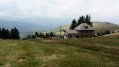
 Moderate