Country:

 City:
City:


(S) From the inn, head east towards Oberlauchen along a straight, gently ascending path, marked throughout by the Red Triangle. Starting in open country, the path enters the forest. At a hairpin bend to the right, the path splits. Continue on the right, still following the Red Triangle markings. Leave the forest to reach the Oberlauchen moorland and come to a crossroads.
(1) Continue left, uphill, towards the pass and reach the next track (marked with the Yellow Rectangle ofthe GR®532). See Practical Information.
(2) Turn right onto the “Sentier des Américains”, staying on theGR®; follow these markings all the way to Rothenbrunnen.
This route passes via the Col du Lauchen (altitude: 1,194 m. ONF shelter open).
(3) Continue straight ahead along the path that skirts the ridge, through the Langenfeldkopf nature reserve. Reach the ridge of the same name.
(4) Head straight ahead along the path leading to the Hilsenfirst Pass (altitude: 1,124 metres. Superb views over the Florival valley).
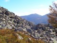
(5) Continue straight on, then turn left onto the path that crosses the first scree slopes of the Steinmauer.
(6) The path crosses over to the other side of the mountain (stunning views of the villages of Sondernach and Metzeral). Carry on straight ahead along the path that passes in front of the Vosges Trotters de Strasbourg mountain hut, then turn right uphill to reach the Amis de la Nature mountain hut in Rothenbrunnen.
(7) Climb to the summit of the Petit Ballon (Blue Diamond), via the second path on the right, to enjoy a magnificent view of the Guebwiller and Munster valleys and the surrounding peaks. Looking south, you’ll see the Grand Ballon directly opposite you.
(8) Descend from the summit of the Petit Ballon via the path on the right, marked with a Yellow Rectangle. At the junction, continue to the left to reach the woodland towards Mullermatt, at a junction of marked paths.
(9) Leave theGR® and follow the Blue Triangle markings to the right. Continue straight down the slope; at the first junction, turn left, then right. Pass close to the hamlet of Belchenbach, where there is a lodge with the ‘gîte panda’ label (eco-accommodation and biodiversity awareness). Reach the Hilsen crossroads.
(10) Passing just above the Hilsen farmhouse inn (snacks available at any time, with farm-produced cheeses and cured meats on sale), carry on straight ahead twice along the path marked with a Yellow Rectangle crossed by a white bar.
You will need to open electric fences several times. Make sure you close each one properly. When you reach a tarmac road, turn right. Leave the dirt track behind. In a left-hand bend, the road turns into a track.
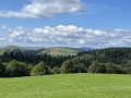
(11) Continue along this unmarked path (Rue du Hilsenfirst) towards Obersengern, ignoring five Forks in the road. This path offers superb views of the Hilsen, the Hilsenfirst, the Petit Ballon, the valley and the Alsace plain.
The path leads to the hamlet of Obersengern and a Yellow Triangle trail, heading towards Linthal.
(12) First, pass between the houses along a narrow track. Continue straight on, then turn right. At the edge of the forest, continue along the Yellow Triangle path towards Linthal. At the junction, turn left. The path descends through a fir forest, then joins a wider track on the right until it crosses the tarmac road to Obersengern for the first time.
On the other side of the road, the path narrows again and crosses the Obersengern road twice more. Carry on, still heading towards Linthal, following the Yellow Triangle. The forest becomes lighter (oaks) and rockier. On the right, you can stop off briefly on a promontory where there is a bench offering a lovely view of the village of Sengern (municipality of Lautenbach-Zell).
(13) Continue along the path. At the junction, turn left, following the Yellow Cross sign, then turn right towards Sengern. Cross a track, then turn right. As you emerge from the forest, the path becomes very narrow as it passes between the fences of two houses, then it opens out onto Rue du Markstein. Turn left to reach the car park (E).
 Visorando Member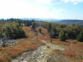
 Moderate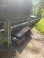
 Easy
Easy  Tourism professional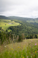
 Very difficult
  Tourist office