Country:

 City:
City:


The route starts at the Col du Platzerwaesel: easy parking.
(S/E) With your back to the car park, cross the D27 carefully and begin the climb through the forest towards the Nonselkopf.
(1) At the first junction, carry on straight ahead along the path marked with a Blue Disc. Go through the gate in the field and tackle the steep climb straight ahead across the meadow, which will take you up to the Nonselkopf.
(2) At the Nonselkopf, follow the path which descends slightly before climbing again through a beautiful beech forest.
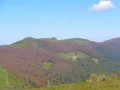
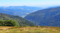
(3) As you approach the Lauchenkof, you can enjoy a magnificent panoramic view of the ridges. Carry on straight ahead until you reach a junction.
(4) Ignore the paths branching off to the right and then to the left, and continue following the Blue Disc markings to the Oberlauchen Pass. Looking north, you’ll have a bird’s-eye view of the Sondernach valley.
(5) Continue eastwards along the path as it climbs through the forest towards the Klintzkopf (marked with Yellow Rectangles and White Rectangles).
Please note: this path is closed to the public from 1 December to 30 June to ensure the animals’ peace and quiet. It is essential that you comply with this restriction.
You’ll reach the Klintzkopf. Rising to 1,329 metres, this unusual summit (a huge pile of rocks) is the fifth-highest peak in the Vosges and offers a 360° panorama across the entire Hautes Vosges.
(6) After a well-deserved break, begin the descent, marked with Yellow Rectangles and White Rectangles, along a narrow path that winds through a superb beech forest to the Col de Lauchen.
(7) At the pass, turn right onto the wide Chemin des Américains (marked with a Yellow Rectangle), which climbs gently through the beech forest and takes you back to the Col d’Oberlauchen.
(5) At the pass, continue straight on along the Chemin des Américains, which changes its markings (Blue Saltire) and takes you to a junction with the D27 county road.
(8) Cross the road carefully and head straight down an unmarked path, which is grassy at first and then leads into the forest. As you emerge from the forest, you’ll see the Salzbach farmhouse inn directly ahead; you’ll reach it by continuing straight on along a wide track. The farmhouse is the ideal spot for a gourmet break, whether for a meal or a snack, depending on what time you arrive.
(9) From the farm, take the small red-and-white-marked path that climbs up opposite the farm to join a wide forest track, which you’ll leave on the right after the first bend.
(10) Continue along the red-and-white-marked path until you reach the Uff-rain farmhouse inn, another possible stop for a bite to eat.
(11) From the farm, head right onto the county road via the wide, carriageable track; follow the D27 for a few dozen metres, then turn off onto a wide track branching off to the right, which takes you back to the original junction on the outward journey.
(1) Then head down to the left to reach the car park (S/E).
 Visorando Member
 Easy
Easy 
 Tourism professional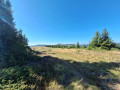
 Difficult