Country:

 City:


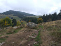
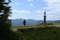
(S) Take the track on the right marked ‘Blue Diamond’, which then climbs in a straight line towards the statue of the Virgin Mary at the summit of the Petit Ballon (360° panoramic view of the Guebwiller and Munster valleys, the Hohneck range, the Grand Ballon range, the Black Forest massif and the Bernese Oberland Alps on a clear day).
(1) Follow the summit ridge (marked with a Yellow Triangle and a Red Saltire). At the end of the ridge, the path begins its descent by turning left. It overlooks the steep slopes of the north face (with a bird’s-eye view of the Petit Ballon glacial cirque and the Strohberg farmhouse inn), then enters the forest before finally emerging onto a very wide, vehicle-accessible track at Kahlenwasen.
(2) Follow this track downwards to the right. At the bend, continue straight on along a track which leads in a few minutes to the Strohberg farmhouse inn (altitude: 1,083 metres. Alpine herdsman’s meal. Booking recommended). Continue the descent along the track, now marked with a Red Disc, to the Col de Boenlesgrab (altitude: 885 metres. Inn), keeping to the descending track on the right.
(3) From the pass, follow the level track marked with a Yellow Cross – the second track on the left – towards the Col du Firstplan. Further on, at a three-way junction, turn right to arrive immediately at a crossroads known as ‘Plaine de Rouffach’ (altitude: 881 metres. Bench and table). Leave theGR® 532 to follow a lovely little path starting almost directly opposite, sloping gently downwards and marked with a Red Disc, towards Wintzfelden. It joins a forest track at a place called Taefelen. Cross the forest track to rejoin the path, still marked with a Red Disc. The descent becomes steeper, passes the Rocher du Rehfelsen (viewpoint) and crosses another forest track. You’ll reach a junction.
(4) Leave the path towards Wintzfelden and take a path branching off to the right. Then head straight ahead and then turn left onto the Chemin du Gros Rocher, which descends steeply towards the Club Vosgien de Rouffach mountain hut (benches). Join the track which winds downhill to the right, skirting the refuge. As you come out of the bend, you’ll find a new path marked with a Blue Triangle on your right. This joins another forest track. Follow it to the right, keeping to the same markings.
(5) Leave the Blue Triangle-marked path by turning left to arrive shortly afterwards at the remarkable site of the ruins of Schwartzenthann Convent (you can follow the themed circular trail, which takes about 30 minutes. Numerous information boards). At the starting point of this route, leave the site via a wide, straight, downhill path, enjoying a magnificent view of the village of Osenbach. At the end of the straight stretch, turn left. After crossing the Muhlmattenbach stream, you’ll come to a junction where several paths meet. Take the path straight ahead, ignoring those leading off to the right and left. The path leaves the forest and, further on, joins Rue des Vosges and the first houses of Wintzfelden.
(6) Take this road uphill to the forest ranger’s house. From there, the signposting resumes. Follow the forest track branching off to the right (marked with a Red Disc), then continue straight on along the track leading to the Ritzenthal Friends of Nature refuge (altitude: 400 metres. See accommodation section), until you reach a crossroads.
(7) Leave the track coming from the village of Wintzfelden and turn left towards Osenbach, following the Red Disc markings. At the Ritzenthal Forest House and the refuge, continue straight on along this balcony-style route, which winds through vineyards and orchards and offers superb views over the Wintzfelden valley. Part of this route overlaps with another themed route, the Sentier des Sols (featuring numerous, highly detailed information boards on the nature of the soils you pass through). Keep going straight ahead along the path, which leads to the junction with Rue du Steinfeld.
(8) Follow the street and, at the end, turn left onto Rue du Moulin until you reach the church.
(9) Leave the village’s central square via Rue du Heidenberg (on the right immediately after the town hall, towards the campsite). Turn left onto Rue de l’Or. This road leaves the village in a straight, downhill line and joins the D18bis. Cross the D18bis (take care) and head slightly to the left up the steps cut into the grassy embankment, which lead onto a track suitable for vehicles. Follow it to the right. This wide, level track runs alongside the last houses in the village before gradually heading into the forest via the first track on the left. Carry on straight ahead at the hairpin bend and the junction that follows. At the fork, head left until you reach the road leading to the Col du Kreutzlein.
(10) Cut across this road and head straight on, keeping level, until you reach the vineyards.
(11) Stunning views over the village of Soultzmatt, the Vallée Noble, the limestone hills and the Alsace plain. Now simply follow the main path downhill (ignore any side paths you come across along the way) , which leads onto Rue de la Vallée, the main street in the village of Soultzmatt.
(12) To reach the village centre whilst avoiding traffic, walk up the street for a few metres, then turn left into Avenue de la Cité. After crossing over the Ruisseau de l’Ohmbach, turn left again into Rue du Canal. This street, which runs parallel to the main street, leads towards the village church.
(13) Just before the church, turn left one last time into Rue des Prêtres, then right, to come out at the town hall car park (water features, emergency services centre, hotels, shops) (E).
 Tourist office
 Easy
 Visorando Member
 Tourism professional
 Difficult