Hahnenbrunnen Pass and Uff Rain from Langenwasen

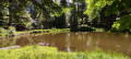
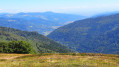
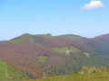
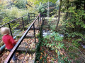
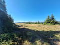
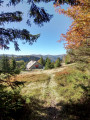
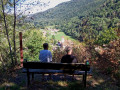
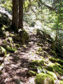
A lovely climb towards the Vosges ridge along the River Pfahlrunz, with a stop at a charming little lake (unnamed). Lots of remarkable trees. Then an easy walk along theGR®5along the ridge before heading towards the farm inns at Salzbach and Uff Rain, with panoramic views of the Vosges peaks.

Details

22883391
Creation:
Last update:
Last review:
  • Walking
    Activity: Walking
  • ↔
    Distance: 9.32 mi
  • ◔
    Average duration: 6h 10 
  • ▲
    Difficulty: Difficult

  • ⚐
    Back to start: No
  • ↗
    Ascent: + 2,182 ft
  • ↘
    Descent: - 2,146 ft

  • ▲
    Highest point: 4,016 ft
  • ▼
    Lowest point: 2,129 ft
  • ⚐ Country: France
  • ⚐
  • ⚐ City: Metzeral (68380)
  • ⚑
    Start: N 47.982827° / E 7.018458°
  • ⚑
    End: N 47.981885° / E 7.018072°
  • ❏
    IGN map(s): Ref. 3618OT, 3618OTR, 3619OT, 3619OTR
  • Hour-by-hour weather

Photos

Description of the walk

From Mittlach, follow the ‘Chemin du camping’ road uphill. Car park just past the Langenwasen campsite.

(S/E) Continue along the road for a few dozen metres to find a path heading off to the right.

Marked with Yellow Crosses

(1) Take the path on the right, cross the bridge and head uphill alongside the Pfahlrunz stream. As the path winds its way up, it approaches the waterfall.

(2) Go and see the Pfahlrunz waterfall, then continue up the path. The slope becomes less steep and the path joins a wide track.

(3) Turn right at the fork, then cross the Chemin Renaud. After a short climb, turn left towards a charming little lake with a picnic area. Return to the fork.

(3) Take the hairpin bend to the right onto the Chemin du Schweisel, heading south-west. At a left-hand bend, you’ll reach a crossroads.

(4) Leave the Chemin du Schweisel and take the path on the right, continuing in the same direction. Cross a pasture, then another stretch of woodland before reaching the stubble fields and the T-junction with a wide track.

(5) Turn right onto this path, which curves to the left and, after a junction, joins theGR®5.

Red Rectangle markings (GR®5)

(6) Turn left onto the ridge. Follow this path to the Klein Hahnenbrunnen refuge, situated next to the pass of the same name which links the Thur and Fecht valleys. There is a viewpoint overlooking several Vosges peaks, indicated on a sign.

Red-White-Red Red Rectangle Markings (GR®5variant)

(7) Take the path towards Salzbach and go straight on at the fork. Ignore the paths to the left and right. A sign points to the source of the Fecht on the left. Continue to the access path leading down to the farm below.

(8) At the crossroads, turn left and head for the Salzbach farmhouse inn, where you can have a meal and enjoy views of the neighbouring peaks of the Hohneck. Return to the previous crossroads.

(8) Turn left onto the Salzbach track towards the hamlet of Uff Rain. After a left-hand bend, you’ll reach a Y-junction.

(9) Turn right and continue along this track to the Uff Rain farmhouse inn, the highest point of the walk at an altitude of 1,171 metres.

Yellow Triangle markings

(10) Head down the path towards Mittlach Camping. Enter the forest and turn left. The path joins a track. Turn right, then immediately left, heading due south, until you reach a junction.

(11) Take the right-hand hairpin bend, then, about 500 m further on, turn right onto a track. Continue for about 400 m.

(12) Turn left at the hairpin bend, then shortly afterwards turn right. Pass a track on your right, then a second one, and continue downhill to reach a T-junction.

(13) Turn left onto the track. Shortly afterwards, leave it to head down the path on the right. Cross a path and carry on until you reach the campsite track

(14) Turn right onto the track and return to the car park (S/E).

Waypoints

  1. S : mi 0 - alt. 2,129 ft - Car park after the Langenwasen campsite
  2. 1 : mi 0.1 - alt. 2,152 ft - Path along the Pfahlrunz stream. Cross the - Source de la Fecht
  3. 2 : mi 0.47 - alt. 2,405 ft - Waterfall at the - Pfahlrunz (cours d'eau) - Affluent de la Fecht
  4. 3 : mi 1.83 - alt. 3,127 ft - Junction leading to the unnamed lake
  5. 4 : mi 1.93 - alt. 3,186 ft - Path
  6. 5 : mi 2.57 - alt. 3,868 ft - T-junction
  7. 6 : mi 2.78 - alt. 3,934 ft - Ridge path
  8. 7 : mi 4.52 - alt. 3,898 ft - Breitfirst
  9. 8 : mi 5.4 - alt. 3,835 ft - Salzbach fork
  10. 9 : mi 5.69 - alt. 3,858 ft - Turn right at the fork.
  11. 10 : mi 6.38 - alt. 3,835 ft - A place called Uff Rain.
  12. 11 : mi 6.9 - alt. 3,488 ft - Hairpin bend
  13. 12 : mi 7.4 - alt. 3,189 ft - Hairpin bend
  14. 13 : mi 8.65 - alt. 2,690 ft - T-junction
  15. 14 : mi 9.24 - alt. 2,169 ft - Path
  16. E : mi 9.32 - alt. 2,149 ft - Car park after the Langenwasen campsite

Notes

Water tap at the Salzbach Inn. Food and drink available at the Hahnenbrunnen mountain hut and at the two farm inns (Please note: check opening times).

Shelter is available at the Hahnenbrunnen mountain refuge and at the two farm inns, provided they are open.

Always be cautious and plan ahead when you're outdoors. Visorando and the author of this route cannot be held responsible for any accidents occurring on this route.

The GR® and PR® markings are the intellectual property of the Fédération Française de Randonnée Pédestre.

Reviews and comments

4.8 / 5
Based on 2 reviews

Reliability of the description
5 / 5
Ease of following the route
5 / 5
Route interest
4.5 / 5
User 12134307

Overall rating : 4.7 / 5

Date of your route : Jun 14, 2026
Reliability of the description : ★★★★★ Very good
Ease of following the route : ★★★★★ Very good
Route interest : ★★★★☆ Good
Very busy route : No

A lovely walk; the climb is a bit challenging, but what a spectacular view once you reach the ridges
3 farm inns along the route (always very busy, so booking is essential)

Machine-translated

Nature57
Nature57

Overall rating : 5 / 5

Date of your route : Jul 06, 2022
Reliability of the description : ★★★★★ Very good
Ease of following the route : ★★★★★ Very good
Route interest : ★★★★★ Very good
Very busy route : No

A lovely walk, mainly through woodland, with stunning views once you reach the ridges. Not many people about, except on the GR5. The route description and signposting are excellent. Thanks to the author for this lovely day’s walk.

Machine-translated

Other walks in the area

For more walks, use our search engine .

The GPS track and description are the property of this route's author. Please do not copy them without permission.