


Refine your search for walks in La Ciotat
La Ciotat walks


 La Voie Douce and Port Saint-Jean in La Ciotat
 Visorando Member
 5.75 mi
 +312 ft
 -318 ft
 2h 55
2h 55
 Easy
Easy
 Departure from La Ciotat (Bouches-du-Rhône)
This very easy hike follows an old tree-lined railway line that crosses La Ciotat, passes in front of the station and descends towards Port Saint-Jean and the Mediterranean. The return journey follows the coastline. The hike is accessible by bus and train.
La Ciotat and Cap Canaille
 7.04 mi
+1,699 ft
-1,716 ft
4h 45
7.04 mi
+1,699 ft
-1,716 ft
4h 45
 Moderate
Departure from La Ciotat (Bouches-du-Rhône)
Moderate
Departure from La Ciotat (Bouches-du-Rhône)
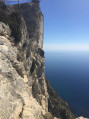
A walk exploring the sights of Cap Canaille.
The Tour of the Soubeyran Massif
 Association / Club / Walk leader
 14.00 mi
+3,274 ft
-3,284 ft
7 hrs
14.00 mi
+3,274 ft
-3,284 ft
7 hrs
 Very difficult
Departure from La Ciotat (Bouches-du-Rhône)
Very difficult
Departure from La Ciotat (Bouches-du-Rhône)
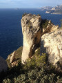
This long hike will take you around the Tour du Massif Soubeyran, bordered by the Mediterranean Sea and the D559 road linking Cassis to La Ciotat. For a good half of the route, you will follow the ridge line between Pas de Bellefille and La Ciotat. This balcony section offers breathtaking views of the Toulon-Marseille arc throughout the route. You will complete the route in a circular fashion with a tour of the valleys overlooking La Ciotat.
GPS is highly recommended!
La Ciotat Bay seen from above via the Carrière du Loin
 6.30 mi
+2,982 ft
-2,982 ft
5h 30
Moderate
Departure from La Ciotat (Bouches-du-Rhône)
6.30 mi
+2,982 ft
-2,982 ft
5h 30
Moderate
Departure from La Ciotat (Bouches-du-Rhône)
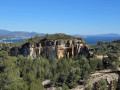
This is a walk that follows the ridges, overlooking the whole of La Ciotat Bay with stunning panoramic views. The walk allows you to walk for a long time whilst enjoying the view of La Ciotat Bay. Discover a cave on the ridge, at the highest point, with a double open cavity – it’s really lovely and not to be missed.
The Coastal Path between La Garde and the Bec de l'Aigle Semaphore
 4.53 mi
+1,460 ft
-1,447 ft
3h 20
4.53 mi
+1,460 ft
-1,447 ft
3h 20
 Difficult
Departure from La Ciotat (Bouches-du-Rhône)
Difficult
Departure from La Ciotat (Bouches-du-Rhône)
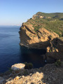
This challenging and technical route, which is exposed in places (please read the description carefully), starts from La Garde in La Ciotat and takes you close to part of the Soubeyranes Cliffs between Notre-Dame de la Garde and the Bec de l'Aigle semaphore. You will discover the unique characteristics of these cliffs, made of a mixture of sandstone, puddingstone and limestone. On the way back, you will cross ancient terraces and the ruins of forgotten farms before returning to your starting point via a small road.
See the chapter: practical information about the (4)
Traversée des Émigrés and Vire des Immortelles
 4.20 mi
+2,595 ft
-2,618 ft
5 hrs
4.20 mi
+2,595 ft
-2,618 ft
5 hrs
 Extremely difficult
Departure from La Ciotat (Bouches-du-Rhône)
Extremely difficult
Departure from La Ciotat (Bouches-du-Rhône)
(Please note) The Immortels, Corniche des Grand Ducs and Fight-Club sectors are currently "closed to all visitors" until 15 August 2024. See the message posted on 20 May 2024.
This hike starting from La Ciotat will take you above and below the Soubeyrannes Cliffs between the Grotte des Émigrés and Sainte-Frétouse. The outward route follows the Yellow ridge trail, offering breathtaking views of the Calanques and the Golfe d'Amour. The return route is more technical, alternating between walking and easy climbing, and follows the Black trail below the ridges on the sea side, then a system of ledges halfway up the cliff that will take you back to your starting point.
The Soubeyranes Cliffs with return via the Dent du Chat from La Ciotat
 5.92 mi
+1,335 ft
-1,322 ft
3h 55
Moderate
Departure from La Ciotat (Bouches-du-Rhône)
5.92 mi
+1,335 ft
-1,322 ft
3h 55
Moderate
Departure from La Ciotat (Bouches-du-Rhône)
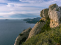
A fairly classic hike that allows us to admire the high cliffs of Cassis, the caves and the Dent du Chat with its amazing stone arch.
Semaphore, viewpoint and Cap Canaille Arch
 2.87 mi
+623 ft
-627 ft
1h 50
Moderate
Departure from La Ciotat (Bouches-du-Rhône)
2.87 mi
+623 ft
-627 ft
1h 50
Moderate
Departure from La Ciotat (Bouches-du-Rhône)
This hike will take you to the ridges of Cap Canaille, at the top of the Soubeyranes Cliffs.
Admire the magnificent landscape stretching from the Riou Archipelago in the west to the Embiez Archipelago in the east, and beautiful viewpoints over the Calanques and La Ciotat.
GPS is strongly recommended.
Circular route between La Ciotat, Cassis and the Soubeyranes Cliffs
 6.53 mi
+2,438 ft
-2,461 ft
5h 05
Difficult
Departure from La Ciotat (Bouches-du-Rhône)
6.53 mi
+2,438 ft
-2,461 ft
5h 05
Difficult
Departure from La Ciotat (Bouches-du-Rhône)
Explore the highlights of the massif behind the Soubeyranes Cliffs between La Ciotat and Cassis. Beautiful views of specific points in the massif: Fardeloup Cave, Dent du Chat, Terrevaine Arch, Bau Rous, etc. Also of the bays of La Ciotat and Cassis, the cliffs, and in the distance, the inland massifs stretching as far as Sainte-Baume and the Col de l’Espigoulier.
Soubeyranes Cliffs
 10.95 mi
+3,159 ft
-3,153 ft
7h 45
Difficult
Departure from La Ciotat (Bouches-du-Rhône)
10.95 mi
+3,159 ft
-3,153 ft
7h 45
Difficult
Departure from La Ciotat (Bouches-du-Rhône)
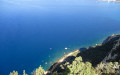
A hike in two distinct sections, each requiring a different level of effort. The first involves crossing the Falaises Soubeyranes, France’s highest sea cliffs. There are numerous exceptional viewpoints, although these are unsecured and therefore require caution. The second section passes through the Grande Tête, the Dent du Loup and the Bau Rous, in a wilder setting with far fewer visitors. A long stretch without signposting, along little-used paths, will require careful attention to ensure you do not miss the various, sometimes tricky, changes of direction. However, you’ll be rewarded with stunning views of La Ciotat Bay and its iconic rock, the famous Bec de l’Aigle.
A GPS is strongly recommended!
From the Chemin de Saint-Loup to the Calanques viewpoint in La Ciotat
 5.97 mi
+768 ft
-764 ft
3h 25
Moderate
Departure from La Ciotat (Bouches-du-Rhône)
5.97 mi
+768 ft
-764 ft
3h 25
Moderate
Departure from La Ciotat (Bouches-du-Rhône)
A walk presenting no particular difficulty, offering the chance to enjoy the magnificent view from the Calanques viewpoint and, as an added bonus, a beautiful panorama of the town of La Ciotat on the return journey towards the Chemin de Saint-Loup.
 A circular walk starting from Ceyreste
 10.81 mi
+1,804 ft
-1,834 ft
4 hrs
Moderate
Departure from La Ciotat (Bouches-du-Rhône)
10.81 mi
+1,804 ft
-1,834 ft
4 hrs
Moderate
Departure from La Ciotat (Bouches-du-Rhône)
A superb mountain bike ride that joins theGR®51and offers magnificent views over La Ciotat Bay.
There are a few fairly technical downhill sections, but nothing insurmountable.
The paths are mostly rideable, with relatively few stones.
Ceyreste loop via the Pas d'Ouillier and the Cabanon des Gardes
 6.08 mi
+1,188 ft
-1,161 ft
3h 50
Moderate
Departure from La Ciotat (Bouches-du-Rhône)
6.08 mi
+1,188 ft
-1,161 ft
3h 50
Moderate
Departure from La Ciotat (Bouches-du-Rhône)
An unusual departure from the Athélia area in La Ciotat towards the Pas d'Ouillier via the Vallon de Roumagoua to the Cabanon des Gardes with a descent to the Vallon de Gendarme via the Gouffre Durand. Beautiful views of La Ciotat and the Gulf of Sanary as far as Les Embiez dot the path.
La Vigie via the Vallon des Gendarmes and the refuges
 9.51 mi
+1,926 ft
-1,942 ft
6h 05
Moderate
Departure from Ceyreste (Bouches-du-Rhône)
9.51 mi
+1,926 ft
-1,942 ft
6h 05
Moderate
Departure from Ceyreste (Bouches-du-Rhône)
This is a nice hike to do. Most of it climbs a moderate slope. Once you reach La Vigie, you will find Refuge de Roquefort, La Bédoule and it takes just under two hours to get there at a leisurely pace. At the top, you can stop and enjoy the barbecue and outdoor table. There are beautiful views from the lookout point behind the refuge. There are also some lovely wooded paths with no particular difficulty other than the elevation. The path is very easy to walk on from start to finish.
Le Télégraphe from Les Plaines Baronnes
 7.65 mi
+1,345 ft
-1,352 ft
4h 40
Moderate
Departure from La Ciotat (Bouches-du-Rhône)
7.65 mi
+1,345 ft
-1,352 ft
4h 40
Moderate
Departure from La Ciotat (Bouches-du-Rhône)
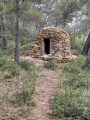
This circular hike starts from Chemin des Plaines Baronnes in La Ciotat, alternating between tracks and paths, and takes you to the summit of Le Télégraphe. The route offers some beautiful views of the Golfe d'Amour and the various surrounding mountains: Calanques, Sainte Baume, etc. Along the route, you can see the remains of ancient dwellings: jas, drystone shelters, Cade ovens, charcoal kilns... some of which have been restored by associations of enthusiasts.
Bau de la Saoupe viewpoint and the Grotte des Espagnols
 3.40 mi
+751 ft
-768 ft
2h 15
Moderate
Departure from Cassis (Bouches-du-Rhône)
3.40 mi
+751 ft
-768 ft
2h 15
Moderate
Departure from Cassis (Bouches-du-Rhône)
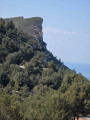
Somewhere between a hike and a stroll, given its distance, this route offers a wealth of panoramic views over the Cassis and La Ciotat areas and the sea with its coves. It starts on a hiking trail, then follows a partly tarmac-surfaced path until reaching the viewpoint just past the transmission mast. There is no option for a circular route.
Le Télégraphe de Ceyreste, le Cabanon des Gendarmes starting from Ceyreste
 8.92 mi
+2,228 ft
-2,211 ft
6h 00
Difficult
Departure from Ceyreste (Bouches-du-Rhône)
8.92 mi
+2,228 ft
-2,211 ft
6h 00
Difficult
Departure from Ceyreste (Bouches-du-Rhône)
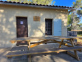
This hike is suitable for groups or families and is of moderate difficulty, but requires a minimum level of fitness given the cumulative elevation gain. It is mostly on wide, easy paths with a few trails to add variety to the route, offering beautiful views of La Ciotat, Pic de Bertagne and Dents de Roque Fourcade.After about two hours of walking, you arrive at the Cabanon des Gendarmes, a very friendly place where you can have a barbecue. Tables and benches are provided, with beautiful views of La Ciotat.Note: it is possible to make a circular pattern; see the chapter on practical information for details.
Between sea and limestone: a gentle circular to the Calanque de Port-Miou
 4.85 mi
+331 ft
-331 ft
2h 30
Moderate
Departure from Cassis (Bouches-du-Rhône)
4.85 mi
+331 ft
-331 ft
2h 30
Moderate
Departure from Cassis (Bouches-du-Rhône)
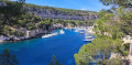
From the picturesque heart of Cassis, this easy circular takes you to discover the Calanque de Port-Miou, the easternmost of the famous calanques in the National Park. The trail runs along the coastline, offering beautiful views of the white cliffs of Cap Canaille and the turquoise waters of the Mediterranean. After strolling along the natural harbour of Port-Miou, lined with sailing boats and maritime pines, the return to Cassis is a gentle walk along urban paths and shaded passages. A hike accessible to all, ideal for a warm-up or a contemplative getaway.
Mont Gibaou via the Grotte des Janots
 6.67 mi
+1,355 ft
-1,345 ft
4h 15
Moderate
Departure from Cassis (Bouches-du-Rhône)
6.67 mi
+1,355 ft
-1,345 ft
4h 15
Moderate
Departure from Cassis (Bouches-du-Rhône)
This hike allows you to explore the Grotte des Janots, which is no small affair: it is truly impressive in size and is one of the largest caves to visit in the region to date. The hike involves some climbing and a section of rocky terrain that is somewhat difficult, even technical, with a risk of slipping. Mont Gibaou offers some lovely views of the region. It’s a fairly short hike and a very enjoyable one to do.
More walks in La Ciotat
Select a point of interest below: