A circular walk starting from Ceyreste

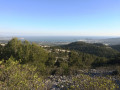
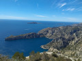
A superb mountain bike ride that joins theGR®51and offers magnificent views over La Ciotat Bay.
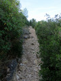
There are a few fairly technical downhill sections, but nothing insurmountable.
The paths are mostly rideable, with relatively few stones.

Details

1966493
Creation:
Last update:
Last review:
  • Mountain biking
    Activity: Mountain biking
  • ↔
    Distance: 10.81 mi
  • ◔
    Duration according to the author: 4 hrs 
  • ▲
    Difficulty: Moderate

  • ⚐
    Back to start: Yes
  • ↗
    Ascent: + 1,804 ft
  • ↘
    Descent: - 1,834 ft

  • ▲
    Highest point: 1,709 ft
  • ▼
    Lowest point: 384 ft
  • ⚐ Country: France
  • ⚐ City: La Ciotat (13600)
  • ⚑
    Start/End: N 43.212454° / E 5.603675°

  • ◶
    Type of surface: Not specified
  • ⇧
    Bike carrying: Not specified
  • ▲
    Difficulty: Not specified
  • Hour-by-hour weather

Photos

Description of the route

Park on the Chemin du Petit Roumagoua near the quarry.

(S/E) Follow the tarmac road heading north-east, keeping to the left at all times, until you reach a barrier marking the entrance to the nature reserve.

(1) Follow the dirt track to a junction at Jas de Mondon.

(2) Turn right and enjoy the descent to the crossroads by the water tank.
.
(3) Be careful not to miss the path branching off to the left. Continue to the bottom of the ravine. Here, take a sharp right-hand bend to follow another path which is quite rugged but passable. You’ll reach another junction.

(4) Turn left and carry on to the junction where several paths meet. Turn right, making a 180° turn at the hairpin bend. Join the DFCI track.

(5) Turn left onto it, passing a pylon and then a water tank. Follow this track uphill for a long stretch; it is fairly even. At the next junction, join a new track that forms part of theGR®51

(6) Turn left onto thisGR® track. Further on, you’ll cross theGR®98, which then merges with theGR®51.

(7) Continue straight ahead, following the red and white markings. Pass several water tanks and the Cabanon des Gardes. Further on, you’ll come out onto the D559a road.

(8) Leave theGR®. Follow the road to the left for a few hundred metres until you see a path on the left: there is a fairly wide verge at the side of the road, so you can cross safely.

(9) Take this track; you’ll soon reach another crossroads with several directions.

(10) Take the path on the left. Follow it and pass close to some water tanks once again. Leave the path leading to the Petit Roumagoua building on your left before reaching the starting car park at the edge of the quarry (S/E).

Waypoints

  1. S/E : mi 0 - alt. 449 ft - Chemin du Petit Roumagoua near the quarry
  2. 1 : mi 0.67 - alt. 732 ft - Barrier
  3. 2 : mi 0.99 - alt. 863 ft - Jas de Mondon
  4. 3 : mi 1.46 - alt. 646 ft - Water tank junction
  5. 4 : mi 2 - alt. 397 ft - Valley junction
  6. 5 : mi 2.5 - alt. 607 ft - DFCI track
  7. 6 : mi 4.31 - alt. 1,414 ft - GR51 junction
  8. 7 : mi 4.88 - alt. 1,594 ft - Junction with the GR98
  9. 8 : mi 8.07 - alt. 1,145 ft - D559a junction
  10. 9 : mi 8.59 - alt. 1,014 ft - Path junction
  11. 10 : mi 8.87 - alt. 889 ft - Return route junction
  12. S/E : mi 10.81 - alt. 449 ft - Chemin du Petit Roumagoua near the quarry

Worth a visit

(Between)7(et)8:: enjoy the view of La Ciotat on the left and Roquefort-la-Bédoule on the right.

Always be cautious and plan ahead when you're outdoors. Visorando and the author of this route cannot be held responsible for any accidents occurring on this route.

The GR® and PR® markings are the intellectual property of the Fédération Française de Randonnée Pédestre.

Reviews and comments

4.8 / 5
Based on 2 reviews

Reliability of the description
5 / 5
Ease of following the route
5 / 5
Route interest
4.5 / 5
Fx13
Fx13
• Edited:

Overall rating : 5 / 5

Date of your route : Jun 23, 2024
Reliability of the description : ★★★★★ Very good
Ease of following the route : ★★★★★ Very good
Route interest : ★★★★★ Very good
Very busy route : No

A circular route designed for e-MTBs but requiring sustained physical effort: a long climb with no major obstacles, followed by a very fast ride along the ridge offering magnificent views, and finally a more technical descent, which is narrow in places and requires good balance.

Machine-translated

nathdu13
nathdu13

Overall rating : 4.7 / 5

Date of your route : Apr 29, 2019
Reliability of the description : ★★★★★ Very good
Ease of following the route : ★★★★★ Very good
Route interest : ★★★★☆ Good

Thank you for this lovely walk, which has plenty of hills...

Machine-translated

For more walks, use our search engine .

The GPS track and description are the property of this route's author. Please do not copy them without permission.