


Refine your search for walks in Hourges
Hourges walks


 Circular route between Vesle and Ardre starting from Hourges
 Visorando Member
 7.36 mi
 +732 ft
 -735 ft
 4h 00
 Moderate
 Departure from Hourges (Marne)
This circular walk will take you up to a few “high points” along good paths alternating between vineyards and fields. You’ll be treated to beautiful views from the heights, as well as old stone buildings.
Part of the walk follows the yellow trail markers.
Circular route from Jonchey-sur-Vesle via Vandeuil, Branscourt and Hourges
9.22 mi
+830 ft
-827 ft
5h 00
Moderate
Departure from Jonchery-sur-Vesle (Marne)
A walk along good paths leading from the Vesle Valley to the Ardre Valley. The route passes through villages with old stone buildings and runs past Irval Castle.
From the various high points, you’ll be treated to lovely views of the Ardre Valley, and then, on the way back, of the Saint-Thierry massif and Mont Die.
Circular Crugny to Saint-Gilles via Courville
 Association / Club / Walk leader
 7.51 mi
+171 ft
-187 ft
3h 35
Moderate
Departure from Crugny (Marne)
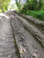
An easy walk, following part ofthe GR®142 trailand the former platform of the Reims Suburban Railway (CBR).
Through fields and copses near Montigny-sur-Vesle
 7.04 mi
+833 ft
-827 ft
4h 00
Moderate
Departure from Montigny-sur-Vesle (Marne)
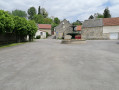
A beautiful route through fields and copses. It offers superb views of the Vesle valley, including a 360° panorama. Le Petit Hameau is full of charm.
The Courville ponds
 3.51 mi
+262 ft
-262 ft
1h 50
 Easy
Departure from Courville (Marne)
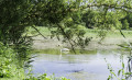
Between land and water.
Nestled in a valley, the Courville ponds are a unique wetland area in the Tardenois natural region, which is dominated by woods, vineyards and large-scale farming.
Prouilly circular route via Montigny-sur-Vesle and Pévy
 6.93 mi
+574 ft
-581 ft
3h 40
Moderate
Departure from Prouilly (Marne)
This circular route will take you from the Prouilly war memorial to the church in Montigny-sur-Vesle, then to the church in Pévy, through fields and vineyards with beautiful views of the hills.
Prouilly–Pévy circular loop
3.70 mi
+161 ft
-177 ft
1h 50
Easy
Departure from Prouilly (Marne)
A short, varied walk featuring woodland, clearings, small streams and vineyard edges. Ideal for a short Sunday stroll with the family. The paths are clearly visible on GPS apps and are well maintained. A few watchtowers indicate a possible hunting ground.
Loop from Fismes to Saint-Gilles
4.18 mi
+151 ft
-157 ft
2h 05
Easy
Departure from Fismes (Marne)
This loop runs through the Ardre valley, with the first part through woodland and the second part along field paths. The first part from Fismes to Saint-Gilles follows the old Reims Suburban Railway (CBR) line, which served many towns. The second part runs along the ridge of the road from Fismes to Fère-en-Tardenois, where, when conditions allow, many paragliders take flight.
Around Germigny
 6.43 mi
+472 ft
-482 ft
3h 20
Moderate
Departure from Germigny (Marne)
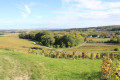
These paths are lined with woodland, vineyards, fields and panoramic views. The paths are open to motorised vehicles. This circular route is maintained by the “Germigny, c’est Chouette” Association.
Sarcy circular route via Bligny and Poilly
 8.50 mi
+663 ft
-640 ft
4h 30
Moderate
Departure from Sarcy (Marne)
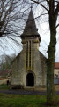
A stroll through the Champagne countryside to discover First World War cemeteries, old wash houses and churches.
Les Septvallons over hill and dale
 5.21 mi
+358 ft
-387 ft
2h 45
Easy
Departure from Glennes (Aisne)
This short hike takes you through several villages in the Septvallons. You will see creutes (troglodytic dwellings used by soldiers during the First World War) and no fewer than four typical churches or chapels in varied landscapes.
Circular route from Guyencourt via Roucy and Bouffignereux
7.79 mi
+554 ft
-545 ft
4h 05
Moderate
Departure from Guyencourt (Aisne)
From the church in Guyencourt, you’ll head to Roucy and its church. After a circular route through Roucy, you’ll set off again towards Bouffignereux. The whole route follows good farm and forest tracks. You’ll be treated to beautiful views of the villages and the Aisne valley.
Circular route starting from Notre-Dame-d'Igny Abbey
7.82 mi
+545 ft
-535 ft
4h 05
Moderate
Departure from Arcis-le-Ponsart (Marne)
A walk through the meadows and woods from Notre-Dame-d'Igny Abbey to the pretty village of Coulonges-Cohan with its wash houses and fountains.
Calmet Wood and Petite Montagne
 5.87 mi
+587 ft
-581 ft
3h 15
Moderate
Departure from Cormicy (Marne)
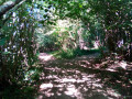
An ideal walk in summer. Apart from a short stretch in the open, which is sunny only in the afternoon (facing south-west), the entire route takes you almost entirely through woodland along varied paths (uphills, downhills, bends, changes of direction…), which are well shaded and pleasant to walk along.
From Bouilly to Pourcy via the Ardre Valley
 11.76 mi
+1,020 ft
-1,050 ft
6h 20
Moderate
Departure from Bouilly (Marne) (Marne)
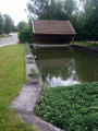
This day-long walk starting from Bouilly will allow you to explore the lovely Ardre Valley. Vineyards, pastures and woodland. Total tranquillity.
Please note, it isn’t easy to find the right path in the woods, as there are no signposts. I’d strongly advise you to follow the map and use the Visorando app.