Country:
 City:
City:


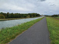
Start from the car park to the west of Cormicy, after passing the hamlet of Les Pissotées, near a small house.
(S/E) Take the path running parallel to the track. After about 50 m, turn right. After about 50 m, turn right again. You’ll come to a path on the left; carry straight on and, at the Fork in the road that appears immediately, take the left-hand path.
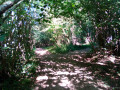
(1) Further on, at a T-junction, turn left. After about , then after about 250 m, turn right. At the next junction, turn right and, immediately afterwards, right again. The path descends gently at first and then becomes steeper. There are deep ruts in places. Follow this path until you emerge from the woods.
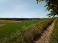
(2) Leave the woodland and follow a good track to the right, which runs alongside a wide valley. Stay on the edge of the woodland for a good kilometre. Enter the woodland again.
(3) At the junction, turn sharply left and go round a fenced-off private property. After about 300 metres, take a path leading uphill to the right. At the top, veer left and continue along the main path. The path then turns into a narrow track.
(4) Take another path on the right and head uphill. Then turn left. After about 300 metres, at a T-junction, take the path on the left. After about 150 metres, take the path that curves to the right. At the next junction, go straight on (north-east).
(5) At the three-way junction, veer to the right. Climb a short, very steep section.
(6) At the crossroads, carry on straight ahead towards a tree and, just before you reach it, take the path on the left. After about 200 m, turn left.
(7) At the junction, turn right. At the next T-junction, turn right.
(8) You’ll join a good track; follow it to the left. Carry on straight ahead (south then south-east) and ignore all the turnings on the right. Continue to the left along the track that crosses the road and follow this track to the car park where you started (S/E).





 Visorando Member
 Very difficult
  Easy
Easy 
 Difficult
  Association / Club / Walk leader