Prouilly–Pévy circular loop

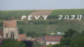
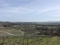
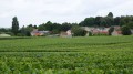
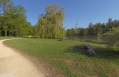
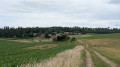
A short, varied walk featuring woodland, clearings, small streams and vineyard edges. Ideal for a short Sunday stroll with the family. The paths are clearly visible on GPS apps and are well maintained. A few watchtowers indicate a possible hunting ground.

Details

16019245
Creation:
Last update:
Last review:
  • Walking
    Activity: Walking
  • ↔
    Distance: 3.70 mi
  • ◔
    Average duration: 1h 50 
  • ▲
    Difficulty: Easy

  • ⚐
    Back to start: Yes
  • ↗
    Ascent: + 161 ft
  • ↘
    Descent: - 177 ft

  • ▲
    Highest point: 449 ft
  • ▼
    Lowest point: 289 ft
  • ⚐ Country: France
  • ⚐ City: Prouilly (51140)
  • ⚑
    Start/End: N 49.303971° / E 3.857082°
  • ❏
    IGN map(s): Ref. 2712E
  • Hour-by-hour weather

Description of the walk

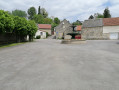
The route starts at the village exit. You can park alongside the few detached houses just past the cemetery on Chemin des Monts de la Ville.

(S/E) With your back to the cemetery, set off across the fields towards the woods. Keep heading in the same direction, then negotiate a bend to the right before reaching a fork in the path.

(1) Don’t miss the narrow path that winds its way down to the left. Cross the Ru du Cochot, then keep left at the next junction to come out opposite the houses in Hervelon.

(2) Take the path on the left, covered in white gravel, which leads back towards Pévy. Continue through the woods, then along the edge of the woods to reach the village.

(3) Turn left to walk alongside the D575 (which has very little traffic) and head back towards Prouilly.

(4) Turn left onto Chemin des Monts de la Ville to return to the starting point (S/E).

Waypoints

  1. S/E : mi 0 - alt. 322 ft - Chemin des Monts de la Ville
  2. 1 : mi 1.11 - alt. 354 ft - Junction, path on the left
  3. 2 : mi 1.58 - alt. 443 ft - Hervelon, on the left
  4. 3 : mi 2.99 - alt. 348 ft - Pévy, D575, on the left
  5. 4 : mi 3.62 - alt. 318 ft - To the left
  6. S/E : mi 3.7 - alt. 322 ft - Chemin des Monts de la Ville

Reviews and comments

4.2 / 5
Based on 3 reviews

Reliability of the description
4 / 5
Ease of following the route
4.7 / 5
Route interest
4 / 5
julien.ri
julien.ri

As far as I can remember, there’s a strip of grass there and the road isn’t very busy. Your idea is certainly worth exploring. I think we could go round the last copse – which is on the right-hand side of the local road in question – via the right-hand side to get straight to Champagne Potaufeux, but that would make the journey longer...

Machine-translated

pavois51
pavois51

Overall rating : 4 / 5

Date of your route : May 21, 2022
Reliability of the description : ★★★★☆ Good
Ease of following the route : ★★★★☆ Good
Route interest : ★★★★☆ Good
Very busy route : No

The first section through the woodland is really lovely, but you’ll need a sat-nav as there are lots of junctions.
The return journey along the road and the D575 is far less pleasant. An alternative route back via Hervelon might be more enjoyable. Something to think about...

Machine-translated

julien.ri
julien.ri

Exactly, that’s a very useful point.

Machine-translated

Francis BUREAU
Francis BUREAU

Overall rating : 4.3 / 5

Date of your route : Mar 24, 2022
Reliability of the description : ★★★★☆ Good
Ease of following the route : ★★★★★ Very good
Route interest : ★★★★☆ Good
Very busy route : No

A pleasant walk, half of which is through the woods.
It’s easy to park in the cemetery car park.
Walking along the D575 is safe as the verge is wide and easily accessible.
PLEASE NOTE
After crossing the stream at the junction, do not turn left (this path is not marked on the map) but take the path on the right that goes uphill. It is only at the next junction that you should turn left.

Machine-translated

Dessons Evelyne
Dessons Evelyne

Overall rating : 4.3 / 5

Date of your route : Oct 25, 2021
Reliability of the description : ★★★★☆ Good
Ease of following the route : ★★★★★ Very good
Route interest : ★★★★☆ Good
Very busy route : No

:a lovely route.

Machine-translated

Other walks in the area

For more walks, use our search engine .

The GPS track and description are the property of this route's author. Please do not copy them without permission.