From Bouilly to Pourcy via the Ardre Valley

This day-long walk starting from Bouilly will allow you to explore the lovely Ardre Valley. Vineyards, pastures and woodland. Total tranquillity.

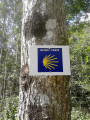
Please note, it isn’t easy to find the right path in the woods, as there are no signposts. I’d strongly advise you to follow the map and use the Visorando app.

Details

1199778
Creation:
Last update:
Last review:
  • Walking
    Activity: Walking
  • ↔
    Distance: 11.76 mi
  • ◔
    Average duration: 6h 20 
  • ▲
    Difficulty: Moderate

  • ⚐
    Back to start: Yes
  • ↗
    Ascent: + 1,020 ft
  • ↘
    Descent: - 1,050 ft

  • ▲
    Highest point: 873 ft
  • ▼
    Lowest point: 390 ft

Photos

Description of the walk

(S/E) From Bouilly Town Hall (large car park on Rue des Vignes), take Rue des Vignes to leave the village. Continue straight on along the path which climbs through the vineyard and enters a small wood.

(1) At the crossroads, take the path opposite which continues into the woods. Follow it through the fields.

(2) The path joins theGR® de Pays de l’Ardre. Turn left. Walk past the Chaumuzy mill, cross the River Ardre and walk to the village of Chaumuzy.

(3) At the junction with the D386, turn left and walk through the village.

(4) About a hundred metres past the church, turn right into Rue des Nappes.

(5) At the football pitch, carry on straight ahead, skirting the pitch, then follow the edge of a small wood.

(6) At the junction, turn left and, at the next junction, turn right. Follow the path until you reach another small woodland, which you go round to the left.

(7) Head towards the Ferme du Moulin de l’Ardre. The path runs right through the middle of the farm, between two buildings, under a large canopy. Cross the bridge and walk to the road.

(8) Once on the D386, turn right and walk carefully alongside the road . Pass the wayside shrine and enter the village of Pourcy via Rue de la Barbe aux Canes. Continue straight on into Rue Jean Jaurès and leave the village.

(9) After the last houses, take the path on the left which climbs across the fields and then enters the woods. This path is often in poor condition due to forestry work.

(10) Cross the forest track and take the path straight ahead that enters the woods (sometimes hidden by vegetation at the entrance). As you emerge from the woods, keep slightly to the left, following the pastures towards the Ferme d’Écueil.

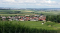
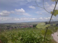
(11) When you can see the farm, turn right. Stay on the path which descends through the woods, then through the vineyards towards Chamery. There’s a lovely view of Reims as you emerge from the woods.

(12) Just before the reservoir (poplars), turn left onto the vineyard path. This path joins theGR®142, which climbs through the vineyard to the edge of the woods. Follow it to the left.

(13) When you reach a spot where vineyard earthworks have just been carried out, take the path on the left which enters the woods, markedGR® at the start. Continue straight on through the woods, without changing direction. Do not follow theGR® which branches off to the right.

(14) After about 600m, you’ll reach a track suitable for vehicles. Cross it and continue straight ahead along the forest track.

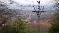
(15) After 500m, turn left and then immediately right. The path descends through the woods towards the village of Courmas. Pass under the high-voltage power line and continue straight on to the village.

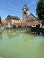
(16) After the church, turn into the second street on the left, Rue des Hauts Murs. Carry on without changing direction along the small road that runs alongside the grounds of the Domaine de Commétreuil.

(17) At the crossroads, turn left, then right, following the beautiful avenue of chestnut trees. Continue slightly to the left along Rue Saint Caprais. Walk past the wash house to complete the route (S/E).

Waypoints

  1. S/E : mi 0 - alt. 522 ft - Town Hall (large car park on Rue des Vignes)
  2. 1 : mi 0.66 - alt. 745 ft - Opposite, a path through the woods
  3. 2 : mi 1.57 - alt. 443 ft - Junction with the GR de Pays de l’Ardre. Towards the - Ardre (rivière)
  4. 3 : mi 2.09 - alt. 443 ft - Junction with the D386
  5. 4 : mi 2.51 - alt. 436 ft - On the right, Rue des Nappes
  6. 5 : mi 2.87 - alt. 443 ft - Football pitch
  7. 6 : mi 3.84 - alt. 459 ft - Turn left at the crossroads
  8. 7 : mi 4.82 - alt. 492 ft - Turn left towards the Ferme du Moulin de l’Ardre
  9. 8 : mi 5.17 - alt. 499 ft - Junction of the D386e
  10. 9 : mi 5.88 - alt. 587 ft - On the left, an uphill path
  11. 10 : mi 6.81 - alt. 823 ft - Crossing a forest track
  12. 11 : mi 7.18 - alt. 860 ft - Écueil Farm
  13. 12 : mi 7.84 - alt. 600 ft - Turn left before a reservoir
  14. 13 : mi 8.58 - alt. 774 ft - Entrance to the woods
  15. 14 : mi 9.28 - alt. 873 ft - Crossing a road
  16. 15 : mi 9.67 - alt. 817 ft - Turn left/right at the junction
  17. 16 : mi 10.54 - alt. 581 ft - On the left, Rue des Hauts Murs
  18. 17 : mi 11.21 - alt. 492 ft - Turn left at the crossroads
  19. S/E : mi 11.76 - alt. 522 ft - Bouilly Town Hall

Notes

Water available at the cemeteries in the villages along the route. No water at military cemeteries.

Picnic areas in Bouilly (housing estate) and at the Maison du Parc in Pourcy.

Do feel free to stop off at the Maison du Parc.
You’ll receive a very warm welcome there, even on Sundays during the summer. They provide information on everything to do with the nature reserve, and there are often lovely exhibitions. Heritage orchard, picnic area, toilets. Wi-Fi.

Worth a visit

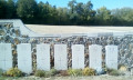
World War I military cemeteries nearby in Bouilly, Courmas and Marfaux.

AOC Champagne winegrowers in all the villages along the route.

Check for hunting days.

Always be cautious and plan ahead when you're outdoors. Visorando and the author of this route cannot be held responsible for any accidents occurring on this route.

The GR® and PR® markings are the intellectual property of the Fédération Française de Randonnée Pédestre.

Reviews and comments

4.7 / 5
Based on 2 reviews

Reliability of the description
4.5 / 5
Ease of following the route
5 / 5
Route interest
4.5 / 5
virgule
virgule

@PresidentMarc:

A lovely and very interesting walk… Do bear in mind, however, point 14… it’s not easy to find the grassy path… which is very little used.

At point (14), the path is no longer grassy but has been rutted by forestry work. So it’s easy to spot.

Machine-translated

virgule
virgule

Hello,

I did this route again today. It’s essential to go via the Ferme du Moulin, as the PR path has been ploughed up again. It’s a private plot of land, which has a plot number, and is therefore not a rural track. I think those in charge of the PR should change their route.

Machine-translated

virgule
virgule

At the point (7), did you go via the farm, or did you follow the GR?

I usually avoid going via the farms so as not to come face to face with a Beauceron guarding its territory.

Machine-translated

virgule
virgule

Thank you for this review. I was there this summer; the path was very clear, but the grass must have grown since then. I think the gamekeepers will mow it down soon.

Machine-translated

PresidentMarc
PresidentMarc

Overall rating : 4.7 / 5

Date of your route : Sep 25, 2021
Reliability of the description : ★★★★☆ Good
Ease of following the route : ★★★★★ Very good
Route interest : ★★★★★ Very good
Very busy route : No

A really lovely and interesting walk… Do bear in mind, however, that at point 14… it’s not easy to find the grassy path… which is very little used.

Machine-translated

virgule
virgule
• Edited:

Hello,

I did this route again today. At the point (7), the GR is visible once more, and it leads to Pourcy. When you reach the road, turn left to get to the Maison du Parc.

Update: in September 2023, the path had disappeared.

Machine-translated

virgule
virgule

You can also start the route in Pourcy at the Maison du Parc, and have a picnic in Bouilly or Courmas, where there are picnic areas. See POI.

Machine-translated

leontiine
leontiine

Overall rating : 4.7 / 5

Date of your route : Sep 11, 2019
Reliability of the description : ★★★★★ Very good
Ease of following the route : ★★★★★ Very good
Route interest : ★★★★☆ Good

A lovely walk along some excellent paths. The villages of Villedommange, Chamery and Ecueil are in the midst of the grape harvest, basking in the sunshine. We had a lovely picnic at the Maison du Parc.

Machine-translated

virgule
virgule

This route partly follows the route of the “Rando du Parc” that I did this weekend. The tricky bit where you enter the woods above Chamery is no longer a problem, so I’ve rated the walk as “moderate”.
With the Visorando app, nobody should get lost.

Machine-translated

virgule
virgule

Well done to the moderators for their prompt response

I did part of the route again today. It’s the perfect time to go – there’s hardly any water left in the woods, and we didn’t see a single mosquito.

Machine-translated

Other walks in the area

For more walks, use our search engine .

The GPS track and description are the property of this route's author. Please do not copy them without permission.