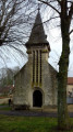
Circular route between Vesle and Ardre starting from Hourges

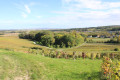
This circular walk will take you up to a few “high points” along good paths alternating between vineyards and fields. You’ll be treated to beautiful views from the heights, as well as old stone buildings.
Part of the walk follows the yellow trail markers.

Details

3587286
Creation:
Last update:
Last review:
  • Walking
    Activity: Walking
  • ↔
    Distance: 7.36 mi
  • ◔
    Average duration: 4h 00 
  • ▲
    Difficulty: Moderate

  • ⚐
    Back to start: Yes
  • ↗
    Ascent: + 732 ft
  • ↘
    Descent: - 735 ft

  • ▲
    Highest point: 643 ft
  • ▼
    Lowest point: 308 ft
  • ⚐ Country: France
  • ⚐ City: Hourges (51140)
  • ⚑
    Start/End: N 49.282313° / E 3.769309°
  • ❏
    IGN map(s): Ref. 2712O
  • Hour-by-hour weather

Description of the walk

(S/E) From the church car park, turn your back on the church and take Rue Drouot, then turn right onto Rue Lava. Continue along the path that leads uphill.

(1) At the top, turn right and follow the yellow markings straight on. Pass under a power line and cross two roads.

(2) Leave the marked path by turning left, then right onto the path leading down towards the woods, with bramble-covered ground on your left.

(3) When you reach the bottom of the path, turn left.
''A detour to the right offers a shortcut to the edge of the woods.

(4) Turn right onto the sloping path, then take the steep climb straight ahead to reach the Bois de Barbette, which you will go round on the left.

(5) Keep the woodland on your right as you take the grassy path to the right.

(6) Leave the edge of the woodland by taking the gently sloping path heading due north on the left. Cross the road, pass under the high-voltage power line, then continue to a junction of paths.

(7) Turn right down the slope towards Unchair, then left onto the second marked path, indicated by a wooden post. Walk through Unchair.

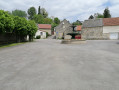
(8) At the town hall square, turn right at the Stop sign onto Rue du Pontce, then left onto Chemin de Reims. You will leave the signposted route and exit Unchair

(9) After the copse opposite ‘la Maison Rouge’, turn right onto the path leading uphill. At the Y-junction, turn left towards the woods. The signposting resumes.

(10) Continue straight on along the D328 to return to the car park at Hourges church (S/E).

Waypoints

  1. S/E : mi 0 - alt. 387 ft - Car park at Hourges church
  2. 1 : mi 0.44 - alt. 587 ft - Turn right at the fork
  3. 2 : mi 1.65 - alt. 620 ft - T-junction at La Fournoise
  4. 3 : mi 2.19 - alt. 545 ft - T-junction at the edge of the forest. Shortcut
  5. 4 : mi 2.78 - alt. 463 ft - On the right is the correct descent
  6. 5 : mi 3.66 - alt. 561 ft - Between the old quarry and the Bois de la Barbette
  7. 6 : mi 4.21 - alt. 584 ft - Edge of the Bois de la Barbette
  8. 7 : mi 5.3 - alt. 597 ft - Trail junction
  9. 8 : mi 5.81 - alt. 338 ft - Pick-up point: Town Hall square
  10. 9 : mi 6.33 - alt. 308 ft - La Maison Rouge
  11. 10 : mi 7.16 - alt. 335 ft - D328 road
  12. S/E : mi 7.36 - alt. 390 ft - Car park at Hourges church

Notes

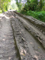
There is virtually no shade. It is best to avoid hiking in very hot weather; higher points can also be very exposed to the wind.
The paths, which are sometimes stony, can be slippery. As always, walking sticks and sturdy footwear are recommended. And, of course, a GPS or the Visorando app for those who, like me, find map-reading difficult.

Worth a visit

Two or three independent winegrowers offer their wines.

Reviews and comments

4.3 / 5
Based on 2 reviews

Reliability of the description
4.5 / 5
Ease of following the route
5 / 5
Route interest
3.5 / 5
Bauthadam
Bauthadam

Overall rating : 4.3 / 5

Date of your route : Mar 07, 2021
Reliability of the description : ★★★★★ Very good
Ease of following the route : ★★★★★ Very good
Route interest : ★★★☆☆ Average
Very busy route : No

A pleasant walk under a clear blue sky. We didn’t encounter any difficulties with the route description or the path itself.
We chose to go straight from point 3 to 6 because of the curfew, but we plan
to complete the full route on another occasion

Machine-translated

Carterando2
Carterando2

Overall rating : 4.3 / 5

Date of your route : Aug 20, 2020
Reliability of the description : ★★★★☆ Good
Ease of following the route : ★★★★★ Very good
Route interest : ★★★★☆ Good
Very busy route : No

A lovely, varied walk to enjoy in spring or autumn.

Machine-translated

Other walks in the area

For more walks, use our search engine .

The GPS track and description are the property of this route's author. Please do not copy them without permission.