


 Country:
 City:
City:


Car park at 4 Rue de la Montagne, next to the Town Hall.
(S/E) To start, take the path opposite the church steps. At the end of this path, turn left onto Rue Fosse la Ville, keeping well to the right.
(1) At the start of a shed, take a path on the right; it is signposted. Cross over to higher ground via a wooden footbridge, then continue straight on along vineyard paths.
At the end of this path, turn left and, after about 100 metres, you’ll see a vineyard on your left that’s over a century old (recognisable by the lack of wire fencing and a wooden stake at each vine). You’ll come out onto a road.
(2) Cross the road and take a grassy path between a wire fence and a vineyard.
Then turn left and follow a tree-lined ditch. At the end of this ditch, veer left and you’ll come across some ponds. At the wide track, turn left and continue following the ponds, passing a farm shed, until you reach the RD 228.
(3) Turn right, then, 100 metres further on, take a path on the left. After 80 metres, continue left again, then take the first path on the right, into the woods.
You are now at Mont Courgeon, where you’ll come across a pond with a fisherman along this path.
Then head right and, at the end of this track, turn left to reach a T-junction.
(4) Turn left, follow this path for 300 m, then veer slightly to the left. You’ll come across a bench.
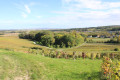
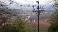
(5) A stunning view. Carry on along the path until you reach a tarmac road. Turn right, passing a walnut tree.
(6) At the foot of this walnut tree, there is a bench and table where you can have a rest.
Turn left onto the road leading to Mery Prémery, keeping well to the right as you walk past a wayside cross. 80 m after the wayside cross, take the path on the right. At the end of this straight stretch, turn right and then immediately left. Continue along this path, following the high-speed rail line until you reach the road.
(7) Turn right onto this road and, after about 80 m, take the path on the left. Follow the high-speed rail line again and, at the end of this long straight stretch, take a small grassy path leading into the Bois des Poulets. You’ll come to a small bridge.
(8) Turn left towards the village of Janvry (Rue des Vignes). Walk down this street for 70 metres, then take the road on the left. Walk past the cemetery, continuing straight on.
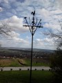
(9) At the high-voltage power lines, turn right onto the “Chemin de Vignes”, signposted on a wine-racking stand.
In this woodland, you’ll find figurines carved into the trees and on the ground.
At the end of this path, turn right and carry on straight ahead.
(10) Take care: before you reach the road, turn right. This short path leads to a small wooden bridge over a tarmac road. Walk down this road, keeping well to the right, and enter Germigny.
(11) Take a path on the left, by the village garden, before the town hall car park. Continue for a few metres, then turn left at the football pitch. You are now at Le Souchet; at the end, turn right. About 180 metres further on, take the first path on the right, then carry on straight ahead to reach Rue de Reims and the church (S/E).

 Visorando Member

 Easy
Easy  Association / Club / Walk leader
 Difficult
