Circular route from Jonchey-sur-Vesle via Vandeuil, Branscourt and Hourges

A walk along good paths leading from the Vesle Valley to the Ardre Valley. The route passes through villages with old stone buildings and runs past Irval Castle.

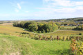
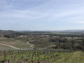
From the various high points, you’ll be treated to lovely views of the Ardre Valley, and then, on the way back, of the Saint-Thierry massif and Mont Die.

Details

n°3542884
Creation:
Last update:
Last review:
  • Walking
    Activity: Walking
  • ↔
    Distance: 9.22 mi
  • ◔
    Average duration: 5h 00 
  • ▲
    Difficulty: Moderate

  • ⚐
    Back to start: Yes
  • ↗
    Ascent: + 830 ft
  • ↘
    Descent: - 827 ft

  • ▲
    Highest point: 643 ft
  • ▼
    Lowest point: 259 ft

Description of the walk

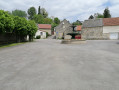
Parking in front of the hotel-restaurant “L’Auberg’inn” on the main street in Jonchery/Vesle (near the post office).

Yellow markings will appear sporadically but do not need to be followed from start to finish.

(S/E) Take the main street eastwards (towards Reims) for 50 metres, then turn right onto Rue Prioux. Follow it to a T-junction.

(1) Turn left onto Avenue Saguet, then go through the tunnel and continue along the tarmac road

(2) Take the path on the right towards Vandeuil. When you reach the road, turn left onto it and cross through Vandeuil, keeping to the left at the junction in the village centre. At the last houses, veer slightly to the left, then continue along this roughly tarmac-surfaced track.

(3) Just after the pond, turn right, then leave the castle on your right and follow the path which climbs towards the forest. When the forest thins out, head left (north-east). Stay on this main path until you reach the road.

(4) Take the road to the right (south-west) and follow it for about 300 m, then turn left onto the vineyard path that descends towards Branscourt, which you can see below. Walk through Branscourt along the main street.

(5) Shortly after the War Memorial, turn right and head uphill along Rue de la Montagne. A picnic table at the entrance to the woods awaits you. Follow this path to the top.

(6) At the crossroads where four paths meet, take the one furthest to the right. When you reach the road, cross it and take the path almost directly opposite. Follow this path, ignoring the various paths to the right or left.

(7) Cross the road and take the path directly opposite.

(8) Turn right, heading due north, onto the path that descends towards Hourges. At the Y-junction, turn right to just ‘skirt’ Hourges.
At this point, the signpost points to Jonchery on the left; do not follow it, but take Rue de Jonchery.

(9) Once past the last houses, turn right onto the grassy track (barely visible) that climbs towards the woods, then stay on this track, ignoring all the paths (some of which are signposted) branching off to the right or left.

(10) Turn left onto the stony track which descends in a long straight line; at the bottom, turn right and follow the N31, keeping it on your left.

(11) Be careful not to take a wrong turn. At this point, head in the opposite direction to the bridge to keep the road on your left.

(12) When you see the road sign for Reims, cross the road, then take the path that runs along the right-hand side of the slip road onto the N31 towards Reims. This path may be difficult to see, depending on how well it is maintained. When you reach the road, turn left to go back through the tunnel.

(1) Before the recycling centre, turn right to rejoin Rue Prioux, then left onto the main road to return to the starting point (S/E).

Waypoints

  1. S/E : mi 0 - alt. 259 ft - Car park in front of the hotel-restaurant. Valley of the - Vesle (rivière)
  2. 1 : mi 0.3 - alt. 266 ft - Junction with the recycling centre
  3. 2 : mi 0.68 - alt. 308 ft - Junction before Le Grand Pré
  4. 3 : mi 1.85 - alt. 364 ft - Crossroads between the path and the road at the duck pond
  5. 4 : mi 2.52 - alt. 443 ft - Junction of the path and the D28 road
  6. 5 : mi 3.38 - alt. 374 ft - After the Branscourt war memorial
  7. 6 : mi 4.01 - alt. 630 ft - X-shaped junction of four paths at an elevation of 193
  8. 7 : mi 5.45 - alt. 607 ft - Cross the road at Les Longues Raies
  9. 8 : mi 6.14 - alt. 584 ft - On the right, behind Laval
  10. 9 : mi 6.73 - alt. 390 ft - Exit at Hourges
  11. 10 : mi 7.7 - alt. 443 ft - Descent towards the RN31
  12. 11 : mi 8.46 - alt. 308 ft - Dangerous junction
  13. 12 : mi 8.56 - alt. 328 ft - Path between the road and the fields
  14. S/E : mi 9.22 - alt. 259 ft - Car park in front of the hotel-restaurant

Notes

Do not undertake this walk in very hot weather, as there is very little shade.
Wear sturdy shoes and bring walking poles, as there are some stony paths.
The Visorando app or a GPS will be useful in addition to the map.
Bakery and restaurant near the start/finish point. Supermarket with petrol station if required.
Picnic table on the outskirts of Branscourt.

Worth a visit

Domaine d’Irval. Views of the higher ground.
Independent winegrowers.

Reviews and comments

3.8 / 5
Based on 2 reviews

Reliability of the description
4 / 5
Ease of following the route
3.5 / 5
Route interest
4 / 5
Delphds02
Delphds02

Overall rating : 3.7 / 5

Date of your route : Aug 04, 2025
Reliability of the description : ★★★★☆ Good
Ease of following the route : ★★★☆☆ Average
Route interest : ★★★★☆ Good
Very busy route : No

Quite varied, nice for picnics (lots of tables along the route), but be careful at the last point (12), as the path no longer exists

Machine-translated

petits randonneurs
petits randonneurs

Thank you

Machine-translated

MCbubu
MCbubu

Hello, I went on the walk this Sunday, but not all the way to Bourges – we did the 9km route via Vandeuil.
A really lovely route – we loved it.

Machine-translated

petits randonneurs
petits randonneurs

Thank you

Machine-translated

Jojodesbatignoles
Jojodesbatignoles

Overall rating : 4 / 5

Date of your route : Feb 11, 2022
Reliability of the description : ★★★★☆ Good
Ease of following the route : ★★★★☆ Good
Route interest : ★★★★☆ Good
Very busy route : No

An interesting walk through woods, fields and villages ==> absolutely brilliant

Machine-translated

TIQUET
TIQUET

Please note: this route is recognised by the French Hiking Federation (Mont Grenet Route and variant)

Machine-translated

Other walks in the area

For more walks, use our search engine .

The GPS track and description are the property of this route's author. Please do not copy them without permission.