


Refine your search for walks in Gouesnou
Gouesnou walks
 Why not come and have a look round Lambé?
 Visorando Member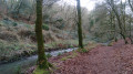
 4.79 mi
 +154 ft
 -167 ft
 2h 20
2h 20
 Easy
Easy
 Departure from Finistère
As the song by the famous Brest band Matmatah goes, “if you enjoy walking, why not come and have a wander around Lambé?”. Here’s a walk to help you discover this neighbourhood of Brest and the Spernot valley.
Although this walk is largely urban, make sure you wear suitable footwear as some paths may be damp.
This walk is not signposted; do not rely on any signposting you may come across.
Tour of the Bourg-Blanc communal lake
 2.28 mi
+10 ft
-10 ft
1h 05
Easy
Departure from Bourg-Blanc (Finistère)
2.28 mi
+10 ft
-10 ft
1h 05
Easy
Departure from Bourg-Blanc (Finistère)
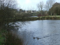
A peaceful walk around the communal lake in Bourg-Blanc.These former meadows were used for tin mining by the Société Comiren (Compagnie Minière Rennanaise).Since mining ceased, a 6-hectare lake has been developed as a place for walking and relaxation, not to mention fishing for enthusiasts.
Route des Vergers in Plabennec
 Tourist office2.69 mi
+66 ft
-66 ft
1h 20
Easy
Departure from Plabennec (Finistère)
Tourist office2.69 mi
+66 ft
-66 ft
1h 20
Easy
Departure from Plabennec (Finistère)
The starting point for this route is at the Espace Louis Coz, marked in blue. Along this educational route, you will discover five information panels providing information about the different species of apple trees and apples in general. Designed for Sunday walkers, this route is a good route for families who want to take a short walk around the town while learning about the association's work in conserving rare apples. Each panel is located in one of the five conservation orchards maintained by the Avalou Plab association.
Around the Costour Valley, Mescalon and the old quarry
 5.38 mi
+525 ft
-535 ft
2h 55
5.38 mi
+525 ft
-535 ft
2h 55
 Moderate
Departure from Le Relecq-Kerhuon (Finistère)
Moderate
Departure from Le Relecq-Kerhuon (Finistère)
A very varied route through wooded areas and green passages near the Stang Alar valley, the Costour valley and its old flooded quarry. Detours, "surprise" shortcuts and exploration of little-frequented areas with passages through a few meadows, along fields and through undergrowth.
Through the Stang-Alar valley and south of old Saint-Marc
 5.27 mi
+463 ft
-466 ft
2h 50
Easy
Departure from Finistère
5.27 mi
+463 ft
-466 ft
2h 50
Easy
Departure from Finistère
Detours via the Botanical Conservatory Garden and the Vallon du Stang-Alar, and the discreet southern part of the old town of Saint-Marc. A shady and very green environment that contrasts with Brest's reputation as a concrete city.
Walk along the banks of the Penfeld
 3.80 mi
+102 ft
-82 ft
1h 50
Easy
Departure from Finistère
3.80 mi
+102 ft
-82 ft
1h 50
Easy
Departure from Finistère
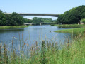
The bed of the Penfeld, Brest’s iconic river, was long used by the navy to store tree trunks between piles for use by shipwrights.
Since the 1980s, this part of the river and its banks bordering the western edge of the Bellevue district have been transformed into a park open to the public, featuring a navigable stretch of water for kayaks.
These banks offer an easy and pleasant route, mostly in the shade.
Kervallon Park and the Capucins plateau
 3.22 mi
+381 ft
-374 ft
1h 50
Easy
Departure from Finistère
3.22 mi
+381 ft
-374 ft
1h 50
Easy
Departure from Finistère
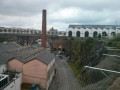
Route exploring part of the Brest Arsenal’s site along the River Penfeld. The route takes in Rue de Saint-Malo, the only street to have escaped Allied bombing during the Second World War, as well as the Capucins plateau, a new neighbourhood since its handover by the navy.
A countryside stroll in the Keroual woods on the north-eastern outskirts of Brest
 2.63 mi
+177 ft
-177 ft
1h 20
Easy
Departure from Guilers (Finistère)
2.63 mi
+177 ft
-177 ft
1h 20
Easy
Departure from Guilers (Finistère)
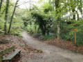
The Keroual woods and their manor house are a veritable green oasis just on the outskirts of Brest. You’ll feel as though you’re in a forest and can enjoy the tranquillity of the surroundings whilst taking in the varied flora and fauna. Streams and ponds add variety to the landscape. This walk takes you round the woods, but there are plenty of alternative routes to explore the area in greater depth or extend your walk.
Around the mouth of the Penfeld and the Arsenal by Kervallon
 7.42 mi
+531 ft
-531 ft
3h 55
Moderate
Departure from Finistère
7.42 mi
+531 ft
-531 ft
3h 55
Moderate
Departure from Finistère
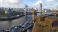
Let’s explore the Brest Arsenal, deeply sunken around the River Penfeld, the ramparts hidden in the woods, and several vantage points overlooking the city and the harbour. The saying goes that Brest was completely razed to the ground during the Second World War… that’s not true: ‘only’ 80 per cent of it was. This route takes you on a journey to discover part of the remaining 20 per cent (towers, gates, ramparts, a few old streets and houses).
Circular walk starting from the Albert Louppe Bridge in Le Relecq-Kerhuon
 8.38 mi
+984 ft
-974 ft
4h 45
Moderate
Departure from Le Relecq-Kerhuon (Finistère)
8.38 mi
+984 ft
-974 ft
4h 45
Moderate
Departure from Le Relecq-Kerhuon (Finistère)
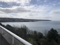
Viewpoint overlooking the Brest harbour, the Élorn, Relecq-Kerhuon and Le Passage (former ferry crossing), the Rocher de l’Impératrice, the two bridges (Albert Louppe and L’Iroise), the Moulin-Blanc marina, Océanopolis, the polder, the ship repair yard, the commercial harbour and the naval base, the city of Brest, the Goulet de Brest, the Pointe des Espagnols, the Petit Minou and Portzic lighthouses, the Pointe Marloux and the Pointe du Corbeau. Kernisi offers a beautiful panoramic view of Brest, its harbour, its bay and the Elorn estuary.
The Cavale Blanche Walk
 4.77 mi
+302 ft
-289 ft
2h 25
Easy
Departure from Finistère
4.77 mi
+302 ft
-289 ft
2h 25
Easy
Departure from Finistère
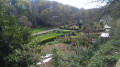
A route around the Cavale Blanche – a neighbourhood that could just as easily have been called the Cavale Verte, given how green this area, built in the late 1970s, is.
Short tour of Relecq-Kerhuon
 4.71 mi
+240 ft
-210 ft
2h 20
Easy
Departure from Le Relecq-Kerhuon (Finistère)
4.71 mi
+240 ft
-210 ft
2h 20
Easy
Departure from Le Relecq-Kerhuon (Finistère)
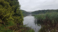
A very varied route with coastal paths, urban cliffs, gardens and shady woods, urban shortcuts and alleyways.
Passages along the Corniche, along the Anse de Kerhuon, a discreet street overlooking Le Relecq and La Rade, Notre Dame du Relecq in the centre, return via the Relecq-Kerhuon greenway along the Domaine de Lossulien (private) then through the alleyways.
Loop around Brest city centre
 7.21 mi
+778 ft
-797 ft
4h 00
Moderate
Departure from Finistère
7.21 mi
+778 ft
-797 ft
4h 00
Moderate
Departure from Finistère
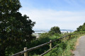
How to combine a visit to Brest with a beautiful walk: this walk takes you through the city centre neighbourhoods, the main streets, monuments and churches, the train station and the town hall.
Start in the Recouvrance neighbourhood, then take Rue Vauban towards the Plateau des Capucins. Cross the Plateau des Capucins. Join and follow the Pont de l'Harteloire. Head towards Place Albert 1er, where you turn towards Saint-Martin. Join Rue de Richelieu to cross the Pont du Forestou bridge. Head towards Chemin du Merle Blanc before reaching the train station, then Brest Town Hall and walk up Rue Jean Jaurès to return to Saint-Louis Church. Cross Rue de Siam to reach Cours Dajot before reaching the Maritime Prefecture, Pont de Recouvrance and then the Tanguy Tower. Pass La Porte Jean Bart, then the Maison de la Fontaine before passing through the Jardin des Explorateurs to complete the loop.
Autour de l'Aber Benoît depuis Plouvien
 10.33 mi
+381 ft
-351 ft
5h 05
Moderate
Departure from Plouvien (Finistère)
10.33 mi
+381 ft
-351 ft
5h 05
Moderate
Departure from Plouvien (Finistère)
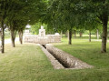
Ce parcours suit en partie celui du Rand'abers 11 en sens inverse. Il vous fera découvrir de beaux paysages de campagne et vous emmènera le long de l'Aber Benoît et ses nombreux moulins à eau.
The banks of the Élorn and the Rocher de l'Impératrice
 4.10 mi
+502 ft
-509 ft
2h 20
Easy
Departure from Plougastel-Daoulas (Finistère)
4.10 mi
+502 ft
-509 ft
2h 20
Easy
Departure from Plougastel-Daoulas (Finistère)
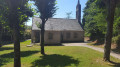
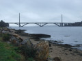
A route offering varied landscapes: woodland and rocky outcrops, including the Rocher de l'Impératrice, and the banks of the Élorn, a coastal river which flows into Brest harbour, passing under the old Albert Louppe Bridge (or Plougastel Bridge) and the more recent Iroise Bridge. Two small chapels add a touch of heritage.
The sunken paths of Lanninguer
 4.99 mi
+98 ft
-89 ft
2h 25
Easy
Departure from Plouzané (Finistère)
4.99 mi
+98 ft
-89 ft
2h 25
Easy
Departure from Plouzané (Finistère)
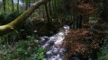
A countryside walk between Plouzané and Guilers, offering the chance to discover the sunken paths and charming landscapes of this little corner of Brittany.
A journey through the Aber Wrac’h valley from Lanarvily
3.47 mi
+302 ft
-331 ft
1h 50
Easy
Departure from Lanarvily (Finistère)
This pleasant circular route starting from Lanarvily offers a refreshing and verdant immersion in the heart of the inland landscapes of Léon, following the upper reaches of the Aber Wrac’h. At this point near Lanarvily, the Aber Wrac’h is unquestionably a river (or a ‘rivière’ in everyday language), and not a ria. The watercourse flows through a steep-sided valley in a strictly fluvial bed (the water here is exclusively fresh, with no tidal range or estuarine influence). The maritime influence only begins to make itself felt much further downstream. This route therefore invites you to discover an authentic riverine and woodland landscape!
More walks in Gouesnou
Select a point of interest below: