The Cavale Blanche Walk

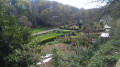
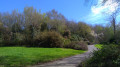
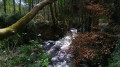
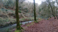
A route around the Cavale Blanche – a neighbourhood that could just as easily have been called the Cavale Verte, given how green this area, built in the late 1970s, is.

Details

28825281
Creation:
Last update:
Last review:
  • Walking
    Activity: Walking
  • ↔
    Distance: 4.77 mi
  • ◔
    Average duration: 2h 25 
  • ▲
    Difficulty: Easy

  • ⚐
    Back to start: Yes
  • ↗
    Ascent: + 302 ft
  • ↘
    Descent: - 289 ft

  • ▲
    Highest point: 295 ft
  • ▼
    Lowest point: 10 ft
  • ⚐ Country: France
  • ⚐ City: Finistère (29)
  • ⚑
    Start/End: N 48.395508° / W 4.531845°
  • ❏
    IGN map(s): Ref. 0417ET
  • Hour-by-hour weather

Photos

Description of the walk

Start from the Questel school complex car park. You can also get there by bus, taking line 4 to the Wagner stop.

(S/E) Take the path marked in yellow on the right at the bottom of the car park to walk alongside Rue Jean Sébastien Bach.

(1) After 250 m, leave the marked path by turning right to take the tunnel that passes under the road. Cross the stream then turn left to follow it.

(2) At the end of the path, turn right onto Chemin du Buis. Keep right at the three-way junction, cross the bridge and immediately turn right onto the path behind the wooden gate.

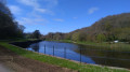
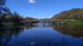
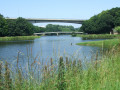
.(3) At the junction, turn right onto the path marked in yellow. Continue along Chemin de Langoulouarn, passing the sewage treatment works. Then take a quick left and right to join the path that runs alongside the banks of the Penfeld, passes under the Pont de la Villeneuve and bends to the right. Continue to follow the path, which winds through the woodland, running alongside the River Penfeld at varying distances. Go round the sports grounds and reach Avenue de la Libération.

(4) Cross the road carefully to join the path opposite and turn left. At the junction just after this, leave the signposted path and head left to reach the other bank of the Penfeld, following it as far as the Porte de l’Arrière-garde.

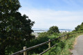
(5) Follow the path to the right, turn left once you reach the small car park, and start climbing Route de Kervallon. After 200 metres, at the small wash house, turn right onto the path that climbs through the terraced plots until you reach the path at the very top. Turn left onto the yellow-marked path overlooking the allotments to reach the playgrounds, then walk between the houses to Place Jack London.

(6) Head towards the school and turn left to walk up Rue Alexandre Pradère-Niquet (leaving the signposted path after the school), then onto Rue Schiller. At the first roundabout, turn left; then, 50 metres further on, at the second roundabout, turn right and continue straight on to Parc d’Éole via Avenue de Tallin.

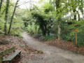
(7) Enter the park via the yellow-marked path behind the metal gate, going round the hillock on the right. Once on the other side, follow the yellow-marked dirt track to the right, which descends until it reaches the stream; follow the stream, then cross it before emerging onto Rue Johann Strauss.

(8) Cross the street and take the path opposite. Cross the stream again, then turn left to continue following it. You’ll come out onto Rue Jean Sébastien Bach.

Cross at the pedestrian crossing and turn right to return to the car park of the Questel school complex (S/E).

Waypoints

  1. S/E : mi 0 - alt. 128 ft - Questel School Complex
  2. 1 : mi 0.09 - alt. 115 ft - Junction of the circular loop
  3. 2 : mi 0.52 - alt. 62 ft - Chemin du Buis
  4. 3 : mi 0.92 - alt. 36 ft - Junction
  5. 4 : mi 2.28 - alt. 46 ft - Avenue de la Libération - Penfeld (fleuve) - Affluent de l'Océan Atlantique
  6. 5 : mi 2.63 - alt. 16 ft - Porte de l’Arrière-Garde
  7. 6 : mi 3.22 - alt. 220 ft - Place Jack London
  8. 7 : mi 3.87 - alt. 279 ft - Éole Park
  9. 8 : mi 4.32 - alt. 167 ft - Rue Johann Strauss
  10. S/E : mi 4.77 - alt. 128 ft - Questel School Complex

Reviews and comments

4.5 / 5
Based on 2 reviews

Reliability of the description
4.5 / 5
Ease of following the route
4 / 5
Route interest
5 / 5
Eric2B
Eric2B

Overall rating : 4.7 / 5

Date of your route : Aug 09, 2026
Reliability of the description : ★★★★★ Very good
Ease of following the route : ★★★★☆ Good
Route interest : ★★★★★ Very good
Very busy route : No

This lovely walk starts in a fairly built-up neighbourhood of Brest. I did this route in the opposite direction, starting from Place Jack London. Very quickly, you find yourself deep in dense woodland, following cross-country paths that you rarely leave. The tarmac sections are kept to a minimum and the overall impression is that of a walk in the countryside. This route is ideal when the sun gets too hot, as most of the walk is in the shade. In some areas, the paths criss-cross, so it’s best to follow the GPS directions on the Visorando app. Thanks to everyone who suggested this lovely walk in Brest.

Machine-translated

Ch.borel
Ch.borel

Overall rating : 4.3 / 5

Date of your route : Jul 21, 2024
Reliability of the description : ★★★★☆ Good
Ease of following the route : ★★★★☆ Good
Route interest : ★★★★★ Very good
Very busy route : No

A very original walk, much of it through greenery along the waterfront, whilst remaining within the city of Brest. Although I’ve lived in Brest for over 20 years, I’ve discovered some surprising and charming spots thanks to this walk.
Thank you for this original itinerary :-)

Machine-translated

User 17069738

Thank you for your reply.
I’ll try my luck again on a future visit to Brest. I saw several school groups, but not that one, and I must not have come across anyone who knows their local area well.
But never mind – I found a path leading down to the banks of the Penfeld, where I’d never had the chance to go for a walk before!
So it wasn’t all for nothing!

Machine-translated

matranv
matranv

I’m sorry you weren’t able to go on the walk. The school grounds are clearly signposted, though, and well known to locals. Still, there’s no need to feel too disappointed, as following the recent storm I’m not sure all the paths will be passable straight away.

Machine-translated

User 17069738

Hello,

After wandering around the neighbourhood for ages and asking several people, I still couldn’t find the start of the footpath or the Questel school complex...?

Machine-translated

Other walks in the area

For more walks, use our search engine .

The GPS track and description are the property of this route's author. Please do not copy them without permission.