Circular walk starting from the Albert Louppe Bridge in Le Relecq-Kerhuon

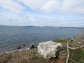
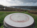
Viewpoint overlooking the Brest harbour, the Élorn, Relecq-Kerhuon and Le Passage (former ferry crossing), the Rocher de l’Impératrice, the two bridges (Albert Louppe and L’Iroise), the Moulin-Blanc marina, Océanopolis, the polder, the ship repair yard, the commercial harbour and the naval base, the city of Brest, the Goulet de Brest, the Pointe des Espagnols, the Petit Minou and Portzic lighthouses, the Pointe Marloux and the Pointe du Corbeau. Kernisi offers a beautiful panoramic view of Brest, its harbour, its bay and the Elorn estuary.

Details

31811138
Creation:
Last update:
Last review:
  • Walking
    Activity: Walking
  • ↔
    Distance: 8.38 mi
  • ◔
    Average duration: 4h 45 
  • ▲
    Difficulty: Moderate

  • ⚐
    Back to start: Yes
  • ↗
    Ascent: + 984 ft
  • ↘
    Descent: - 974 ft

  • ▲
    Highest point: 276 ft
  • ▼
    Lowest point: -10 ft

Photos

Description of the walk

Park in the north car park at the entrance to the Albert Louppe Bridge.

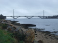
(S/E) Cross the bridge; access is permitted for pedestrians, cyclists, mopeds under 50 cm³ and licence-free cars weighing less than 1 tonne.

(1) Continue straight ahead, then take the left-hand bend onto the Chemin du Vieux Pont. Turn left immediately onto the path that leads back, allowing you to pass under the bridge and reach the riverbank. Follow the riverbank to Porz Ar Vil, then on to Pors Karo Keralliou (shipyard). Continue along the beach to the Kéraliou fishponds and head for the Ar Porzh Nevez slipway.

(2) Carry on to reach the Roc’h Killiou crossroads.

(3) Keep to the right along the foreshore and you’ll soon reach the Kernizi crossroads (on the IGN map).

(4) Carry on along the beach, then turn off it to reach Pointe Marloux. To climb to the top of the headland, turn right behind the low wall, then return to the same spot to follow the yellow markings again and reach the Kerdrein beach.

(5) Turn left onto the Chemin de la Grève de Kerdrein. At the Stop sign, turn left onto the Route du Moulin de Kerdrein , taking care of the traffic. Continue along the Route de Kerdrein and then the Route de Kernizi as far as Kernizi.

(6) Turn left, then left again at the junction to take the Route du Panorama de Kernizi and head down to the beach to return to the junction you passed on the way there.

(4) Turn right to follow the same route as on the way there, returning to the Roc’h Killiou crossroads.

(3) Take the small path on the right behind the wall, which leads to the hamlet of Leur ar Marc’h.

(7) Turn left onto Route de Leur ar Marc’h, continue along Route de Roc’h Kiliou and then Route de Kerouezec to reach the village of Kerouezeg.

(8) Turn left onto Route de Prat Bihan and head towards the entrance to Traouidan. At the stop sign, turn right onto Route de Traouidan and then continue to the An Dalar roundabout.

(9) Carry on straight ahead onto Route de Keraliou. Pass through this village to reach the south car park of the Albert Louppe Bridge. Turn left and return to the junction you passed on the way there.

(1) Follow the route taken on the way there in the opposite direction, cross the bridge and then return to the northern car park (S/E).

Waypoints

  1. S/E : mi 0 - alt. 89 ft - North car park of the Albert Louppe Bridge on the - Elorn (fleuve)
  2. 1 : mi 0.56 - alt. 33 ft - Junction of the circular loop
  3. 2 : mi 1.86 - alt. 16 ft - Ar Porzh Nevez
  4. 3 : mi 2.58 - alt. 7 ft - Roc’h Killiou crossroads
  5. 4 : mi 2.91 - alt. 43 ft - Kernizi crossroads
  6. 5 : mi 3.92 - alt. 16 ft - Kerdrein beach
  7. 6 : mi 4.67 - alt. 226 ft - Kernisi
  8. 7 : mi 5.8 - alt. 226 ft - Leur ar Marc’h
  9. 8 : mi 6.5 - alt. 276 ft - Kerouezeg
  10. 9 : mi 7.02 - alt. 220 ft - An Dalar roundabout
  11. S/E : mi 8.38 - alt. 89 ft - North car park by the Albert Louppe Bridge

Notes

Please note: this walk should be undertaken at low tide; some sections are inaccessible at high tide (possible but dangerous).
This is a fairly challenging route as it involves walking on the pebbles along the foreshores bordering the Brest harbour.
Bring a bottle of water. The fountain at the end of the bridge on the Plougastel-Daoulas side is no longer in use.
(5) You can extend the walk to the Pointe du Corbeau and its old fort (an extra 3 km). At the stop sign, turn right onto the Route du Moulin de Kerdrein.

Worth a visit

Reviews and comments

3.9 / 5
Based on 4 reviews

Reliability of the description
4.5 / 5
Ease of following the route
3.5 / 5
Route interest
3.8 / 5
Majerix8 @yahoo.fr
Majerix8 @yahoo.fr

Overall rating : 3.7 / 5

Date of your route : Apr 13, 2025
Reliability of the description : ★★★★☆ Good
Ease of following the route : ★★★☆☆ Average
Route interest : ★★★★☆ Good
Very busy route : Yes

When I say ‘walked’
I’m referring to the section from point 3 onwards, as before that you’re walking over rocks and along the shore...
So it’s a tricky start to the walk – be careful depending on the tide, and watch your ankles
A lovely walk otherwise, with a 4-kilometre return journey along the road

Machine-translated

Mamyja
Mamyja

Overall rating : 3 / 5

Date of your route : May 15, 2023
Reliability of the description : ★★★★☆ Good
Ease of following the route : ★★★☆☆ Average
Route interest : ★★☆☆☆ Disappointing
Very busy route : No

Too many sections along the shore with pebbles, making for a rather unpleasant walk
Bear the tide in mind. We decided to alter the route

Machine-translated

oeildepoisson
oeildepoisson

Overall rating : 4.3 / 5

Date of your route : May 02, 2023
Reliability of the description : ★★★★★ Very good
Ease of following the route : ★★★★☆ Good
Route interest : ★★★★☆ Good
Very busy route : No

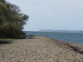
Please note: the first kilometre is along an overgrown, unmaintained path; the following 4 kilometres are along the beach (which is covered in nothing but pebbles)

Machine-translated

Pierre isa
Pierre isa

Overall rating : 4.7 / 5

Date of your route : Apr 08, 2023
Reliability of the description : ★★★★★ Very good
Ease of following the route : ★★★★☆ Good
Route interest : ★★★★★ Very good
Very busy route : Yes

A lovely walk, though the route could do with some improvement, especially when you’re on the pebbles
We found ourselves looking at our feet more than the scenery, which meant our route took longer than planned, but
it was still enjoyable
However, the path was very busy.
Best done during the week, if possible

Machine-translated

Other walks in the area

For more walks, use our search engine .

The GPS track and description are the property of this route's author. Please do not copy them without permission.