Country:
 City:
City:


Access: In Brest, head to the large roundabout at Place Albert Premier, cross the Robert Schumann Bridge, which leads onto Avenue Victor le Gorgeu. Follow this avenue heading north-west.
Pass three roundabouts and, atthe fourth, near the modern-style Notre-Dame du Bouguen Church, turn left. Follow Avenue de Tarente, pass a roundabout and continue straight on along Rue de Normandie, which runs past the Keralet municipal swimming pool, and head down towards La Penfelt via Rue de Normandie. At the bottom, continue along Rue de l’Anse Saupin, following it to the end where there is a small car park.
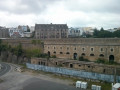
(S/E) From the car park, walk along the edge of the lake and start the climb up Route de Kervallon. Walk past the old military buildings on your right, then the allotments.
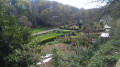
After these, take a short detour to the right to cross a park featuring a waterfall, a wash house and a fountain; continue along the road until you reach the park’s exit, marked by two pillars. Turn left and join Rue de Guilers.
(1) Turn left onto this street, cross the tram tracks (at the traffic lights) and carry on along the same street. Cross Rue Beaumanoir (at the pedestrian crossing) and walk on for about a hundred metres.
(2) Turn right onto Rue des Mousses, which leads to a car park. Turn left onto a footpath that runs behind the Collège des Quatre Moulins. This path, known as Chemin du Belvédère, offers two viewpoints: one over the city of Brest and the other over the inner harbour. You’ll come to a flight of steps leading down to Rue de la Frégate Laplace. On your right is Recouvrance Cemetery.
(3) Follow this street to the left and, at the Fork in the road, keep right. Cross a street, then turn left to walk through a small public garden. At the exit, pass under a archway between two buildings and turn right. Take the first street on the left, Rue Charles de Bortoli. When you reach Boulevard Commandant Mouchotte, make the first turn right then left to continue along Venelle Eugène Béléguic. Cross a street and continue along Rue Védrines, which leads onto a street running alongside the tram line. Turn right and, after about a hundred metres, cross the tram line and take the street that runs alongside the swimming pool, then past a primary school.
(4) At the junction with a park opposite, turn left into Rue de Pontaniou, which runs alongside the arsenal’s moats on your right.
Immediately afterwards, leave the street and turn left into a small street, Rue Pierre Ozanne, which runs alongside the buildings of the former Brest prison on your right. At the end, look out for a flight of steps on your right.
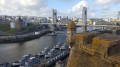
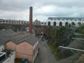
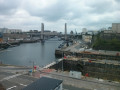
(5) Take these steps down to the lower part of Rue de Saint-Malo, the only street dating from the Revolution to have been spared by the Allied bombings. At the end, take the staircase leading up to the Plateau des Capucins. Turn right to walk round the industrial buildings that once housed the French Navy’s mechanical workshops (foundry, fitting-out and assembly) and were renovated in 2017 (open to visitors). Follow the path to the viewing point, which offers a view of the Penfeld basin – where the naval dockyard developed – and part of the city of Brest. Pass under the cable car and head to the roundabout at the top of the Rampe des Capucins.
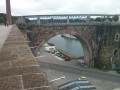
(6) Follow this street, taking the pavement on the right which overlooks the various docks of the arsenal. Pass under the Pont de l’Harteloire, the second road bridge crossing the Penfeld. Continue to the end of the street and turn right to pass through an area of old buildings that have been turned into a graffiti zone.
Turn right to return to the starting car park (S/E).

 Visorando Member

 Moderate