Country:
 City:
City:


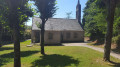
Start from the car park at Lambézellec Church. Please note that on Fridaymornings it’s market day, so parking is much more difficult.
(S/E) Take the steps to the west of the car park, then head down to the right along Rue de Bohars. Turn left towards the Maison de Retraite de la Source, pass under the building to enter the Bois de la Brasserie.
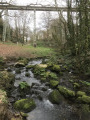
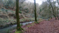
(1) Take the path on the right that runs alongside the Le Spernot stream on its left bank (ignore the signposting) until you come out onto Boulevard de l’Europe.
(2) Walk down the boulevard to the right as far as the roundabout, then turn right. At the next roundabout, turn right and then immediately left onto the path overlooking Rue Louise Weiss. Continue to the end of the path.
(3) Follow the road to the right for a few metres, cross the road carefully, then take the path opposite which leads down to the roundabout on the left. Cross at the pedestrian crossing, continue for a few dozen metres and turn right onto the path that runs between the buildings. At the far end on the right, after a final car park, join a path that runs below Route Léopold Sédar Sengor and leads to a roundabout.
(4) Go round the roundabout on the left, crossing two streets, and turn left for about twenty metres. Then take the path on the left, between Ouest Pathologie and Publio, which runs alongside a stream to a wetland area. Follow it, turning immediately left. After the wetland area, take the path on the right which leads back up towards the Chemin du Petit Kervao.
(5) Take this path on the left. Cross Rue du Tromeur with care and continue along the path opposite, passing under the high-voltage power lines until you reach the junction of the Kerizac Vian paths.
(6) Carry on straight ahead, then follow Rue du Restic as far as Rue de Loscoat; cross this to rejoin Rue du Restic, then turn left into Rue Broussais and continue along Rue du Général Ely to No. 14.
(7) Turn right into Rue Alfred Binet until you reach No. 7, then turn right onto Rue Françoise Dolto. At No. 135, turn left onto the small lane. At the end of the lane, on Rue Suzanne Poumerol, turn left and then left again, then continue straight on to Rue Marcelin Duval. Go round the roundabout and continue towards the stadium along Rue Henri Bordeaux until you reach the wide left-hand bend.
(8) After number 35 on Rue Henry Bordeau, turn right to reach the Keravelloc Kerallan garden. Enter the garden, turn right and follow the path running alongside the Spernot. On leaving the garden, take the path opposite between the houses. Continue straight on until you reach Rue Saint-Vincent-de-Paul, then turn right. Just before the bus stop, turn left onto the path to reach the Spernot one last time. At the end of the path, take the street on the left to reach the car park and your starting point (S/E).

 Visorando Member


 Moderate