A countryside stroll in the Keroual woods on the north-eastern outskirts of Brest

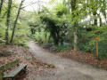
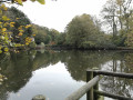
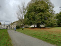
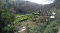
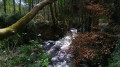
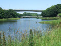
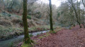
The Keroual woods and their manor house are a veritable green oasis just on the outskirts of Brest. You’ll feel as though you’re in a forest and can enjoy the tranquillity of the surroundings whilst taking in the varied flora and fauna. Streams and ponds add variety to the landscape. This walk takes you round the woods, but there are plenty of alternative routes to explore the area in greater depth or extend your walk.

Details

1594968
Creation:
Last update:
Last review:
  • Walking
    Activity: Walking
  • ↔
    Distance: 2.63 mi
  • ◔
    Average duration: 1h 20 
  • ▲
    Difficulty: Easy

  • ⚐
    Back to start: Yes
  • ↗
    Ascent: + 177 ft
  • ↘
    Descent: - 177 ft

  • ▲
    Highest point: 259 ft
  • ▼
    Lowest point: 69 ft
  • ⚐ Country: France
  • ⚐ City: Guilers (29820)
  • ⚑
    Start/End: N 48.414788° / W 4.552324°
  • ❏
    IGN map(s): Ref. 0417ET
  • Hour-by-hour weather

Photos

Description of the walk

Roadside parking near Keroual Manor

(S/E) Set off from the main gate of Keroual Manor and follow the tarmac road alongside the manor. Before reaching the gate, leave the small road and turn right onto a narrow gravel track. 50 metres further on, turn left to rejoin the main track.

(1) After passing a clearing, the path begins to descend. At the fork, take the path on the right; then, after a 50-metre descent, turn right again to continue straight down the slope.

(2) At the bottom of the descent, head slightly to the left at the fork. From there, continue to follow the small stream, then the ponds, and then the small stream again. After the second pond, carry on straight ahead towards the Kervaly car park.
When you reach the end, the path makes a 180° turn. There is a sign for Keroual Park at this point. Follow the sign for the stables. From there, follow the orange route
Note: Just before you reach the sign for the Kerlidien car park, you can take a path on the left which takes you through the allotments in the Keroual woods.
Continue by following the signs pointing towards the Kerlidien car park.

(3) Turn left and carry on, following the signs for “Le Moulin”.

(4) Turn slightly left towards the car park, which you’ll see on your left. Walk about 50 metres to the right along the tarmac road, then turn left just before the small bridge. Then continue along the path, keeping the lake on your right.

(5) Turn right twice in quick succession, walk for about 500 metres and then turn left to return to the starting car park (S/E).

Waypoints

  1. S/E : mi 0 - alt. 246 ft - Car park at Keroual Manor
  2. 1 : mi 0.33 - alt. 236 ft - Clearing
  3. 2 : mi 0.49 - alt. 171 ft - Turn left at the bottom of the descent
  4. 3 : mi 1.84 - alt. 223 ft - Turn left at the fork
  5. 4 : mi 2.09 - alt. 213 ft - Turn left at the junction
  6. 5 : mi 2.41 - alt. 220 ft - Turn right at the fork
  7. S/E : mi 2.63 - alt. 246 ft - Car park at Keroual Manor

Notes

There are many other paths and trails in the woods. Longer walks are possible. Several signposts help you find your way.
The track is suitable for vehicles throughout and accessible all year round.

Worth a visit

A short break at the Blé Noir crêperie.
Public barbecues near the car park at the start of the trail.

Reviews and comments

4.5 / 5
Based on 2 reviews

Reliability of the description
5 / 5
Ease of following the route
4 / 5
Route interest
4.5 / 5
User 28617780

Overall rating : 5 / 5

Date of your route : Jun 08, 2026
Reliability of the description : ★★★★★ Very good
Ease of following the route : ★★★★★ Very good
Route interest : ★★★★★ Very good
Very busy route : Yes

The walk is nice, but there are a lot of stones.

Machine-translated

jolo07
jolo07

At present, the route is not recommended: following a series of storms, many trees have fallen and numerous paths are closed
Only access to the crêperie is permitted!

Machine-translated

jolo07
jolo07

Due to Storm Ciaran, as the footpaths are not safe, walking is prohibited
If you do so, it is at your own risk
Access to the crêperie and the manor house is permitted

Machine-translated

panuela
panuela

Overall rating : 4 / 5

Date of your route : May 20, 2020
Reliability of the description : ★★★★★ Very good
Ease of following the route : ★★★☆☆ Average
Route interest : ★★★★☆ Good
Very busy route : No

A lovely walk to get back into the swing of things after lockdown; the paths are wide enough to easily maintain a safe distance between people. We got a bit lost trying to walk round the woods, but we only had the map I’d printed out, and we parked in the wrong car park!!!
Otherwise, it’s a lovely walk – you really feel like you’re in the forest, and the ponds give you a chance to admire the wildlife and add variety to the scenery.

Machine-translated

Other walks in the area

For more walks, use our search engine .

The GPS track and description are the property of this route's author. Please do not copy them without permission.