Country:
 City:
City:


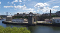
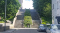
(DA) Start from the Parc à Chaînes car park. With your back to the sea (and facing the high walls), head to the far left-hand end of the car park, and at the corner, cross the small roundabout on Rue Commandant Mabert to go up a flight of stairs.
Continue along the path beyond the steps, towards the castle (so turn left into the street).
Take a detour via the small Jardin de l’Académie de Marine (popular for its lawns in summer and offering a panoramic view of the harbour).
Then continue to Brest Castle by following a winding, uphill street.
Pass the entrance to the Musée de la Marine – that is, the Château de Brest (open to visitors) – and walk along the park at the edge of the château.
After the park, do not head down via Boulevard de la Marine, but cross over to the opposite side, at the foot of a white residential block, through a pedestrian zone, until you reach the Pont de Recouvrance (with its large twin concrete pylons).
(1) Cross the Pont de Recouvrance (a large concrete drawbridge, an iconic feature of the city despite its purely functional design).
After the bridge, turn left and head downhill towards the Tour Tanguy (a large medieval tower which is open to visitors and houses a small museum).
(2) Walk past the base of the Tanguy Tower and continue down a flight of steps into the street. Follow the perimeter wall (military grounds) along Rue de l’Église, but immediately after a large house, turn right onto a wide stone staircase signposted ‘Petite Rue de l’Église’.
The staircase winds its way between buildings; leave it by turning left into Rue Traverse de l’Église. At the end, turn left.
(3) On the corner with Rue de la Pointe stands the Maison de la Fontaine and its public fountain (one of the oldest houses in Brest, open to visitors).
Note the plaque on the fountain referring to the thirst of the people of Brest, and next to it a very old crucifix carved from a single block of stone.
Opposite the fountain, the high wall has an opening with a grille: this is an entrance to the Jardin des Explorateurs.
(4) Enter the Jardin des Explorateurs, which features a viewing platform with a stunning view over the harbour (see ‘During the walk or nearby’).
Exit at the other end of the garden and take Rue de Rochefort opposite.
Walk round the church via the small square on the left, then turn right at the corner of the church towards Place Vauban.
Cross straight ahead, then turn left into Rue de la Communauté, which then becomes Rue Bouillon.
When you see a tree-lined square below on your right, take the second right into Rue Docteur Thielmans, which runs alongside small blocks of flats on your left without going back down to the tree-lined square.
Further on, where Rue Thielmans curves round, leave it and continue straight on down the steps towards the Pont de Recouvrance.
Go down a series of steps to pass under the Pont de Recouvrance this time.
On the other side, walk alongside the white fence overlooking the military zone, then continue along Rue Quartier Maître Bondon, followed by Rue “Place Jean Bart” and then Rue Jean Bart.
Take a detour via the Jardin du Deuxième Dépôt on the right.
A little further on, as you leave the garden, turn right into Rue du Pontaniou, then turn left and make your way up the very steep Rue Victor Rossel.
Turn right onto Rue Lars. Halfway along, on your right, you’ll find No. 16 Rue Lars, with its remarkable columns facing the street and the building’s entrance dating from 1759 (though the building itself appears to be more recent).
At the end of Rue Lars, opposite and slightly to the left, go through a gap in the vegetation and go down a flight of steps leading into a courtyard.
(5) Just past the courtyard, turn right onto Rue de Saint-Malo – or, more precisely, its old section (it is the oldest street in Brest). Ruins open to visitors.
At the very other end, go back up a flight of steps to reach the corner of the Ateliers des Capucins.
(6) Take the Belvédère Cesaria Evora pedestrian walkway, which circles the large building known as Les Ateliers des Capucins.
Don’t hesitate to visit the Ateliers des Capucins (see “During the walk or nearby”).
After going round the building, return to Rue de Pontaniou and take the flight of steps opposite Les Ateliers des Capucins. Cross the square and, opposite, take a second flight of steps leading up alongside a modern block of flats.
Turn immediately right to walk alongside another building on your left and pass in front of a large cylindrical concrete tank.
Carry on straight ahead as if to go under the bridge visible opposite, and at the foot of it you’ll find a flight of steps leading up to the Pont de l’Harteloire.
At the roundabout, cross the road and, opposite the pedestrian crossing, take a path cut through the lawn which runs behind a large light-blue building with red trim.
Follow the path, which eventually leads (after passing some communal gardens and a small park) to the entrance to the Quéliverzan Ramparts (marked by a round metal ‘Balcon Penfeld’ sign on the ground).
(7) Take the path that allows you to explore the Quéliverzan ramparts (visible beyond a large dip in the ground, covered in vegetation).
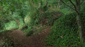
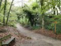
The path winds its way for several hundred metres through woodland; follow it and, at each junction, take the path that leads downhill.
The path emerges onto the tarmac Route de Kervallon, with numerous ruins of buildings and ramparts visible on the other side.
Turn right onto Route de Kervallon and head downhill towards a wooden barrier and some very colourful street art. Carry straight on: cross the small dam on the River Penfeld.
(8) On the other side, walk past the Porte de l’Arrière-Garde, keeping it on your right, and follow the hairpin bend.
Opposite, you’ll find a high stone wall with a sign reading “Rue des Archives”; at the corner, look for a small flight of steps leading up into the woods and take them.
Follow the steps and then the narrow path that runs alongside the high wall, before entering the woods (stay on the widest path).
After the path has crossed a clearing, it comes out onto a junction with two paths, opposite a white and blue building and a well-tended lawn. Stay within the woods and take the path that turns right (ignore the building and the lawn).
Continue along the path, staying within the woods (further on, ignore another path on the left leading towards the lawn). Look for a path that turns right and leads to a winding wooden staircase going downhill: take this.
At the bottom of the steps, turn left and walk along the top of the military boundary wall, straight on until you reach the end.
After about 500m, turn off at the corner of the perimeter wall and head up onto the lawn opposite, veering slightly to the left.
You’ll need to cross the road (behind the bush) and make your way to the stadium on the other side: look for a white metal gate – if it’s locked, use the tunnel just below it. Make your way to the edge of the stadium.
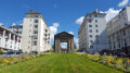
On the other side of the stadium (the rugby pitch surrounded by an athletics track), look for a grassy area and cross it due south towards the Porte Castelnau, a very prominent stone arch.
From the grassy area and the stadium, you can see the hills of the whole of southern Brest, including the Recouvrance Bridge and the cable car.
(9) Pass under the Porte Castelnau.
Like many monuments in Brest, these are ruins from the Second World War that were salvaged, then reassembled and often moved.
On the other side, walk down Rue de Lille, then turn left to walk back up it.
At a small roundabout, take the second right, still onto Rue de Lille (a cul-de-sac).
Follow the fence on your left, then at the first entrance cross to the other side of the fence, and continue along it on the other side through the university car park lanes.
Turn left between two buildings when you can no longer go straight on (you’ll pass the Armen university canteen on your right).
Carry on straight ahead through the car park but do not exit onto Avenue Victor Le Gorgeu opposite: turn right before the small steps, to walk alongside a rounded blue/green building on your right.
Further on, when the path bends to the right, take a small path on the left, which passes under the Schuman Bridge.
Follow the main path down through the woods via several flights of steps.
You’ll emerge onto Rue Lanrédec via a flight of steps; turn right there.
Then take the first right again, onto Rue de la Digue, and follow it until you reach the bridge.
Almost exactly under the bridge, turn right under the leafy trees into Impasse du Bois de Boulogne.
Walk up this charming little, shaded cul-de-sac, which winds its way up, until you reach the end.
Right at the end, at the foot of a house with a veranda – and almost invisible from the cul-de-sac – you’ll find a flight of steps leading to several houses.
Go down this narrow flight of steps, which leads back onto Rue de la Digue, then continue on the other side to reach the parallel street: Rue du Moulin à Poudre, where you should turn right.
Follow the street for 300–400 metres: note the remains of the ramparts high up on the right; pass a roundabout flanked on one side by the Porte de la Brasserie (a military gate), and opposite the remains of an old building: the Octroi; then, a little further on, you’ll find a large double flight of steps on the left.
(10) Bravely climb this large staircase on Rue Latouche-Tréville (note that it is surprisingly warped).
Turn immediately right into Rue Lamotte-Picquet, then take the first right onto Rue Louis Delobeau.
At the next bend, you’ll find a modern, all-black house on the right-hand corner.
Turn right onto the grass to go round the black house and you’ll end up in a small public park that’s hidden from view from the street.
Leave the park heading in the opposite direction and continue straight ahead along the street, which becomes Rue Jules Vallès.
At the far end, in a car park, ignore a flight of steps on the left leading uphill, and at the very end take a flight of steps leading down under the Pont de l’Harteloire. Cross the road.
Carry on under the bridge, passing between the piers as far as possible, until you reach a bend where you turn left onto Boulevard Jean Moulin.
Follow Boulevard Jean Moulin for about 600–800 metres, alongside the high fence marking the boundary of the military zone and overlooking the River Penfeld, with a stunning view of the Ateliers des Capucins.
(11) On the way (in a small triangular park opposite a roundabout), you’ll find the reconstructed remains of the Peristyle of the Fautras Barracks.
Continue along the boulevard to the cable car terminal (shunned by skiers, even in winter).
With your back to the cable car, take Rue Ducouedic and its steps opposite, then take the first left into Rue de Siam.
Walk up Rue de Siam, a long, straight street with the Town Hall at the very top, and a street that epitomises life in Brest both day and night.
After passing two junctions, you’ll arrive at Place des Fontaines (which certainly lives up to its name), flanked on the left by the Dialogue bookshop and on the right by a passageway under a block of flats leading to a small square with a lawn.
The Dialogue bookshop is well worth a visit (see “During the walk or nearby”).
(12) Turn right (opposite the bookshop) through the passageway under a block of flats, into Square Commandant L’Herminier, with its Porte de la Caserne Guépin.
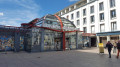
Carry on straight ahead to Place Wilson (with a round concrete kiosk in the centre), and cross it diagonally to the left to reach the corner opposite (a small roundabout).
Take Rue Jean Macé, which slopes downwards with a view of the harbour.
On Rue Jean Macé, take the first left onto Rue Voltaire (you’ll go round a primary school).
Carry on straight ahead along Rue Voltaire, pass the first junction, then, just after the second junction, you’ll arrive at a park (with a small car park under the trees), the Jardin Alphonse Juin.
Carry on, keeping the small car park under the trees on your right, and take a path on the right to cross the very shady park.
Walk through the park under the trees, heading south.
Exit at the other end of the park (at the junction of Avenue Salaun Penquer and Rue de Denver), and on the other side of Rue de Denver, take a path leading into another park: the Jardin Victor Ségalen.
Walk through the Jardin Victor Ségalen, then continue straight on for about 300 metres along the Cours d’Ajot (a tree-lined avenue).
You’ll reach the American First World War Memorial (Brest) or the ‘Tour Rose’, as the locals call it (its actual English name is the ‘Naval Monument’). It is a memorial owned by the USA, built after the First World War in 1930, destroyed by the Nazis, and rebuilt in 1958.
It also offers a stunning view of Brest Harbour, as does the entire promenade along the Cours d’Ajot (as the locals spell it; in reality, it is Cours Dajot without an apostrophe).
Continue along the promenade for 100 to 200 metres past the monument, then turn left onto the large flight of steps leading down to the commercial harbour and a roundabout.
Cross the roundabout carefully and, on the other side, take a second flight of steps leading directly to the Parc à Chaîne car park (S/E).



 Visorando Member

 Easy
Easy