Country:
 City:
City:


The walk starts from the car park at Lanarvily Town Hall.
(S/E) From the car park, walk past the church and the city park and leave the village to begin the descent towards the valley. At the first Fork in the road, turn right onto the Route du Mingant and continue to the first hairpin bend.
(1) Leave the road and take a path through the woods. The route follows the lower section of a trail running course. This stretch through the woodland offers a particularly cool, shaded and relaxing interlude, with a slightly undulating profile that makes this section a little challenging. All along the path, you can look down onto the river. Carry on until you reach the D38.
(2) Cross it carefully and carry on straight ahead along the forest track to the picturesque Moulin du Vern.
(3) Follow a small road across the stream to reach the left bank. The route then continues along this narrow shared road, used by a few cars and cyclists, which retains a peaceful, rural atmosphere. Join the D38 again.
(4) Cross it again carefully and take the path that winds down through the woodland towards the valley, to begin your return to the other bank. You’ll come to a road; follow it straight ahead for about 300 metres.
(5) Before Kergus, leave the road, turn left onto a track and continue to the bridge over the Aber Wrac’h.
(6) Turn left to cross the bridge, continue along the road, pass Mingant and reach the hairpin bend you passed on the way out.
(1) Turn right and follow the route you took on the way there in the opposite direction until you reach the car park at Lanarvily Town Hall (S/E).
 Visorando Member
 Moderate
 Tourist office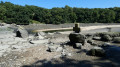
 Association / Club / Walk leader
 Difficult