Refine your search for walks in Firminy
Firminy walks


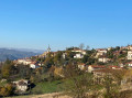
 On the edge of the Haute-Loire, starting from Fiminy-Vert
 Visorando Member
 7.06 mi
 +1,142 ft
 -1,112 ft
 4h 15
4h 15
 Moderate
 Departure from Firminy (Loire)
A walk on the edge of the Haute-Loire region that will also allow you to discover Le Corbusier’s architectural heritage.
Route from the Firminy mine to Roche-la-Molière
 7.63 mi
+833 ft
-817 ft
4h 15
Moderate
Departure from Le Chambon-Feugerolles (Loire)
7.63 mi
+833 ft
-817 ft
4h 15
Moderate
Departure from Le Chambon-Feugerolles (Loire)
A semi-urban route that follows part of the disused railway line connecting the mine shafts of Firminy and Roche-la-Molière. You will pass through two tunnels (bring a torch). Thesecond part takes you up to higher ground and the return journey is via the ridge road connecting Saint-Étienne to Firminy.
Moderator's warning on 15/02/2021: private property issue in (1), see comments at the bottom of the page.
Circular route around the Gaffard district in Firminy
3.41 mi
+535 ft
-561 ft
2h 00
 Easy
Departure from Le Chambon-Feugerolles (Loire)
Easy
Departure from Le Chambon-Feugerolles (Loire)
A circular loop around the Gaffard neighbourhood, with no difficulty apart from a slightly steep climb in the first section.
Pertuiset Circular - Grangent Dam
 14.44 mi
+2,615 ft
-2,638 ft
8h 55
14.44 mi
+2,615 ft
-2,638 ft
8h 55
 Difficult
Departure from Unieux (Loire)
Difficult
Departure from Unieux (Loire)
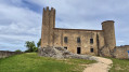
Located on the outskirts of Saint-Étienne, on the border between the Loire and Haute-Loire departments, the Loire Gorges, a 4,000-hectare nature reserve, charms visitors with its peaceful wooded landscapes, remarkable flora and fauna, rocky outcrops, beautiful Lake Grangent, medieval castles and traditional villages.
Circular route on the edge of the Pilat Regional Nature Park
 8.24 mi
+1,604 ft
-1,578 ft
5h 10
Moderate
Departure from Le Chambon-Feugerolles (Loire)
8.24 mi
+1,604 ft
-1,578 ft
5h 10
Moderate
Departure from Le Chambon-Feugerolles (Loire)
This circular route starts at La Pouratte stadium in Chambon-Feugerolles and takes you to the Cotatay dam, which supplies the town with drinking water, before climbing to overlook the Ondaine valley.
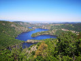
Loire Gorges and Plateau de la Danse from Saint-Victor sur Loire
 5.04 mi
+886 ft
-906 ft
3h 05
Moderate
Departure from Saint-Étienne (Loire)
5.04 mi
+886 ft
-906 ft
3h 05
Moderate
Departure from Saint-Étienne (Loire)
This is a challenging hike with significant elevation gain, but the beautiful panoramas and views of this little-known region are well worth the effort.
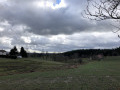
The Massardière circular in Saint-Just-Malmont
 5.03 mi
+538 ft
-515 ft
2h 45
Easy
Departure from Saint-Just-Malmont (Haute-Loire)
5.03 mi
+538 ft
-515 ft
2h 45
Easy
Departure from Saint-Just-Malmont (Haute-Loire)
A lovely, relatively easy walk starting from the hamlet of Les Gouttes, in Saint-Just-Malmont. A hilly route alternating between open landscapes and forest sections, at an altitude of around 900 metres.
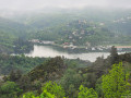
Circular starting from Chambles
 7.58 mi
+801 ft
-797 ft
4h 10
Moderate
Departure from Chambles (Loire)
7.58 mi
+801 ft
-797 ft
4h 10
Moderate
Departure from Chambles (Loire)
Circular starting from the village of Chambles with beautiful views of the Loire Gorges, passing by the medieval Essalois Castle, the Monts du Lyonnais, the plain and the Monts du Forez.
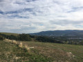
Walk around Chaucombet Hill, starting from the Caintin sports complex
 2.89 mi
+381 ft
-381 ft
1h 40
Easy
Departure from La Ricamarie (Loire)
2.89 mi
+381 ft
-381 ft
1h 40
Easy
Departure from La Ricamarie (Loire)
A pleasant walk of about an hour, on the outskirts of Saint-Étienne, which takes you up to higher ground and offers beautiful views of the surrounding valleys and hills.
At the start of the walk, there are signs prohibiting dogs from entering.
The Sainte-Reine Chapel in Aurec-sur-Loire
 9.92 mi
+1,542 ft
-1,542 ft
5h 55
Moderate
Departure from Aurec-sur-Loire (Haute-Loire)
9.92 mi
+1,542 ft
-1,542 ft
5h 55
Moderate
Departure from Aurec-sur-Loire (Haute-Loire)
A circular walk starting from Aurec-sur-Loire along the banks of the Loire and the footbridges at “Saut du Chien”, before heading uphill to reach the village of Malvalette via thePR®® “Le Pont d’Angelard”. The route passes through the Chapelle Sainte-Reine on theGR®® de Pays des Gorges de la Loire, which leads back to Aurec via the valley of the Rivoire stream.
Saint-Genest-Lerpt circular via Landuzière and Le Chasseur
 6.40 mi
+584 ft
-568 ft
3h 25
Moderate
Departure from Saint-Genest-Lerpt (Loire)
6.40 mi
+584 ft
-568 ft
3h 25
Moderate
Departure from Saint-Genest-Lerpt (Loire)
A pleasant short hike in the countryside around Saint-Genest-Lerpt.
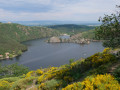
La Bachasse on the edge of the artificial lake at Grangent
 2.96 mi
+463 ft
-479 ft
1h 45
Easy
Departure from Saint-Étienne (Loire)
2.96 mi
+463 ft
-479 ft
1h 45
Easy
Departure from Saint-Étienne (Loire)
An easy, mostly shaded walk with beautiful views of Lake Grangent at the start and the rest in the forest. The route is dotted with informative and entertaining signs about the flora and fauna. The site is currently being restored to a natural forest after being planted with Douglas firs in the last century. Ideal for family walks and/or hot weather.
Around the woods and the Ondenon dam
 4.57 mi
+1,047 ft
-1,047 ft
3h 00
Moderate
Departure from La Ricamarie (Loire)
4.57 mi
+1,047 ft
-1,047 ft
3h 00
Moderate
Departure from La Ricamarie (Loire)
This walk starts in the Ondenon valley and climbs twice to 900m, on both sides of the river.
It offers several panoramic views of the Ondaine valley, the city of Saint-Étienne and, in the distance, the Monts du Forez.
Tour of the Cotatay dam lake
 2.13 mi
+351 ft
-351 ft
1h 15
Easy
Departure from Saint-Genest-Malifaux (Loire)
2.13 mi
+351 ft
-351 ft
1h 15
Easy
Departure from Saint-Genest-Malifaux (Loire)
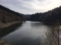
This is an easy walk on the outskirts of Saint-Étienne, with a few short sections of steep inclines or slopes.
Located at the entrance to Pilat Park, the Cotatay dam is one of the dams that supplies water to the towns in the valley.
A pleasant, shaded walk that is refreshing in summer (but swimming is prohibited).
Around Saint-Maurice-en-Gourgois
6.97 mi
+843 ft
-850 ft
3h 55
Moderate
Departure from Saint-Maurice-en-Gourgois (Loire)
A short half-day walk along the edge of the Loire Gorges, overlooking Aurec-sur-Loire with sweeping panoramic views, returning via the plateau with views of Saint-Bonnet-le-Château, the capital of pétanque.
Ascent to Le Guizay via the Ondenon dam
5.78 mi
+1,325 ft
-1,306 ft
3h 50
Moderate
Departure from Saint-Étienne (Loire)
This walk from Saint-Étienne will take you to Le Guizay via the Ondenon dam. It offers several panoramic views, including the Ondaine valley, Saint-Étienne and the Forez plain.
Ascent to Guizay from Saint-Étienne
 3.19 mi
+771 ft
-771 ft
2h 10
Moderate
Departure from Saint-Étienne (Loire)
3.19 mi
+771 ft
-771 ft
2h 10
Moderate
Departure from Saint-Étienne (Loire)
This walk, which takes about 1½ hours, starts at the gates of Saint-Étienne and then follows a circular route that includes the remarkable Guizay viewpoint.
Walk in the south-west of Saint-Étienne
 4.97 mi
+463 ft
-456 ft
2h 40
Easy
Departure from Saint-Étienne (Loire)
4.97 mi
+463 ft
-456 ft
2h 40
Easy
Departure from Saint-Étienne (Loire)
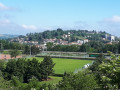
This urban route is more of a Sunday stroll than a proper hike. There’s plenty of tarmac, certainly, but on quiet roads. It allows you to explore the countryside on the outskirts of the city and enjoy some lovely views over the Saint-Étienne conurbation.
From Essalois to Les Camaldules
 2.97 mi
+600 ft
-600 ft
1h 55
Moderate
Departure from Chambles (Loire)
2.97 mi
+600 ft
-600 ft
1h 55
Moderate
Departure from Chambles (Loire)
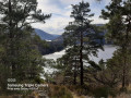
This route through the Loire Gorges offers beautiful panoramic views.
 Saint-Étienne Greenway, from Centre Deux to La Terrasse and back
 13.67 mi
+1,345 ft
-1,362 ft
2 hrs
Moderate
Departure from Saint-Étienne (Loire)
13.67 mi
+1,345 ft
-1,362 ft
2 hrs
Moderate
Departure from Saint-Étienne (Loire)
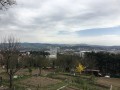
The Saint-Étienne greenway allows you to cross the city from one end to the other via its western side, then return either entirely through the city centre or via the new ‘greenway’ which bypasses the city to the east (Updated 1 December 2019).
On the outward journey, it consists mostly of paths reserved for pedestrians or cyclists; in places, it also follows some of the city’s streets.
On the return journey via the east, it follows the new greenway and also runs largely through the city.
The Saint-Étienne Greenway
 6.06 mi
+502 ft
-735 ft
3h 15
Easy
Departure from Saint-Étienne (Loire)
6.06 mi
+502 ft
-735 ft
3h 15
Easy
Departure from Saint-Étienne (Loire)
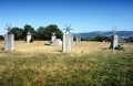
The Greenway allows you to travel from Bellevue to La Terrasse (or vice versa) via the hills west of Saint-Étienne. The signage is sometimes non-existent, sometimes misleading, and most often inadequate. These are all reasons for proposing this walk with a detailed description. It is possible to split it in two by stopping at Puits Couriot.
The route/description update of 16 August 2020 takes into account the new route from Bellevue.
Tour of the Guizay plateau
 4.35 mi
+735 ft
-719 ft
2h 40
Moderate
Departure from Planfoy (Loire)
4.35 mi
+735 ft
-719 ft
2h 40
Moderate
Departure from Planfoy (Loire)
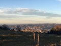
Starting from the Croix du Guizay, this circuit in the Pilat Regional Nature Park offers some of the most beautiful views of Saint-Étienne. The belvedere allows you to take in the city's central street and enjoy a panoramic view of the entire urban area.
Walk through the history of the Earth in Saint-Didier-en-Velay
2.91 mi
+374 ft
-285 ft
1h 40
Easy
Departure from Saint-Didier-en-Velay (Haute-Loire)
This is the story of a 4.7 km route representing the 4.7 billion years of our planet's history. One kilometre corresponds to one billion years and, therefore, one metre (one large step) to one million years. Based on this symbolism, 21 panels have been placed along the route. The location of each panel, and therefore the corresponding period, recounts a major event that changed the course of Earth's evolution. This route, which follows the paths of Saint-Didier-en-Velay, is designed to be fun, historical and original.
The Séauve-sur-Semène Water Trail
3.16 mi
+174 ft
-203 ft
1h 35
Easy
Departure from La Séauve-sur-Semène (Haute-Loire)
To mark World Water Day on 22 March, we suggest walking along the River Semène for half the route. You’ll notice a trout ladder along the way, allowing the fish to swim upstream to spawn at their birthplace. In Mathevard, on the site of a former weaving mill, you can also see a Napoleonic sundial with its decimal scale (a rare feature).
Water walk from La Séauve-sur-Semène, south-east loop
6.06 mi
+974 ft
-971 ft
3h 40
Moderate
Departure from La Séauve-sur-Semène (Haute-Loire)
A short circular walk from La Séauve-sur-Semène, following the Semène river, with a return journey partly through the countryside and partly through ancient forest.
Between the forest and the hamlet around Saint-Victor
8.14 mi
+702 ft
-712 ft
4h 20
Moderate
Departure from Saint-Victor-Malescours (Haute-Loire)
Starting from Saint-Victor-Malescours, a route through woodland, a small hamlet and a plateau offering a lovely view.
A short circular loop near Marlhes
3.49 mi
+318 ft
-322 ft
1h 55
Easy
Departure from Saint-Romain-Lachalm (Haute-Loire)
A walk through fields, the Bois des Cartaires and the charming hamlet of Les Chaizes, with some lovely scenery.No particular difficulties, making it ideal for a family outing, including a picnic
Séauve-Bénite route
 9.06 mi
+1,010 ft
-1,004 ft
5h 05
Moderate
Departure from Monistrol-sur-Loire (Haute-Loire)
9.06 mi
+1,010 ft
-1,004 ft
5h 05
Moderate
Departure from Monistrol-sur-Loire (Haute-Loire)
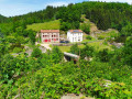
From Paulin, above Monistrol-sur-Loire, let’s set off to explore a former Cistercian abbey on the banks of the Semène, a tributary of the Loire, via a circular route combining twoPR®® trails: the Dames de la Séauve-Bénite and the Route de l’Ecureuil, developed by the Loire-Semène Tourist Office. The stretch of the Semène around the former abbey offers an attractive spot to stop off halfway along the route, with its picnic area, children’s play area and landscaped riverbanks.