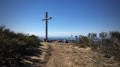
A short circular loop near Marlhes

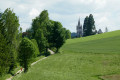
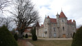
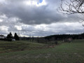
A walk through fields, the Bois des Cartaires and the charming hamlet of Les Chaizes, with some lovely scenery.
No particular difficulties, making it ideal for a family outing, including a picnic

Details

74373113
Creation:
Last update:
Last review:
  • Walking
    Activity: Walking
  • ↔
    Distance: 3.49 mi
  • ◔
    Average duration: 1h 55 
  • ▲
    Difficulty: Easy

  • ⚐
    Back to start: Yes
  • ↗
    Ascent: + 318 ft
  • ↘
    Descent: - 322 ft

  • ▲
    Highest point: 3,130 ft
  • ▼
    Lowest point: 2,756 ft

Description of the walk

Park at the charming hamlet of Les Chaizes.

(S/E) Walk through the hamlet, heading south down towards a small stream. After fording the stream, the path climbs slightly and follows the edge of the wood towards the south-west; do not take the smaller paths that lead up into the forest.

(1) When the main path begins to descend towards the hollow of the small valley on the right, turn off onto the smaller path which climbs to the left, due south, between two fields.

(2) Further up, at the junction about a hundred metres after passing a house on the right, take the path on the left, then follow the main route (the steepest one) into the Bois des Cartaires.

(3) At a cross, continue to the right and arrive, at the edge of the woods, at a crossroads.

(4) Turn left and, as you leave the woods, follow the (relatively) wide path that runs flat to the right towards the north-east instead of continuing straight on downhill, then stay on this fairly level main path, heading north-east, until you reach a junction with a large house below on the left.

(5) Follow the track to the left, heading north-north-west, which joins a road. Continue left along this road, passing the houses.

(6) At the bend in the road, head down a path. At the end of this path, you’ll come to a tarmac section for a few hundred metres, until you reach a house in the middle of the fields.

(7) Continue along the track heading due west, then, after crossing a stream, climb gently back up towards a road. Follow this road to the left, sloping gently westwards, and return to the hamlet of Les Chaizes (S/E).

Waypoints

  1. S/E : mi 0 - alt. 2,828 ft - Les Chaizes hamlet
  2. 1 : mi 0.49 - alt. 2,756 ft - Junction on a small path
  3. 2 : mi 0.8 - alt. 2,900 ft - Junction towards the woods
  4. 3 : mi 1.29 - alt. 3,100 ft - Junction at a cross
  5. 4 : mi 1.65 - alt. 3,117 ft - Crossroads
  6. 5 : mi 2.29 - alt. 3,100 ft - Junction
  7. 6 : mi 2.53 - alt. 3,041 ft - Start of the path
  8. 7 : mi 2.87 - alt. 2,956 ft - Start of the path
  9. S/E : mi 3.49 - alt. 2,828 ft - Les Chaizes hamlet

Notes

The route is half in the shade and half in the sun, so remember to take some water and something to protect yourself from the sun

Reviews and comments

4.3 / 5
Based on 2 reviews

Reliability of the description
4.5 / 5
Ease of following the route
4 / 5
Route interest
4.5 / 5
User 21925576

Overall rating : 4.7 / 5

Date of your route : Sep 14, 2026
Reliability of the description : ★★★★★ Very good
Ease of following the route : ★★★★☆ Good
Route interest : ★★★★★ Very good
Very busy route : No

A nice little walk with no difficulties; the signposts aren’t there at every junction, but it’s no big deal.
It’s pleasant even when it’s hot like today, as there’s plenty of shade.

Machine-translated

User 6770807

Overall rating : 4 / 5

Date of your route : Jul 14, 2025
Reliability of the description : ★★★★☆ Good
Ease of following the route : ★★★★☆ Good
Route interest : ★★★★☆ Good
Very busy route : No

A lovely, short walk with a bit of a slope, and very few people about. Without the Visorando guide, it would be impossible to follow.

Machine-translated

Other walks in the area

For more walks, use our search engine .

The GPS track and description are the property of this route's author. Please do not copy them without permission.