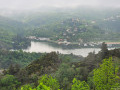
On the edge of the Haute-Loire, starting from Fiminy-Vert

A walk on the edge of the Haute-Loire region that will also allow you to discover Le Corbusier’s architectural heritage.

Details

2024154
Creation:
Last update:
Last review:
  • Walking
    Activity: Walking
  • ↔
    Distance: 7.06 mi
  • ◔
    Average duration: 4h 15 
  • ▲
    Difficulty: Moderate

  • ⚐
    Back to start: Yes
  • ↗
    Ascent: + 1,142 ft
  • ↘
    Descent: - 1,112 ft

  • ▲
    Highest point: 2,238 ft
  • ▼
    Lowest point: 1,506 ft

Photos

Description of the walk

(S/E) Park in the car park near Les Bruneaux secondary school and take the street leading to the school.

(1) Cross the dirt track on the right to reach Rue Victor Hugo. Follow it to the left and cross at the traffic lights to reach Chemin du Gué. Go under the N88 and continue straight ahead.

(2) Turn right onto Rue Vaillant Couturier, then immediately left onto Rue des Gouttes, which curves to the right.

(3) Turn left onto Rue de la Gonnière and follow this street south-west. You will reach the hamlet of La Gonnière.

(4) At the crossroads, carry straight on along the forest track. Continue uphill. This track then turns due north into the Bois de la Gonnière, before turning south-west to join a road.

(5) Continue to the right along the tarmac road which passes through the hamlet of Montauroux.

(6) Turn left onto the path leading downhill. (It can be slippery in wet weather!) Continue to the hamlet of Lafayette.

(7) In the hamlet, turn left, then left again, and leave the tarmac road to follow the path on the right.

(8) Before the pumping station, turn right, then right again. Then turn onto the path on the left which passes under the RN88. Continue left onto the path which climbs into the Bois de Villeneuve and, at the exit, pass under two power lines.

(9) When you reach the ZA du Velay, continue left onto the Chemin du Coulon. At the junction at the bottom of the street, head straight ahead towards the east. Cross the Chemin du Pinay, turning slightly to the left.

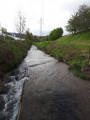
(10) Look out for and follow the path that runs between two houses and descends to the River Gampille, which you cross via a wooden footbridge. Continue along the Chemin de Portafaix. Then turn right until you reach Rue de Chazeau and follow it to the left.

(11) Turn right onto the tarmac road, which ends in a footpath; continue to Rue de la Font du Loup and walk past the Le Corbusier Housing Complex.

(12) Walk down Rue de Chanzy to the car park (S/E).

Waypoints

  1. S/E : mi 0 - alt. 1,627 ft - Les Bruneaux Secondary School car park - Collège Les Bruneaux
  2. 1 : mi 0.11 - alt. 1,608 ft - Dirt track
  3. 2 : mi 0.46 - alt. 1,526 ft - Rue Vaillant Couturier
  4. 3 : mi 0.82 - alt. 1,588 ft - Turn left onto Rue de la Gonnière
  5. 4 : mi 1.5 - alt. 1,827 ft - Junction with a forest track
  6. 5 : mi 2.82 - alt. 2,224 ft - Road to the hamlet of Montauroux
  7. 6 : mi 2.94 - alt. 2,215 ft - Path on the left
  8. 7 : mi 3.49 - alt. 1,936 ft - Lafayette hamlet.
  9. 8 : mi 3.99 - alt. 2,123 ft - Turn right before the pumping station
  10. 9 : mi 4.92 - alt. 2,090 ft - ZA du Velay, which runs alongside the RN88
  11. 10 : mi 5.44 - alt. 1,824 ft - Locate and follow the path
  12. 11 : mi 6.33 - alt. 1,581 ft - Turn right onto the street
  13. 12 : mi 6.82 - alt. 1,706 ft - Straight ahead
  14. S/E : mi 7.06 - alt. 1,627 ft - Les Bruneaux Secondary School car park - Collège Les Bruneaux

Notes

This route offers little shade: avoid walking during periods of high heat.

Take care at point (10): the path between the two houses is not easy to spot.

Worth a visit

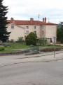
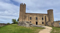
From the car park, you can see some of Le Corbusier’s architectural heritage: the Wogenski swimming pool, Saint-Pierre Church and the Maison de la Culture. The return journey takes you past the Unité d’Habitation.

Reviews and comments

3.6 / 5
Based on 5 reviews

Reliability of the description
3.2 / 5
Ease of following the route
4 / 5
Route interest
3.6 / 5
Traviata
Traviata

Overall rating : 3 / 5

Date of your route : Jun 13, 2022
Reliability of the description : ★★★★☆ Good
Ease of following the route : Not used / Not applicable
Route interest : ★★☆☆☆ Disappointing
Very busy route : No

Right from the start of the walk, I didn’t feel like carrying on. I pushed myself a bit, but then gave up: I wanted to shorten the walk by taking a path marked on the map, but it was impassable. So that was one of the reasons I turned back.

Machine-translated

poussins7
poussins7

Overall rating : 4 / 5

Date of your route : Apr 14, 2021
Reliability of the description : ★★★★☆ Good
Ease of following the route : ★★★★☆ Good
Route interest : ★★★★☆ Good
Very busy route : No

My advice: The start is at the Chateau des Bruneaux car park,

Point 2: Turn right onto Rue Vaillant Couturier, then immediately left onto Rue de la Targe, which curves to the right.

Point: Continue left onto the path that climbs into the Bois de Villeneuve; keep going straight ahead through the woods (ignore the stony path that continues to climb on the right).

Machine-translated

kewelu
kewelu
• Edited:

Overall rating : 3.3 / 5

Date of your route : Jun 14, 2020
Reliability of the description : ★★★☆☆ Average
Ease of following the route : ★★★☆☆ Average
Route interest : ★★★★☆ Good
Very busy route : No

Hello, We’ve just completed this walk using the app. There are a few errors to bear in mind. At the start, to get to Rue des Gouttes, you first need to take Rue de la Targe (which isn’t mentioned in the description). And at point 10, we couldn’t find the path between the two houses. Thank you

Machine-translated

clarinette421
clarinette421
• Edited:

Hello,
Could you please be a bit more specific and note down the errors you’ve spotted so that I can rectify them? Thank you.

Machine-translated

daniel434
daniel434
• Edited:

Overall rating : 3 / 5

Date of your route : Jun 19, 2019
Reliability of the description : ★☆☆☆☆ Very disappointing
Ease of following the route : ★★★★☆ Good
Route interest : ★★★★☆ Good

Numerous errors

Machine-translated

clarinette421
clarinette421
• Edited:

Thank you for clarifying the best time of year to go on this hike. I’ll add that to the description.

Machine-translated

randomarche42
randomarche42
• Edited:

Overall rating : 4.3 / 5

Date of your route : Jun 17, 2019
Reliability of the description : ★★★★☆ Good
Ease of following the route : ★★★★★ Very good
Route interest : ★★★★☆ Good

An urban walk to do in winter, close to where I live, so no time wasted getting to the starting point.

Machine-translated

Other walks in the area

For more walks, use our search engine .

The GPS track and description are the property of this route's author. Please do not copy them without permission.