


 Country:

 City:
City:


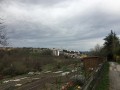
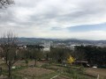
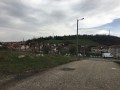
The starting point is on Rue Jean Allemane. There is no car park at this location, but you can park on Rue Jean Allemane or in the surrounding area if necessary. For a walking tour, you can also get there by tram, alighting at the ‘Centre 2’ stop, which is very close by.
(S/E) At the start, in the middle of Rue Allemane, go under the railway line and turn left towards the allotments, then left again, and you’ll find yourself at the entrance to the greenway.
The route is signposted along its entire length by wooden posts, markings on the road surface and green markings.
It initially follows an old railway line, which has been covered with gravel to create a path. Continue along the railway line until you reach an old warehouse.
(1) At the junction, before the warehouse, take the path that climbs up to the right. Carry on until you reach a large meadow.
(2) Walk up through the meadow to the road (Boulevard Duval). Turn onto the boulevard and take thefirst street on the left (Boulevard Salvator Allende), then carry on straight ahead. Leave the boulevard and follow the path on the right across the fields, passing a few houses.
(3) Cross the road (Rue Colombet), continue along the path and cross another road (Rue Florent Évrard). Carry on through the industrial estate until you reach the next street (Rue de la Croix de Mission) and turn right onto it.
(4) Turn left immediately towards the allotments. Cross the allotments, then two streets (Rue Auguste Ponceton and Rue Severine) and continue along the concrete path opposite, which leads to the fire station.
(5) At the bottom of the concrete path (with the fire station on your right), carry on straight ahead and then across the fields until you reach Chemin du Cret de la Faye. Head down to Rue Calixte Ploton.
(6) Turn left, then left onto Boulevard Franchet d’Esperey, and then right onto Boulevard Delattre de Tassigny.
(7) At the junction with Rue Charles Floquet, turn right, then immediately left (Rue Chavassieux) and left again (Rue du Puits de la Garenne). A few metres further on, turn left onto the dirt track. Continue straight on until the end of the track.
(8) When you reach Rue Louise Michel, turn right and continue to the end of Rue Javelle. There you’ll find another dirt track leading up to Parc de Montaud.
(9) Take this track and head uphill to the left, then to the right, until you reach the ‘6 soleils’, the highest point of Colline de Montaud.
(10) Head back down the other side of the hill. The signposting isn’t very visible at this point, but you’ll eventually find it.
(11) After a short descent, turn right, then left before the cemetery. Walk down to Rue Jean-François Revollier.
(12) Turn left; at the next junction, turn right, then left and right. You’ll then enter Allée James Joyce, which leads to some more allotments. Walk all the way round the hill, with the housing estate on your right, until you reach a fork where the greenway is signposted to the left.
(13) At this fork, turn left, then immediately right before the houses (you can also go straight on and join the ‘official’ cycle route just after).
(14) Just before leaving the forest, the greenway is signposted on the left (towards Rue Olivier de Serres); personally, I prefer to continue along the path that goes straight on and heads uphill along the edge of the forest. Cross a small bridge and head back down towards Rue Bergson.
(15) From Rue Bergson (the ‘tram’ street), turn right onto Rue Bergson, then left (new tram line) towards the Stade Geoffroy Guichard. Carefully follow the pavement for 50 metres, then you’ll reach a cycle path.
(16) Leave the stadium on your left and continue along the cycle path, which veers to the right and then curves sharply to the left. A little further on (after crossing Boulevard Pompidou), join the new greenway, which runs along a former railway line. Continue to the end of this route.
(17) The rest of the route, up to the Bois d’Avaize, follows the road. At the end of the cycle path, turn right onto Rue de la Talaudière, cross it and continue straight ahead. At the roundabout, carry on straight ahead along Rue du Serment du Jeu de Paume and turn left onto Rue Auguste Isaac. Continue along Rue Burdeau and Rue Henri de Bornier until you reach Rue de la Montat.
Follow the yellow markings carefully – they are quite subtle – or the route on your GPS.
(18) Cross Rue de la Montat and take Rue Cussinel towards the Bois d’Avaize. At the junction with Rue des Alliés, turn right then left onto Rue Thiollière Matrat. Continue uphill along Rue Mehul and Rue Linossier. At the top of the street, turn left onto Rue du Bois d’Avaize (a downhill street).
(19) The entrance to the woods is clearly signposted; take the path leading uphill to the right to cross through the woods. This section is a steep climb and can be very slippery in wet weather.
Continue along the winding path; then, at the top on the left, as the path emerges, the woodland thins out.
(20) Take the path leading down to the left and join the road. Cross the N88 (via a bridge) towards Terrenoire.
(21) Turn right towards Les Cèdres (retirement home) and walk up to the end of the small street (Allée de l’IUT). Continue up the steep slope along Avenue Léon Jouhaux to the IUT. At the roundabout, turn left and continue through the upper part of the Métare neighbourhood. Follow Rue Virgile to the end.
(22) Cross the Route de Rochetaillée (Rue Abbé Dorna) and continue downhill until you reach a Fork in the road where it is forbidden to turn left;
(23) Walk 50 metres along the one-way street, carefully on the pavement, then go down the footpath (watch out for a few steps). At the bottom of this footpath, carry on straight ahead until you cross the tram tracks.
Carry on straight ahead, pass under the railway line, then take the first street on the right (Rue Allemane). A little further on, turn left under the bridge to return to the starting point (S/E).

 Visorando Member
 Easy
Easy 

