


Refine your search for walks in Courgenard
Courgenard walks


 Around Mont-Chauvel
 Tourism professional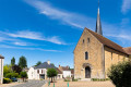
 5.52 mi
 +387 ft
 -384 ft
 2h 50
2h 50
 Easy
Easy
 Departure from Courgenard (Sarthe)
Situated on the eastern slopes of the Huisne, Courgenard, first mentioned at the end ofthe 9th century, was the seat in the Middle Ages of an important barony belonging to the chapter of canons of Le Mans Cathedral. The fine Romanesque architecture of Saint-Martin’s Church still bears witness today to the power of this barony, as does the remarkable16th-century decoration adorning the chancel. In the19th century, the village still lived off agriculture and the production of hemp cloth. Today, it forms part of the La Ferté-Bernard employment area.
A hidden architectural gem near Saint-Jean-des-Échelles
 3.46 mi
+118 ft
-118 ft
1h 40
Easy
Departure from Saint-Jean-des-Échelles (Sarthe)
3.46 mi
+118 ft
-118 ft
1h 40
Easy
Departure from Saint-Jean-des-Échelles (Sarthe)
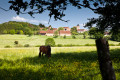
Situated on a small hill overlooking the surrounding area, the village, which takes its nickname from the Échelles farm, the former seat of the parish seigneury, offers a well-preserved architectural and landscape setting, dominated by the Church of Saint John the Baptist. Built inthe 12th century, this church underwent embellishment work in the16th century: what remains is the painted panelled vault, resting—an extremely rare feature—on posts placed against the walls, and above all the remains of an extraordinary altarpiece in carved and painted limestone, dated 1558. The décor was redesigned in the18th century with the installation of three new altarpieces.
Around Cherreau
 3.81 mi
+272 ft
-272 ft
2h 00
Easy
Departure from Cherreau (Sarthe)
3.81 mi
+272 ft
-272 ft
2h 00
Easy
Departure from Cherreau (Sarthe)
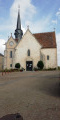
This walk offers beautiful views of La Ferté-Bernard and Cherreau.
Around Saint-Symphorien in Cherré-Au
 4.06 mi
+315 ft
-315 ft
2h 10
Easy
Departure from Cherreau (Sarthe)
4.06 mi
+315 ft
-315 ft
2h 10
Easy
Departure from Cherreau (Sarthe)
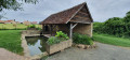
Cherré-Au is a new commune formed in 2019 by merging the communes of Cherré and Cherreau, located east of La Ferté-Bernard. The village of Cherreau has always been closely linked to the neighbouring town of La Ferté-Bernard. Indeed, in the Middle Ages, the lords of La Ferté took over the Abbey of La Pelice at the end ofthe 12th century. Then, in the14th century, the Domaine de la Plaisse was incorporated into that of La Ferté. More recently, as the town of La Ferté-Bernard expanded inthe 19th century, it encroached upon Cherreau, annexing the hamlets of Gué-Faux and La Fosse Fondue in 1889, which bordered the road to Paris.
The Woods of Roussigny
 11.28 mi
+758 ft
-751 ft
5h 50
11.28 mi
+758 ft
-751 ft
5h 50
 Moderate
Departure from Saint-Ulphace (Sarthe)
Moderate
Departure from Saint-Ulphace (Sarthe)
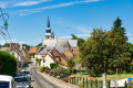
Like the neighbouring village of Gréez, the medieval development of Saint-Ulphace is linked to the settlement, between the Braye and the Saint-Ulphace stream, of a hermit monk in the6th century. The Hermitage of Saint-Ulphace led to the clearing of the surrounding land and the settlement of Christianised populations, followed by the establishment of the parish, first mentioned in 802.
Montmirail Castle and its countryside
 6.17 mi
+295 ft
-312 ft
3h 05
Easy
Departure from Montmirail (Sarthe) (Sarthe)
6.17 mi
+295 ft
-312 ft
3h 05
Easy
Departure from Montmirail (Sarthe) (Sarthe)
This hike allows you to discover Montmirail, a "small town of character", and its green countryside through woods and sunken paths.
The hills of Ceton
 Association / Club / Walk leader
 10.90 mi
+781 ft
-771 ft
5h 40
Moderate
Departure from Ceton (Orne)
10.90 mi
+781 ft
-771 ft
5h 40
Moderate
Departure from Ceton (Orne)
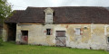
Taking beautiful sunken paths, over hill and dale, you will discover magnificent panoramic views of the Cétonais countryside and be amazed by its diversity: woods, meadows, hedgerows and cultivated fields.
The Vow of Saint-Quentin
 5.43 mi
+266 ft
-269 ft
2h 45
Easy
Departure from Saint-Maixent (Sarthe)
5.43 mi
+266 ft
-269 ft
2h 45
Easy
Departure from Saint-Maixent (Sarthe)
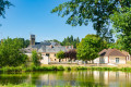
Bordering the Huisne valley to the west and the Vibraye forest to the east, Saint-Maixent is first mentioned in the13th century. Although the settlement is largely scattered (27 farms and 59 cottages in 1841), there are large hamlets such as Les Blousières, whose houses, clustered around a now-vanished pond, once housed up to 40 people, likely hemp workers. The village, crossed by the medieval road known as the “Chemin aux Bœufs” leading to Paris via Châteaudun, grew considerably in the 19th century thanks to the trade generated by this route.
The Abadie factory, the Saules tile works and the Jambette Valley
 17.33 mi
+1,158 ft
-1,161 ft
9h 00
17.33 mi
+1,158 ft
-1,161 ft
9h 00
 Difficult
Departure from Avezé (Sarthe) (Sarthe)
Difficult
Departure from Avezé (Sarthe) (Sarthe)
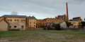
This walk takes you through the Avezé forest to the outskirts of Saint-Germain-de-la-Coudre, passing by the Saules tile works. Winding through the hills, the route passes through Le Theil, a once-thriving industrial town and home to the former Abadie factories, now listed as heritage sites. Then, following the sunken paths, you’ll explore the Jambette Valley before returning to Avezé via the Beauvais woods and the panoramic views over the Huisne Valley.
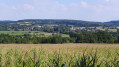
Panoramic views over the Prairies d'Avezé
 6.80 mi
+377 ft
-384 ft
3h 25
Moderate
Departure from Avezé (Sarthe) (Sarthe)
6.80 mi
+377 ft
-384 ft
3h 25
Moderate
Departure from Avezé (Sarthe) (Sarthe)
This route, which alternates between sunken lanes, forest paths and flat sections, will take you to the hill overlooking the Huisne Valley to the west. Along the way, several panoramic views allow you to admire the meadows of Avezé, a veritable hay barn that has provided for generations of farmers.
The woods of Beauvais
 7.14 mi
+548 ft
-538 ft
3h 45
Moderate
Departure from Avezé (Sarthe) (Sarthe)
7.14 mi
+548 ft
-538 ft
3h 45
Moderate
Departure from Avezé (Sarthe) (Sarthe)
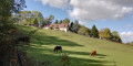
A lovely walk along sunken paths, through woodland and across the gentle hills of the Perche. Panoramic views of the Huisne and Maroisse valleys.
In the heart of the Perche countryside from Avezé
 8.17 mi
+367 ft
-367 ft
4h 05
Moderate
Departure from Avezé (Sarthe) (Sarthe)
8.17 mi
+367 ft
-367 ft
4h 05
Moderate
Departure from Avezé (Sarthe) (Sarthe)
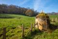
The village of Avezé developed in the Middle Ages to the north-east of the church, which was rebuilt inthe 16th century, at the same time as the priory that adjoined it, of which only extensive farm buildings remain. The main street is dominated by a large two-storey house known as the “Maison du prieur” (Prior’s House), dating from the 15th or 16th century, notable for its rear stair tower and its elegant façade that juts out over the current street.
Route du père from Vibraye
 9.68 mi
+453 ft
-449 ft
4h 50
Moderate
Departure from Vibraye (Sarthe)
9.68 mi
+453 ft
-449 ft
4h 50
Moderate
Departure from Vibraye (Sarthe)
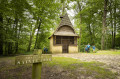
The village is characterised by the presence of the forest. This enabled its owner, the Marquis de Vibraye, to establish forges on the Braye river in Champrond in the early 17th century, where charcoal from the forest fuelled the furnaces producing pig iron and wrought iron until 1913. The trail partly follows the route taken by the convoys laden with heavy iron bars to the workshop in the hamlet of La Fenderie, on the pond of the same name. At La Bouverie, another vanished hamlet, eight houses provided accommodation for the forges’ carters, whilst charcoal burners and miners lived in makeshift huts. Now silent once more, the forest retains of this past activity only the network of paths. Part of it is now a Natura 2000 site.
La Tuilerie des Saules via the hills of Souvigné-sur-Même
 8.10 mi
+659 ft
-653 ft
4h 20
Moderate
Departure from Souvigné-sur-Même (Sarthe)
8.10 mi
+659 ft
-653 ft
4h 20
Moderate
Departure from Souvigné-sur-Même (Sarthe)
This walk starts in the village of Souvigné-sur-Même and follows sunken paths lined with pollarded trees, allowing you to explore the bocage, the grazing meadows, the woods and the surrounding countryside. The rolling hills offer views from their summits of the villages of Préval and Avezé and the Huisne and Même valleys.
 Visorando Member
More walks in Courgenard
Select a point of interest below: