


Refine your search for walks in Condé-sur-Vesgre
Condé-sur-Vesgre walks


 The Bois de l’Épars in the Rambouillet Forest
 Visorando Member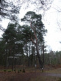
 8.21 mi
 +98 ft
 -98 ft
 1 hr
1 hr
 Easy
Easy
 Departure from Condé-sur-Vesgre (Yvelines)
This is a very pleasant route, presenting no particular difficulties, through this part of the Rambouillet State Forest: the Bois de l’Épars. The woodland consists of oak trees as well as a few pine groves, which give off that delightful scent of pine mixed with the dampness of the humus.
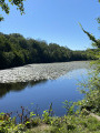
 Circular Haizettes starting from Gambais
 10.98 mi
+436 ft
-410 ft
5h 25
10.98 mi
+436 ft
-410 ft
5h 25
 Moderate
Departure from Gambais (Yvelines)
Moderate
Departure from Gambais (Yvelines)
A route in the heart of the Rambouillet National Forest, in the Chevreuse Valley Regional Nature Park, where you can discover a varied and peaceful natural environment. This hike is ideal for nature lovers and those seeking tranquillity.
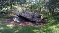
The Dolmen of Pierre Ardoue
 5.90 mi
+318 ft
-318 ft
3h 00
Moderate
Departure from Saint-Léger-en-Yvelines (Yvelines)
5.90 mi
+318 ft
-318 ft
3h 00
Moderate
Departure from Saint-Léger-en-Yvelines (Yvelines)
In the heart of the Rambouillet Forest, a walk tinged with ferns and heather, discovering a Neolithic dolmen and a charming valley along a stream.
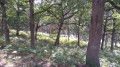
Les Bornes du Planet
 6.11 mi
+266 ft
-266 ft
3h 05
Easy
Departure from Saint-Léger-en-Yvelines (Yvelines)
6.11 mi
+266 ft
-266 ft
3h 05
Easy
Departure from Saint-Léger-en-Yvelines (Yvelines)
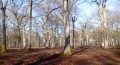
Hike in the Rambouillet Forest
L'Etang Neuf, Haut Beaussart and Bois des Longues Mares
 8.27 mi
+354 ft
-354 ft
4h 05
Moderate
Departure from Gambaiseuil (Yvelines)
8.27 mi
+354 ft
-354 ft
4h 05
Moderate
Departure from Gambaiseuil (Yvelines)
Between ponds, oak forests, pine forests and birch woods, this is a beautiful hike in the north of the Rambouillet Forest. A varied route in a peaceful setting.
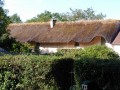
Croix Pater in Mesle
 4.51 mi
+154 ft
-154 ft
2h 10
Moderate
Departure from Saint-Léger-en-Yvelines (Yvelines)
4.51 mi
+154 ft
-154 ft
2h 10
Moderate
Departure from Saint-Léger-en-Yvelines (Yvelines)
Hike from Croix Pater to the village of Le Mesle.
Departure from the CROIX PATER crossroads.
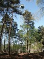
Croix Pater - Pecqueuse - Watchtower
 5.64 mi
+69 ft
-69 ft
2h 40
Easy
Departure from Saint-Léger-en-Yvelines (Yvelines)
5.64 mi
+69 ft
-69 ft
2h 40
Easy
Departure from Saint-Léger-en-Yvelines (Yvelines)
Cycle path and forest track.
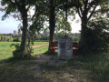
Between Vesgre and Opton, around Houdan
 3.47 mi
+108 ft
-108 ft
1h 40
Easy
Departure from Maulette (Yvelines)
3.47 mi
+108 ft
-108 ft
1h 40
Easy
Departure from Maulette (Yvelines)
A stroll along the banks of the Vesgre and then the Opton, two small rivers that encircle Houdan. A detour via the Croix aux Pèlerins offers a view of the keep and the church of Houdan.
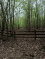
Grosrouvre circular
 6.98 mi
+138 ft
-138 ft
3h 20
Moderate
Departure from Grosrouvre (Yvelines)
6.98 mi
+138 ft
-138 ft
3h 20
Moderate
Departure from Grosrouvre (Yvelines)
Varied landscapes and paths: pine, oak and birch forests, fields and greenhouses, thatched cottages and streams, boundary stones bearing coats of arms and a billionaire's castle.
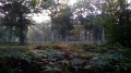
Armed boundary markers in the Rambouillet Forest
 4.22 mi
+66 ft
-66 ft
2h 00
Moderate
Departure from Grosrouvre (Yvelines)
4.22 mi
+66 ft
-66 ft
2h 00
Moderate
Departure from Grosrouvre (Yvelines)
On the edge of the Rambouillet National Forest, the Old Road from Nogent-le-Roy to Montfort-l'Amaury is marked by boundary stones dating from the Ancien Régime and decorated with fleurs-de-lis. This short hike, which requires a good sense of direction, starts in the heart of the forest in search of these boundary stones and ends in a rural setting.
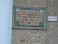
Toulifaut Farm
 5.77 mi
+121 ft
-112 ft
2h 45
Easy
Departure from La Boissière-École (Yvelines)
5.77 mi
+121 ft
-112 ft
2h 45
Easy
Departure from La Boissière-École (Yvelines)
A very peaceful, easy walk through countryside and woodland.
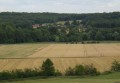
L’Épinette, Les Grippes, Mittainville
 5.39 mi
+207 ft
-207 ft
2h 40
Easy
Departure from La Boissière-École (Yvelines)
5.39 mi
+207 ft
-207 ft
2h 40
Easy
Departure from La Boissière-École (Yvelines)
A route through plains and woodland.
Tartre Gaudran circular starting from La Boissière-École
 7.38 mi
+220 ft
-220 ft
3h 35
Moderate
Departure from La Boissière-École (Yvelines)
7.38 mi
+220 ft
-220 ft
3h 35
Moderate
Departure from La Boissière-École (Yvelines)
A very peaceful, easy walk through a landscape of plains and woodland.
Butte Ronde route
3.86 mi
+98 ft
-98 ft
1h 55
Easy
Departure from La Boissière-École (Yvelines)
Short hike in the Bois de la Butte Ronde and Vallée des Grès. Along some of the paths, you can admire the enormous hundred-year-old oak trees. The Rambouillet Forest is managed by the ONF. The paths are well marked and the natural environment is very varied. You can easily go from birch and hornbeam trees to magnificent oaks, and from heather to ferns or grasses.
Bazainville Circular
 7.02 mi
+259 ft
-276 ft
3h 25
Moderate
Departure from Bazainville (Yvelines)
7.02 mi
+259 ft
-276 ft
3h 25
Moderate
Departure from Bazainville (Yvelines)
A short, easy walk in the beautiful Forêt des Quatre Piliers and the surrounding countryside.
Medieval walk through Houdan
 2.24 mi
+98 ft
-98 ft
1h 05
Easy
Departure from Houdan (Yvelines)
2.24 mi
+98 ft
-98 ft
1h 05
Easy
Departure from Houdan (Yvelines)
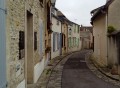
Built on a hillock, nestled between the Vesgre and Opton rivers, the town of Houdan boasts numerous half-timbered houses, a church blending Gothic and Renaissance styles, a keep... This urban walk takes you on a journey of discovery through this rich heritage, taking in streets, alleyways, lanes and riverside paths.
The Houdan Plain and the Roman Villa at La Pièce du Fient
 6.56 mi
+82 ft
-82 ft
3h 05
Moderate
Departure from Houdan (Yvelines)
6.56 mi
+82 ft
-82 ft
3h 05
Moderate
Departure from Houdan (Yvelines)
A route through cultivated countryside, exploring a diverse heritage including the remains of one of the oldest Roman villas recorded in France.
From Saint-Léger-en-Yvelines to Villiers-Saint-Frédéric
12.35 mi
+482 ft
-702 ft
6h 05
Moderate
Departure from Saint-Léger-en-Yvelines (Yvelines)
This is the penultimate stage of the GR®1. It takes you out of the Rambouillet Forest and to the Villiers-Saint-Frédéric RER station. Halfway along the route is the pretty medieval town of Montfort-l'Amaury. The ruins offer superb views of the surrounding area. Half of the stage is through forest, i.e. up to Montfort-l'Amaury. The other part of the stage is more rural.
From Étang Rompu to Pierre Ardoue
 4.88 mi
+187 ft
-171 ft
2h 25
Easy
Departure from Saint-Léger-en-Yvelines (Yvelines)
4.88 mi
+187 ft
-171 ft
2h 25
Easy
Departure from Saint-Léger-en-Yvelines (Yvelines)
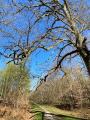
Pond and dolmen: hike in the Rambouillet National Forest near Saint-Léger-en-Yvelines.
Circular route to the south of Mittainville through fields and villages
 10.74 mi
+364 ft
-354 ft
5h 15
Moderate
Departure from Mittainville (Yvelines)
10.74 mi
+364 ft
-354 ft
5h 15
Moderate
Departure from Mittainville (Yvelines)
A lovely, very idyllic walk, ideal in spring or autumn, which will take you through the rapeseed and maize fields behind Mittainville, leading you on to Saint-Lucien and then to the outskirts of Raizeux before heading back via Hermeray through the forest.
There are no particular difficulties, and the few ascents and descents are very gentle; nevertheless, we have rated the difficulty as ‘moderate’ given the route’s length and in line with Visorando’s recommendations.
Note: as nearly two-thirds of this walk takes place in the middle of fields, it is best to avoid doing it during a heatwave or when it is raining.
Exploring Mittainville
 5.03 mi
+108 ft
-112 ft
2h 25
Easy
Departure from Mittainville (Yvelines)
5.03 mi
+108 ft
-112 ft
2h 25
Easy
Departure from Mittainville (Yvelines)
Miitainville is a rural commune with a population of around 600, divided into five hamlets: Mittainville, Vacheresse, Launay, Les Pâtis and Le Val. It is crossed by a river, the Maltorne, which rises at La Boissière-École and flows into the Eure at Chaudon. This walk will allow you to explore the various hamlets of this village, as well as the diversity of its landscapes, ranging from houses to woodland, pastures and farmland.
Thuilay Wood from Les Pâtis to Mittainville
5.54 mi
+131 ft
-131 ft
2h 40
Easy
Departure from Mittainville (Yvelines)
A lovely walk, between fields of wheat and barley, and through the woods. In spring, the woods are full of white anemones, yellow lesser celandines and bluebells. The walk is not difficult. From the top of the fields, you can see all the surrounding countryside. It's very beautiful, especially when the rape fields are in flower.
Bois du Thuilay, Croix Gillet, Gros chêne
 5.86 mi
+177 ft
-164 ft
2h 50
Easy
Departure from Mittainville (Yvelines)
5.86 mi
+177 ft
-164 ft
2h 50
Easy
Departure from Mittainville (Yvelines)
Walk through the Bois du Thuilay, alternating between open land and woods.
Through fields and forests in the Houdan region
 11.76 mi
+325 ft
-338 ft
5h 40
Moderate
Departure from Richebourg (Yvelines) (Yvelines)
11.76 mi
+325 ft
-338 ft
5h 40
Moderate
Departure from Richebourg (Yvelines) (Yvelines)
This easy hike alternates between forest and field passages. You will enjoy beautiful landscapes, encounter numerous horses and discover the small heritage of two pretty villages.
Rambouillet Forest - Angennes Rocks & Former Moulineaux Abbey
 3.78 mi
+180 ft
-157 ft
1h 55
Easy
Departure from Poigny-la-Forêt (Yvelines)
3.78 mi
+180 ft
-157 ft
1h 55
Easy
Departure from Poigny-la-Forêt (Yvelines)
An easy walk in the forest, on the Rochers d'Angennes overlooking the valley, followed by a visit to the beautiful ruins of the Moulineaux Abbey.
Please note! Several hikers have reported that the route is difficult to follow at the site of the former abbey, between points (1) and (2)
According to the latest information, the passage near the former abbey is now closed and dangerous. The route has therefore been modified and the original route removed.
Circular route between the Étang du Roi and Rambouillet
 14.52 mi
+338 ft
-341 ft
7h 00
14.52 mi
+338 ft
-341 ft
7h 00
 Difficult
Departure from Poigny-la-Forêt (Yvelines)
Difficult
Departure from Poigny-la-Forêt (Yvelines)
This walk follows theGR®1de l’Étang du Roi from the village of Poigny-la-Forêt to Rambouillet station. The route takes you through the gardens and along the canals of Rambouillet Castle.
In the Rambouillet Forest around Poigny-la-Forêt
 4.05 mi
+102 ft
-102 ft
1h 55
Easy
Departure from Poigny-la-Forêt (Yvelines)
4.05 mi
+102 ft
-102 ft
1h 55
Easy
Departure from Poigny-la-Forêt (Yvelines)
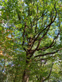
Hike through a forest with a variety of tree species. In autumn, mushrooms are abundant (boletus, parasol mushrooms).
From Orgerus to Mantes-la-Jolie following the Vaucouleurs
 14.10 mi
+413 ft
-725 ft
6h 50
Difficult
Departure from Orgerus (Yvelines)
14.10 mi
+413 ft
-725 ft
6h 50
Difficult
Departure from Orgerus (Yvelines)
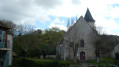
Fifth stage of the Grand Tour of Île-de-France on the GR®11, connecting Orgerus-Béhoust station to Mantes-Station, still through the Yvelines. This is a northbound route that joins the Seine valley at Mantes-la-Jolie, descending the valleys of the Flexanville and then the Vaucouleurs rivers. The route follows both paths at the bottom of the valley and paths on the adjacent plateaus.
From Orgerus to Beynes along the Avre underground aqueduct
 11.82 mi
+236 ft
-509 ft
5h 40
Difficult
Departure from Orgerus (Yvelines)
11.82 mi
+236 ft
-509 ft
5h 40
Difficult
Departure from Orgerus (Yvelines)
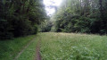
A walk from station to station, largely through cultivated plains. The underground Avre aqueduct runs alongside us halfway through the route and, towards the end, the Beynes National Forest offers pleasant paths. A few beautiful churches complete the picture.
Château Rouge and the Epernon plateau
 5.73 mi
+177 ft
-190 ft
2h 45
Easy
Departure from Hermeray (Yvelines)
5.73 mi
+177 ft
-190 ft
2h 45
Easy
Departure from Hermeray (Yvelines)
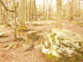
A very peaceful walk, no difficulty, with scenery of plains and woodland.
The Forest of the Four Pillars and the Plain of Garancières
 12.16 mi
+203 ft
-230 ft
5h 45
Difficult
Departure from Garancières (Yvelines)
12.16 mi
+203 ft
-230 ft
5h 45
Difficult
Departure from Garancières (Yvelines)
This route includes a pleasant first section through the forest and then continues mainly between fields. There are a few heritage sites along the way: churches, old crosses in the forest, farmhouses, old wash houses and dovecotes.
Orgerus circular through the Forêt des Quatre Piliers
 6.42 mi
+115 ft
-115 ft
3h 05
Moderate
Departure from Orgerus (Yvelines)
6.42 mi
+115 ft
-115 ft
3h 05
Moderate
Departure from Orgerus (Yvelines)
This easy hike will take you to the beautiful Forêt des Quatre Piliers, where you will discover the Étang de la Pimardière. A short tour of the village of Orgerus is also on the agenda.