The Bois de l’Épars in the Rambouillet Forest

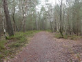
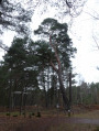
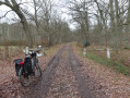
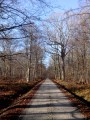
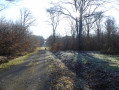
This is a very pleasant route, presenting no particular difficulties, through this part of the Rambouillet State Forest: the Bois de l’Épars. The woodland consists of oak trees as well as a few pine groves, which give off that delightful scent of pine mixed with the dampness of the humus.

Details

29708997
Creation:
Last update:
Last review:
  • Touring/Gravel
    Activity: Touring/Gravel
  • ↔
    Distance: 8.21 mi
  • ◔
    Duration according to the author: 1 hr 
  • ▲
    Difficulty: Easy

  • ⚐
    Back to start: Yes
  • ↗
    Ascent: + 98 ft
  • ↘
    Descent: - 98 ft

  • ▲
    Highest point: 472 ft
  • ▼
    Lowest point: 358 ft
  • ⚐ Country: France
  • ⚐
  • ⚐ City: Condé-sur-Vesgre (78113)
  • ⚑
    Start/End: N 48.729527° / E 1.678391°
  • ❏
    IGN map(s): Ref. 2115O, 2215OT, 2215OTR, M2215OT

  • ◶
    Type of surface:
  •  
     
     
     33% Road  34% Byway  33% Path
  • Hour-by-hour weather

Photos

Description of the route

To reach the town of Saint-Léger-en-Yvelines, take the D936, Route de Houdan, towards Condé-sur-Vesgre, then continue along the same road onto the Route de Saint-Léger.
When you reach the hamlet of Le Hallier, just before Condé-sur-Vesgre, turn left onto Rue du Gué Porcherel. After travelling for about 1.4 km, when the road turns right at a right angle, turn left onto Chemin du Gué de Porcherel towards Saint-Léger. You can park on the left before the barriers, leaving the access road clear for ONF staff, for example.

(S/E) From Gué Porcherel, go through the barrier and continue along Chemin du Gué Porcherel to Saint-Léger until you reach the D936

(1) Cross the D936, taking care to watch out for traffic, continue along the Route de la Chesnaie, pass the Carrefour des Pacages and arrive at the Carrefour des Fontaines Blanches.

(2) Turn right into thesecond lane, Route Croche, pass the Carrefour de l’Entonnoir and continue to the Carrefour de la Croix Gilbon.

(3) Turn right into thethird lane, Route de la Pierre Ardoue.

(4) At the Joubaire junction, turn right onto the cycle path, Route de la Harasserie, and continue straight on to the Barillets junction.

(5) Turn left and continue along the cycle path which runs alongside the Route des Barillets until you reach the D936. Cross the road, taking care of the traffic, and continue straight on along the Route des Barillets.

(6) At the Y-junction, take the right-hand lane. Pass through the hamlet of La Colonie, then La Chesnaie, where the road curves first left then right.

(7) At the Carrefour du Gué Guimont, in the hamlet of La Briqueterie, take thethird road on the left, the Route de la Houssine. At the Y-junction, take the right-hand road, staying on the Route de la Houssine.

(8) At the T-junction in the hamlet of La Houssine, turn right onto the Route du Mesle. Pass through the hamlet of Le Mesle and, at the Y-junction, continue along the right-hand lane, the Route du Mesle.

(9) At the junction, just before the hamlet of La Jaunière, turn right onto Route du Vivier and carry on straight ahead without leaving the road.

(10) At the four-way junction, just before the hamlet of Bel Air, turn right onto Rue du Gué Porcherel. After about 650 metres, at the Y-junction, continue straight on to reach the car park at Le Gué Porcherel (S/E).

Waypoints

  1. S/E : mi 0 - alt. 381 ft - The Gué Porcherel
  2. 1 : mi 0.97 - alt. 397 ft - Route de la Chesnaie
  3. 2 : mi 1.66 - alt. 407 ft - Route Croche
  4. 3 : mi 2.66 - alt. 456 ft - Croix Gilbon junction
  5. 4 : mi 3.24 - alt. 449 ft - Joubaire Crossroads
  6. 5 : mi 4.09 - alt. 413 ft - Carrefour des Barillets
  7. 6 : mi 4.75 - alt. 381 ft - A place known as La Colonie - Vesgre (rivière)
  8. 7 : mi 5.59 - alt. 377 ft - Gué Guimont junction
  9. 8 : mi 6.23 - alt. 436 ft - Route du Mesle
  10. 9 : mi 7.24 - alt. 404 ft - Route du Vivier
  11. 10 : mi 7.88 - alt. 377 ft - Rue du Gué Porcherel
  12. S/E : mi 8.21 - alt. 381 ft - The Gué Porcherel

Notes

There are no picnic areas or shelters along the route.

There are no water points along the route. Look out for them in the hamlets and villages you pass through.

No special equipment is required, other than that needed for cycling.

Point to note:

Between (S/E) and (1), on the Chemin du Gué Porcherel in Saint-Léger up to the D936, all side roads branching off to the left and right are off-limits; either because they are private property or reforestation areas.

Between (4) and (5), from the Carrefour Joubaire junction to the Carrefour des Barillets junction, the Route de La Harasserie cycle path is, in places, in very poor condition due to tree roots lifting the tarmac. You should cycle carefully to avoid jolts or even falls.

Worth a visit

(5) The Scots pine at Carrefour des Barillets – Height: 29 m – Diameter: 0.75 m – 2-star category: a tree of regional significance.

Reviews and comments

4.5 / 5
Based on 2 reviews

Reliability of the description
4.5 / 5
Ease of following the route
5 / 5
Route interest
4 / 5
Steve5
Steve5

Overall rating : 4.7 / 5

Date of your route : Dec 18, 2023
Reliability of the description : ★★★★★ Very good
Ease of following the route : ★★★★★ Very good
Route interest : ★★★★☆ Good
Very busy route : No

A magnificent forest, especially in summer, although the autumn colours are stunning!

Machine-translated

FTALLON
FTALLON

Hello,
That’s an interesting alternative, and what’s more, the cycle path is very pleasant.
Thank you

Machine-translated

farrolulu
farrolulu

Overall rating : 4.3 / 5

Date of your route : Jan 16, 2023
Reliability of the description : ★★★★☆ Good
Ease of following the route : ★★★★★ Very good
Route interest : ★★★★☆ Good
Very busy route : No

A forest route I was familiar with; I took it partly to avoid the road to La Colonie, and made a short detour via Haut-Planet to rejoin the route at Le Mesle

Machine-translated

For more walks, use our search engine .

The GPS track and description are the property of this route's author. Please do not copy them without permission.