Country:
 City:
City:


Start from Place Saint-Jean in La Boissière-École.
(S/E) Head uphill across the grass to the footpath that joins the road (Rue Henri Lagrée) and turn right. At the top of the hill, at the crossroads, turn left, pass the church and continue to the path on the right (Chemin de la White Cross).
(1) Follow this path, pass the White Cross and, at the crossroads, head straight on until you reach the road. Turn left and continue until you reach the first houses.
(2) Turn left and follow the Chemin des Épines for about 2 km, cross the Route des Chapelles, head towards the Butte de Queue Noire and pass a garden on your right (this garden is absolutely beautiful when it’s in bloom). Further on, take the first path on the left and follow it to the D80, Route de Faverolles.
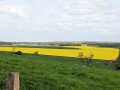
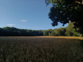
(3) Cross this road; opposite, the track passes through the Grippes de la Boissière-École. At the end, you’ll reach a crossroads. Take the first track on the right and follow it downhill. Pass a field and then a strip of woodland; you’ll arrive at a place called Le Calotier. Do not take the first track; carry on until you reach the second one.
(4) Turn left between the fields. Leave Les Pâtis on your right and continue along the path towards La Boissière-École. At the end of the path known as La Guerre des Forges, you’ll come to a biogas plant, which processes farm waste.
(5) Take a small path on your left between the trees, which slopes gently downwards, and follow it to the end. Head back up and follow this path until you reach the D80 road. Cross this road and continue to Place Saint-Jean, keeping to the right-hand side of the road (S/E).






 Visorando Member

 Moderate