Exploring Mittainville

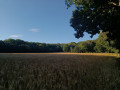
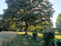
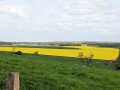
Miitainville is a rural commune with a population of around 600, divided into five hamlets: Mittainville, Vacheresse, Launay, Les Pâtis and Le Val. It is crossed by a river, the Maltorne, which rises at La Boissière-École and flows into the Eure at Chaudon. This walk will allow you to explore the various hamlets of this village, as well as the diversity of its landscapes, ranging from houses to woodland, pastures and farmland.

Details

19777836
Creation:
Last update:
Last review:
  • Walking
    Activity: Walking
  • ↔
    Distance: 5.03 mi
  • ◔
    Average duration: 2h 25 
  • ▲
    Difficulty: Easy

  • ⚐
    Back to start: Yes
  • ↗
    Ascent: + 108 ft
  • ↘
    Descent: - 112 ft

  • ▲
    Highest point: 558 ft
  • ▼
    Lowest point: 413 ft

Photos

Description of the walk

Park in the cemetery car park located along the D71 departmental road.

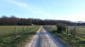
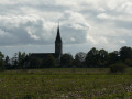
(S/E) Take the path flanked on both sides by horse pastures. You’ll be able to admire Mittainville Church in the background on your right.

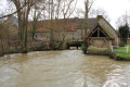
(1) Take the path on your left and follow the Maltorne.

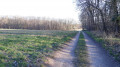
(2) Opposite the Éclimemont Stud Farm, turn onto the path on your right, which continues as a footpath. You can admire the wet meadows on your right, where horses are grazing.

(3) Continue along the footpath just to the right after thefirst property and you’ll reach Rue des Ruelles.

(4) Turn left, go to the end of this street and turn into Rue de la Mare.

(5) At the junction, turn left and carry on to the next junction.
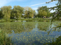
If you’d like to take a detour, at the end of the street you’ll find the pond, with picnic tables, as well as Mittainville’s town hall and school. Otherwise, turn left onto Rue de la Grenouillère, continue along the Sentier d’Éclinemont and cross the Maltorne again.

(2) At the end of the path, do not turn left but carry on straight ahead until you reach the departmental road.
Walk alongside the D71 on your right for 50 metres. Take care, as this is a busy road.
Cross the road to join a small road branching off to your left and follow it. Ignore the small turn-off to your right and carry on straight ahead at the junction.

(6) At the next junction, turn right and carry on until you reach the cross in the hamlet of Le Val.

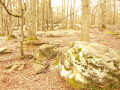
(7) Turn left and head towards the woods. At the Y-junction, keep left and, at the second junction, turn right.
When you reach the end of the sandy slope, ignore the Sentier de la Bruyère, turn right towards the young birch copse and you’ll come to a cross-path.

(8) Turn onto this path heading left and, at the Fork in the road, carry on straight ahead.

(9) Ignore the path branching off to the right and, at the junction, turn left and follow the yellow and red markings ofthe GR® de Pays des Yvelines.
Carry on following these markings. At a fork in the road, keep to the right, follow this path and you will arrive at the car park at the starting point (S/E).


Waypoints

  1. S/E : mi 0 - alt. 453 ft - Cemetery car park
  2. 1 : mi 0.14 - alt. 433 ft - Junction with the Chemin de Houdan
  3. 2 : mi 0.65 - alt. 420 ft - Éclimemont Stud Farm. Crossing the - Mailtorne (rivière) - Affluent de l'Eure
  4. 3 : mi 0.86 - alt. 413 ft - Junction of Rue de la Grenouillère and the footpath
  5. 4 : mi 0.99 - alt. 420 ft - Junction of Rue des Ruelles and the footpath
  6. 5 : mi 1.22 - alt. 420 ft - Rue de la Mare X Rue de la Grenouillère
  7. 6 : mi 2.13 - alt. 436 ft - Chemin de la Berthière
  8. 7 : mi 2.72 - alt. 449 ft - The Val Cross
  9. 8 : mi 3.29 - alt. 551 ft - Rochers du Val trail and path
  10. 9 : mi 3.78 - alt. 548 ft - Path to the hamlet of Château Rouge
  11. S/E : mi 5.03 - alt. 453 ft - Cemetery car park

Notes

Please note that some sections may be muddy.

Always be cautious and plan ahead when you're outdoors. Visorando and the author of this route cannot be held responsible for any accidents occurring on this route.

The GR® and PR® markings are the intellectual property of the Fédération Française de Randonnée Pédestre.

Reviews and comments

4.3 / 5
Based on 3 reviews

Reliability of the description
4 / 5
Ease of following the route
4.7 / 5
Route interest
4.3 / 5
Guszen
Guszen

Overall rating : 4.7 / 5

Date of your route : Jun 16, 2026
Reliability of the description : ★★★★★ Very good
Ease of following the route : ★★★★★ Very good
Route interest : ★★★★☆ Good
Very busy route : No

A really lovely walk, very varied and perfectly accessible – I think it sums up the Chevreuse Valley quite well! It’s a sort of distillation of all the best bits to explore in the area. I’d recommend doing it at the end of the day in summer; the colours and the atmosphere are well worth it. Thanks for the suggestion 😉.

Machine-translated

waiwaite
waiwaite

Overall rating : 4 / 5

Date of your route : Dec 16, 2022
Reliability of the description : ★★★☆☆ Average
Ease of following the route : ★★★★☆ Good
Route interest : ★★★★★ Very good
Very busy route : No

A really lovely and very picturesque walk.
No difficulty at all. The hoarfrost and ice on the ponds really added to the charm of this peaceful route.
The sections between the houses, lined with hedges and high fences, are less pleasant.

Machine-translated

Mframboisie
Mframboisie

Overall rating : 4.3 / 5

Date of your route : Aug 21, 2022
Reliability of the description : ★★★★☆ Good
Ease of following the route : ★★★★★ Very good
Route interest : ★★★★☆ Good
Very busy route : No

It’s a pleasant walk with some lovely hamlets

Machine-translated

Other walks in the area

For more walks, use our search engine .

The GPS track and description are the property of this route's author. Please do not copy them without permission.